Safety Score: 3,0 of 5.0 based on data from 9 authorites. Meaning we advice caution when travelling to Belgium.
Travel warnings are updated daily. Source: Travel Warning Belgium. Last Update: 2024-08-13 08:21:03
Touring Bomerstraat
Bomerstraat in Provincie Limburg (Flanders) is a town located in Belgium about 64 mi (or 104 km) east of Brussels, the country's capital place.
Time in Bomerstraat is now 06:48 AM (Friday). The local timezone is named Europe / Brussels with an UTC offset of one hour. We know of 10 airports nearby Bomerstraat, of which 5 are larger airports. The closest is airport we know is Maastricht Aachen Airport in Netherlands in a distance of 17 mi (or 27 km). The closest airport in Belgium is Hasselt Airport in a distance of 21 mi (or 27 km), South. Besides the airports, there are other travel options available (check left side).
There are several Unesco world heritage sites nearby. The closest heritage site is Aachen Cathedral in Germany at a distance of 30 mi (or 49 km). The closest in Belgium is Flemish Béguinages in a distance of 56 mi (or 49 km), South-East. Also, if you like the game of golf, there are several options within driving distance. We collected 3 points of interest near this location. Need some hints on where to stay? We compiled a list of available hotels close to the map centre further down the page.
Being here already, you might want to pay a visit to some of the following locations: Selfkant, Waldfeucht, Heeze, Gangelt and Maastricht. To further explore this place, just scroll down and browse the available info.
Local weather forecast
Todays Local Weather Conditions & Forecast: 11°C / 52 °F
| Morning Temperature | 9°C / 48 °F |
| Evening Temperature | 8°C / 46 °F |
| Night Temperature | 6°C / 42 °F |
| Chance of rainfall | 0% |
| Air Humidity | 61% |
| Air Pressure | 1028 hPa |
| Wind Speed | Light breeze with 4 km/h (2 mph) from North-East |
| Cloud Conditions | Clear sky, covering 8% of sky |
| General Conditions | Sky is clear |
Saturday, 16th of November 2024
9°C (48 °F)
7°C (45 °F)
Scattered clouds, gentle breeze.
Sunday, 17th of November 2024
8°C (47 °F)
5°C (41 °F)
Moderate rain, moderate breeze, overcast clouds.
Monday, 18th of November 2024
7°C (45 °F)
5°C (42 °F)
Light rain, gentle breeze, few clouds.
Hotels and Places to Stay
Kasteel Wurfeld
Van Eyck
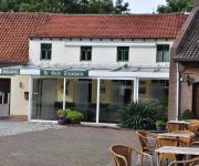
Hotel Restaurant de Roosterhoeve
Herberg de Tramhalte
Botel Ophoven
Videos from this area
These are videos related to the place based on their proximity to this place.
Slideshow from the Maasplassen August '14
7 days 6 nights, first single-handed sailing on a "Valk" on the Maasplassen in the Netherlands.
Boerderij Weert (Stramproy) 18 personen NL-6039-01 Nederland Holiday Home - Belvilla Vakantiehuizen
Bekijk dit Belvilla vakantiehuis in Limburg (Nederland): http://www.belvilla.nl/dv/vdo/vakantiehuizen/stramproy-18-personen-NL-6039-01 Deze 19e-eeuwse boerderij ligt landelijk op een paar...
Videos provided by Youtube are under the copyright of their owners.
Attractions and noteworthy things
Distances are based on the centre of the city/town and sightseeing location. This list contains brief abstracts about monuments, holiday activities, national parcs, museums, organisations and more from the area as well as interesting facts about the region itself. Where available, you'll find the corresponding homepage. Otherwise the related wikipedia article.
Haler
Haler is a town in the Dutch province of Limburg. It is a part of the municipality of Hunsel and lies about 9 km southeast of Weert. In 2001, Haler had 258 inhabitants. The built-up area of the town was 0.08 km², and contained 89 residences.
Ophoven Airfield
Ophoven Airfield is an abandoned World War II military airfield which is located west of Opglabbeek (Limburg); approximately 54 miles northeast of Brussels.


