Safety Score: 2,5 of 5.0 based on data from 9 authorites. Meaning we advice caution when travelling to Barbados.
Travel warnings are updated daily. Source: Travel Warning Barbados. Last Update: 2024-08-13 08:21:03
Discover Foster Hall
Foster Hall in Saint George is a city in Barbados a little north-east of Bridgetown, the country's capital city.
Local time in Foster Hall is now 02:16 PM (Tuesday). The local timezone is named America / Barbados with an UTC offset of -4 hours. We know of 8 airports in the vicinity of Foster Hall. The closest airport in Barbados is Sir Grantley Adams International Airport in a distance of 7 mi (or 11 km), South-East. Besides the airports, there are other travel options available (check left side).
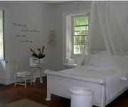
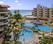
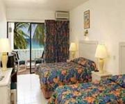
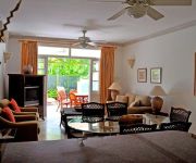
There are two Unesco world heritage sites nearby. The closest heritage site in Barbados is Historic Bridgetown and its Garrison in a distance of 80 mi (or 129 km), East. Also, if you like golfing, there are a few options in driving distance. Looking for a place to stay? we compiled a list of available hotels close to the map centre further down the page.
When in this area, you might want to pay a visit to some of the following locations: Welchman Hall, Bridgetown, Four Cross Roads, Oistins and Holetown. To further explore this place, just scroll down and browse the available info.
Local weather forecast
Todays Local Weather Conditions & Forecast: 28°C / 83 °F
| Morning Temperature | 28°C / 82 °F |
| Evening Temperature | 27°C / 81 °F |
| Night Temperature | 27°C / 81 °F |
| Chance of rainfall | 0% |
| Air Humidity | 68% |
| Air Pressure | 1015 hPa |
| Wind Speed | Fresh Breeze with 17 km/h (11 mph) from West |
| Cloud Conditions | Clear sky, covering 9% of sky |
| General Conditions | Light rain |
Tuesday, 3rd of December 2024
28°C (83 °F)
27°C (80 °F)
Light rain, fresh breeze, clear sky.
Wednesday, 4th of December 2024
28°C (83 °F)
27°C (80 °F)
Moderate rain, fresh breeze, few clouds.
Thursday, 5th of December 2024
28°C (83 °F)
27°C (80 °F)
Moderate rain, fresh breeze, clear sky.
Hotels and Places to Stay
South Beach Hotel
Courtyard Bridgetown Barbados
Hilton Barbados
SWEETFIELD MANOR BO
Accra Beach Hotel & Spa
SOUTHERN PALMS HOTEL
Summerland Villas
Coral Mist Beach Hotel
Coconut Court Beach Hotel
Island Inn All Inclusive Hotel
Videos from this area
These are videos related to the place based on their proximity to this place.
Bridgetown, Barbados
Barbados is a sovereign island country in the Lesser Antilles. Bridgetown is the capital and largest city of the nation of Barbados. Formerly, the Town of Saint Michael, the Greater Bridgetown...
Bridgetown, Barbados
Barbados is a sovereign island country in the Lesser Antilles. Bridgetown is the capital and largest city of the nation of Barbados. Formerly, the Town of Saint Michael, the Greater Bridgetown...
Unsere Reise um die Welt. 31.03.2014 Bridgetown I. - Barbados. 106. Video.
Unsere Reise um die Welt vom 22.12.2013 bis 12.04.2014 Die Reiseroute zu unserer Reise: ART074 | 111 Tage | 22.12.2013 - 12.04.2014 | Artania Weltreisen 2013/2014 22.12.2013 - 12.04.2014...
Bridgetown, Barbados
Barbados is a sovereign island country in the Lesser Antilles. Bridgetown is the capital and largest city of the nation of Barbados. Formerly, the Town of Saint Michael, the Greater Bridgetown...
Bridgetown, Barbados Excursion: Swimming with Turtles on a Catamaran
EXCURSION: Tiami Catamaran Sailing Cruises, aka Barbados Catamaran Snorkeling Excursion (INCLUDES swimming with turtles). I chose this excursion because it included snorkeling with the turtles ...
Barbados Atlantis Submarine Tour
February 18, 2010: 45 minutes tour abord the Atlantis Submarine in Barbados. I have lots of photos from my 2 week Barbados vacation on my Flickr account located at https://flic.kr/s/aHsk4BNJs6.
Things To Do In Barbados - Discover Underwater Barbados
Things To Do In Barbados http://barbados.atlantissubmarines.com Atlantis Submarines Barbados operates underwater tours in a real submarine vessel, providing the opportunity for residents and...
Videos provided by Youtube are under the copyright of their owners.
Attractions and noteworthy things
Distances are based on the centre of the city/town and sightseeing location. This list contains brief abstracts about monuments, holiday activities, national parcs, museums, organisations and more from the area as well as interesting facts about the region itself. Where available, you'll find the corresponding homepage. Otherwise the related wikipedia article.
Saint Michael, Barbados
Statistics Parish:Saint Michael Area:39 km Largest city:Bridgetown Population (2008 est. ):94,860 inhab. Population density:2,432.31 inhab/km² Parliamentary representation - House seats11 Map Parishes of Barbados The parish of St. Michael is one of eleven parishes of Barbados. It has a land area of 39 km² and is found at the south-west portion of the island. Saint Michael has survived by name as one of the original six parishes created in 1629 by Governor Sir William Tufton.
Lloyd Erskine Sandiford Conference and Cultural Centre
The Lloyd Erskine Sandiford Conference And Cultural Centre (or less formally, Lloyd Erskine Sandiford Centre), is a conference centre facility found on the Caribbean island of Barbados. Owned by the Government of Barbados, and managed by the government agency Barbados Conference Services Limited (BCSL), the Lloyd Erskine Sandiford Centre is found just outside of the capital city Bridgetown.
Sharon Moravian Church
Sharon Moravian Church is in the south of the centrally located Saint Thomas parish in Barbados. It was built in 1799 at the behest of missionaries. The missionaries were from the Moravian Church, which originated in the Czech provinces of Bohemia and Moravia. In 1732, the church launched a global mission, going first to the Caribbean.
Warrens, Saint Michael, Barbados
The town of Warrens located in the parish of Saint Michael is one of the fastest developing areas in the country of Barbados. In the span of a few short years beginning around the year 2000, the Warrens, Saint Michael area has become synonymous with new money flowing into the country and for the development in the form of newly constructed tall buildings. Upon the completion of two new towers in Warrens it is estimated that roughly 350,000 square feet of the island's 860,000 sq ft .
Bussa Emancipation Statue
The Bussa Emancipation Statue is a public sculpture of a slave rebellion leader in Barbados, east of Bridgetown. The statue is located at centre of the J.T.C. Ramsay roundabout formed at the junction of the ABC Highway and Highway 5. Many Barbadians refer to the statue as Bussa, the name of a slave who helped inspire a revolt against slavery in Barbados in 1816. The statue was created 1985 by Bajan sculptor Karl Broodhagen 169 years after the rebellion.
Wildey, Saint Michael, Barbados
The Wildey area of the Parish of Saint Michael located roughly 4 km east of Bridgetown, it lies on the border with the Parish of Christ Church. Normally a very busy area with the ABC Highway, Wildey is one of the main convergence points for vehicles travelling either towards the capital-city Bridgetown or towards points in northern Barbados.
Gun Hill Signal Station
Gun Hill Signal Station, St. George is the largest and most important of the military outposts in Barbados, with military associations from at least 1697. In the Militia Act of that year, when it was known as Briggs Hill, it was named as one of the four points where guns were to be placed to give alarm in the event of an invasion, so it is likely that the name Gun Hill goes back nearly 300 years.
Barbados Community College
The Barbados Community College is a tertiary institution located on Eyrie Howells' Road, St. Michael, Barbados.




!['Barbados Bicycle cam # 39 [Bridgetown - Baxters Rd]' preview picture of video 'Barbados Bicycle cam # 39 [Bridgetown - Baxters Rd]'](https://img.youtube.com/vi/Dj9J4RYCCUw/mqdefault.jpg)


