Safety Score: 4,1 of 5.0 based on data from 9 authorites. Meaning please reconsider your need to travel to Bangladesh.
Travel warnings are updated daily. Source: Travel Warning Bangladesh. Last Update: 2024-08-13 08:21:03
Discover Deulpāra
Deulpāra in Narayanganj District (Dhaka Division) is a town in Bangladesh a little south-east of Dhaka, the country's capital city.
Current time in Deulpāra is now 06:38 PM (Friday). The local timezone is named Asia / Dhaka with an UTC offset of 6 hours. We know of 9 airports near Deulpāra, of which one is a larger airport. The closest airport in Bangladesh is Dhaka / Hazrat Shahjalal International Airport in a distance of 12 mi (or 20 km), North. Besides the airports, there are other travel options available (check left side).
There are two Unesco world heritage sites nearby. The closest heritage site in Bangladesh is Historic Mosque City of Bagerhat in a distance of 81 mi (or 131 km), South-West. Looking for a place to stay? we compiled a list of available hotels close to the map centre further down the page.
When in this area, you might want to pay a visit to some of the following locations: Dhaka, Agartala, Barisal, Magura and Mymensingh. To further explore this place, just scroll down and browse the available info.
Local weather forecast
Todays Local Weather Conditions & Forecast: 30°C / 85 °F
| Morning Temperature | 24°C / 74 °F |
| Evening Temperature | 29°C / 85 °F |
| Night Temperature | 26°C / 78 °F |
| Chance of rainfall | 0% |
| Air Humidity | 50% |
| Air Pressure | 1014 hPa |
| Wind Speed | Light breeze with 5 km/h (3 mph) from South |
| Cloud Conditions | Clear sky, covering 0% of sky |
| General Conditions | Sky is clear |
Saturday, 9th of November 2024
30°C (85 °F)
26°C (78 °F)
Sky is clear, light breeze, clear sky.
Sunday, 10th of November 2024
30°C (86 °F)
27°C (80 °F)
Sky is clear, light breeze, clear sky.
Monday, 11th of November 2024
31°C (88 °F)
26°C (80 °F)
Sky is clear, light breeze, clear sky.
Hotels and Places to Stay
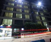
Dhaka Regency
Lake Castle
Hotel 71
BW LA VINCI HOTEL
Videos from this area
These are videos related to the place based on their proximity to this place.
アキーラさん!バングラデッシュ・ダッカの日本車!Dahka,Bangladesh
went around Dahka city in Bangladesh by Rikisha in the night When I visited Dahka on Jun in 2011.バングラデシュの首都のダッカ!!日本車が多く走っていた。車屋があり...
Dancing
This video was taken in front of a fast food shop (Salt Grill) at Bashundhara City in Dhaka, Bangladesh.
DLGS Borshoboron 1421
The main inspiration is the Sanaullah Sunny who always wants to promote his school to a big society around the country.
29-10-2018, Journey To Signboard - Jatrabari By Rickshaw
29-10-2018, Journey To Signboard - Jatrabari By Rickshaw.
Videos provided by Youtube are under the copyright of their owners.
Attractions and noteworthy things
Distances are based on the centre of the city/town and sightseeing location. This list contains brief abstracts about monuments, holiday activities, national parcs, museums, organisations and more from the area as well as interesting facts about the region itself. Where available, you'll find the corresponding homepage. Otherwise the related wikipedia article.
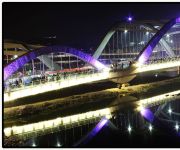
Buriganga River
The Buriganga River flows past the southwest outskirts of Dhaka city, the capital of Bangladesh. Its average depth is 25 feet and maximum depth is 58 feet .
Narayanganj Osmani Stadium
Khan Shaheb Osman Ali Stadium, also known as Narayanganj Osmani Stadium is a cricket stadium located in Fatullah, Narayanganj in central Bangladesh. It has a capacity of 25,000 people.
Demra Thana
Demra is a Thana of Dhaka District in the Division of Dhaka, Bangladesh.
Sutrapur Thana
Sutrapur is a Thana of Dhaka District in the Division of Dhaka, Bangladesh.
Shaympur Thana
Shaympur is a Thana of Dhaka District in the Division of Dhaka, Bangladesh.
Matuail
Matuail is a village of Dhaka Division, Bangladesh, located on the west side of Dhaka–Chittagong Highway and on the south side of Dhaka-Demra Highway. The village is about 6 km from Motijheel.
Matuail Adarsha High School
Matuail Adarsha High School is one of the most prosperous school in Matuail, Bangladesh. It is located near Mridhabari Bus stand, West Matuail. Government Primary High School (no-2) and Matuail Sub post office are situated beside it. It was established in 1985 by some educated youths. It is basically a kindergarten and a higher secondary school. It always cuts a good figure in all types of board examinations (P.S. C, J.S. C,S.S. C).


