Safety Score: 4,1 of 5.0 based on data from 9 authorites. Meaning please reconsider your need to travel to Bangladesh.
Travel warnings are updated daily. Source: Travel Warning Bangladesh. Last Update: 2024-08-13 08:21:03
Touring Nārāyanpur
Nārāyanpur in Brahmanbaria District (Chittagong) is a town located in Bangladesh about 54 mi (or 87 km) east of Dhaka, the country's capital place.
Time in Nārāyanpur is now 05:58 PM (Thursday). The local timezone is named Asia / Dhaka with an UTC offset of 6 hours. We know of 8 airports nearby Nārāyanpur. The closest is airport we know is Agartala Airport in India in a distance of 1 mi (or 2 km). The closest airport in Bangladesh is Comilla Airport in a distance of 32 mi (or 2 km), South. Besides the airports, there are other travel options available (check left side).
There is one Unesco world heritage site nearby. It's Historic Mosque City of Bagerhat in a distance of 125 mi (or 201 km), South-West. Need some hints on where to stay? We compiled a list of available hotels close to the map centre further down the page.
Being here already, you might want to pay a visit to some of the following locations: Agartala, Dhaka, Netrakona, Sylhet and Mymensingh. To further explore this place, just scroll down and browse the available info.
Local weather forecast
Todays Local Weather Conditions & Forecast: 27°C / 81 °F
| Morning Temperature | 18°C / 64 °F |
| Evening Temperature | 23°C / 74 °F |
| Night Temperature | 19°C / 66 °F |
| Chance of rainfall | 0% |
| Air Humidity | 51% |
| Air Pressure | 1014 hPa |
| Wind Speed | Calm with 2 km/h (1 mph) from West |
| Cloud Conditions | Clear sky, covering 0% of sky |
| General Conditions | Sky is clear |
Friday, 22nd of November 2024
27°C (80 °F)
18°C (65 °F)
Sky is clear, calm, clear sky.
Saturday, 23rd of November 2024
27°C (80 °F)
18°C (65 °F)
Sky is clear, light breeze, clear sky.
Sunday, 24th of November 2024
26°C (79 °F)
18°C (64 °F)
Broken clouds, light breeze.
Hotels and Places to Stay
Hotel Sonar Tori
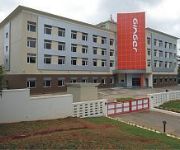
Ginger Agartala
Hotel City Centre
Videos from this area
These are videos related to the place based on their proximity to this place.
Handrolled Raw Incense Stick making
Tripura Bamboo Mission (implemented by IL&FS CDI Ltd.), creating sustainable livelihood for thousands of women through making of hand-rolled raw incense stick. for further info, please contact:...
BHS-S.S.C CANDIDATE 2013
২০১৩ সালের ssc পরীক্ষায় অংশগ্রহণ কারি সকল ছাত্র/ছাত্রীদের বিদায়ী কিছু স্মরণীয় মুহূর্ত ।
Best land marks of Agartala City||shot on sunday eve Drop the Bomb#vlog5||by biker soul
Rabindra Satabarshiki Bhavan https://goo.gl/maps/6qHDrmMoMzp ○Ujjayanta Palace (উজ্জ্বয়ন্ত প্রাসাদ) https://goo.gl/maps/zFeCbi8dzgp ○Laxminarayan Bari...
বিষ্ণুপুরের ( কুমিল্লা ) সুন্দর এক ভোরবেলার প্রাকৃতিক দৃশ্য............
শাহির আহমেদ সুজন (Shahir Ahmed Suzan)
Ride 2 Tea Garden And golf course #BAMUTIA
Durgabari tea estate is one of the most famous tea plantations in the Indian state of Tripura.
#Landscape by Ashraful's Click
Please see my video Feel free, like, comment & share my youtube chanel.
Videos provided by Youtube are under the copyright of their owners.
Attractions and noteworthy things
Distances are based on the centre of the city/town and sightseeing location. This list contains brief abstracts about monuments, holiday activities, national parcs, museums, organisations and more from the area as well as interesting facts about the region itself. Where available, you'll find the corresponding homepage. Otherwise the related wikipedia article.
Agartala Airport
Agartala Airport is located 12 km (6.5 nautical miles) northwest from the city of Agartala, the capital of the state of Tripura in India. It is administered by the Airports Authority of India (AAI) providing world class amenities to passengers. The authority also ensures comfort and safety to the travelers. From 2010 to 2011 it was ranked 22nd busiest airport in India out of 50 major airports.
Akhaura Upazila
Akhaura is an Upazila of Brahmanbaria District in the Division of Chittagong, Bangladesh. Akhaura Upazila with an area of 99.28 sq km, is bounded by brahmanbaria sadar upazila on the north, kasba upazila on the south, Tripura State of India on the east and brahmanbaria sadar upazila on the west. Main rivers is Titas. Akhaura (Town) The town is now a municipality with an area of 2.35 sq km and population 32435; male 50.43%, female 49.57%. It has 9 wards and 23 mahallas.


