Safety Score: 3,0 of 5.0 based on data from 9 authorites. Meaning we advice caution when travelling to Austria.
Travel warnings are updated daily. Source: Travel Warning Austria. Last Update: 2024-08-13 08:21:03
Delve into Tal
Tal in Politischer Bezirk Feldkirch (Vorarlberg) is located in Austria about 317 mi (or 510 km) west of Vienna, the country's capital town.
Current time in Tal is now 02:48 AM (Saturday). The local timezone is named Europe / Vienna with an UTC offset of one hour. We know of 12 airports close to Tal, of which 5 are larger airports. The closest airport in Austria is Hohenems-Dornbirn Airport in a distance of 8 mi (or 13 km), North. Besides the airports, there are other travel options available (check left side).
There are several Unesco world heritage sites nearby. The closest heritage site is Abbey of St Gall in Switzerland at a distance of 19 mi (or 30 km). The closest in Austria is Prehistoric Pile dwellings around the Alps in a distance of 70 mi (or 30 km), North-West. We encountered 4 points of interest near this location. If you need a hotel, we compiled a list of available hotels close to the map centre further down the page.
While being here, you might want to pay a visit to some of the following locations: Ubersaxen, Viktorsberg, Duenserberg, Duns and Rons. To further explore this place, just scroll down and browse the available info.
Local weather forecast
Todays Local Weather Conditions & Forecast: 12°C / 54 °F
| Morning Temperature | 3°C / 38 °F |
| Evening Temperature | 7°C / 45 °F |
| Night Temperature | 6°C / 42 °F |
| Chance of rainfall | 0% |
| Air Humidity | 44% |
| Air Pressure | 1020 hPa |
| Wind Speed | Light breeze with 4 km/h (2 mph) from North |
| Cloud Conditions | Clear sky, covering 0% of sky |
| General Conditions | Sky is clear |
Sunday, 17th of November 2024
12°C (53 °F)
5°C (42 °F)
Moderate rain, light breeze, scattered clouds.
Monday, 18th of November 2024
6°C (44 °F)
4°C (40 °F)
Rain and snow, light breeze, overcast clouds.
Tuesday, 19th of November 2024
8°C (46 °F)
4°C (38 °F)
Rain and snow, light breeze, overcast clouds.
Hotels and Places to Stay
Hoher Freschen
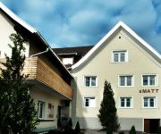
s`Matt
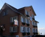
Weisses Kreuz
Hotel am Garnmarkt
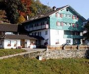
Waldrast Bed and Breakfast
Schöne Aussicht Land&Panoramagasthof
Viktor
Roessle
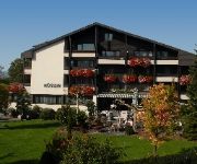
Mohren Gasthof
Schäfle Hotel Landgasthof
Videos from this area
These are videos related to the place based on their proximity to this place.
Suldis - Batschuns - Rankweil via Wanderweg/hiking trail (MTB/Mountainbike-Downhill)
Suldis (Zwischenwasser) - Wanderweg - Batschuns (Gasthaus Waldrast) - Wanderweg - Rankweil (Arkahüsle/Gewerbepark) MTB, Mountainbike, Simplon, Kibo, Downhill, hiking trail, Wanderweg, ...
FCÜ - 2012 - RWR - FCZ
Elfmeterschiessen zwischen RW Rankweil und FC Zwischenwasser zum Aufstieg ins Halbfinale im Cupbewerb 2012.
Dafins
Dafins, ein 350-Seelen-Dorf, ist ein Ortsteil der Gemeinde Zwischenwasser, und liegt zentral im Vorarlberger Rheintal. Allein auf Dafinser Gemeindegebiet sind mehr als 50 km erschlossene ...
STEPHIE Stephanie Heidrich (dez.2011-nov.2014)
Stephanie Heidrich (Dec.2011-Nov.2014) Mountainbiking, Hiking, Climbing, Mountaineering, Skiing, Skitouren, Rodeln, Sledding, Wandern, Schneeschuhwandern, Snowshoeing, Bergsteigen, Outdoor ...
Übersaxen
Das Dorf Übersaxen liegt auf 900 m Seehöhe an den Ausläufern des Walserkammes. Auffallende Straßenschilder und Hausnummern weisen auf das Kunstprojekt "Gisalz 98".
Bergrennen Übersaxen 2013
Ein paar Eindrücke vom Bergrennen Übersaxen (Österreich) 2013 Some impressions of the uphill race in Übersaxen (Austria) 2013.
Musikverein Übersaxen - cold water challenge 2014
Ein herzliches Dankeschön für die Nominierungen an den Musikverein Viktorsberg, den Musikverein Harmonie Sonntag und die Bürgermusik Fraxern. Unsere Nominierungen: Kirchenchor Übersaxen.
Videos provided by Youtube are under the copyright of their owners.
Attractions and noteworthy things
Distances are based on the centre of the city/town and sightseeing location. This list contains brief abstracts about monuments, holiday activities, national parcs, museums, organisations and more from the area as well as interesting facts about the region itself. Where available, you'll find the corresponding homepage. Otherwise the related wikipedia article.
Feldkirch District
The Bezirk Feldkirch is an administrative district in Vorarlberg, Austria. Area of the district is 278.26 km², population is 100,656 (2012), and population density 362 persons per km². Administrative center of the district is Feldkirch. Historical population Year Pop.


