Safety Score: 3,0 of 5.0 based on data from 9 authorites. Meaning we advice caution when travelling to Austria.
Travel warnings are updated daily. Source: Travel Warning Austria. Last Update: 2024-08-13 08:21:03
Delve into Bassing
Bassing in Politischer Bezirk Feldkirch (Vorarlberg) is a town located in Austria about 315 mi (or 507 km) west of Vienna, the country's capital town.
Time in Bassing is now 08:01 AM (Monday). The local timezone is named Europe / Vienna with an UTC offset of one hour. We know of 12 airports closer to Bassing, of which 5 are larger airports. The closest airport in Austria is Hohenems-Dornbirn Airport in a distance of 12 mi (or 19 km), North. Besides the airports, there are other travel options available (check left side).
There are several Unesco world heritage sites nearby. The closest heritage site is Abbey of St Gall in Switzerland at a distance of 23 mi (or 36 km). The closest in Austria is Prehistoric Pile dwellings around the Alps in a distance of 72 mi (or 36 km), North-West. We saw 3 points of interest near this location. In need of a room? We compiled a list of available hotels close to the map centre further down the page.
Since you are here already, you might want to pay a visit to some of the following locations: Schnifis, Thuringen, Bludesch, Duenserberg and Duns. To further explore this place, just scroll down and browse the available info.
Local weather forecast
Todays Local Weather Conditions & Forecast: 11°C / 52 °F
| Morning Temperature | 5°C / 40 °F |
| Evening Temperature | 6°C / 43 °F |
| Night Temperature | 6°C / 43 °F |
| Chance of rainfall | 0% |
| Air Humidity | 82% |
| Air Pressure | 1018 hPa |
| Wind Speed | Gentle Breeze with 8 km/h (5 mph) from North |
| Cloud Conditions | Clear sky, covering 7% of sky |
| General Conditions | Sky is clear |
Tuesday, 26th of November 2024
7°C (44 °F)
6°C (42 °F)
Moderate rain, light breeze, overcast clouds.
Wednesday, 27th of November 2024
10°C (50 °F)
5°C (41 °F)
Scattered clouds, light breeze.
Thursday, 28th of November 2024
7°C (45 °F)
5°C (41 °F)
Moderate rain, light breeze, overcast clouds.
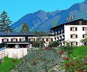
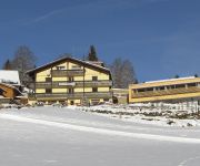
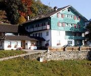
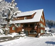
Hotels and Places to Stay
s`Matt
Bauernhof Guschahof
Schlosshotel Dörflinger Ges.mbH.+Co.KG
Taleu Naturhotel
Dunza
Hotel Einhorn Dörflinger Hotelbetriebsges.mbH.
Viktor
Schöne Aussicht Land&Panoramagasthof
Val Blu Resort Spa & Sports
Hotel Gasthof Schäfle
Videos from this area
These are videos related to the place based on their proximity to this place.
Klettern am Hängenden Stein
Klettern und Abseilen am Hängenden Stein in Nüziders, gefilmt von Paul Schmidinger ( http://www.eigelb.at ) mit einer GoPro Hero Helmkamera / Climbing and Rappelling at the "Hängender Stein"...
Klettern am hängenden Stein
Klettern am hängenda Stoa z Nüziders: 08.09.2012 - hängender Stoa 1.)Sektor Elsner: -Tour 55: Handstreicher (6-) 2.)Sektor Ostkamin: (Abseilen) zu -Tour 67: Bierbauch zum Ziel :) Tour:...
Fahrschule
diesen Clip widmete ich einem Kollegen (you know-who you are), der überdurchschnittlich lang dafür brauchte, seinen "Schein" zu machen...
Schlagartig beim Konzert auf Falkenhorst
Die Prima la Musica Sieger zeigten Ihr Können beim Konzert in der Villa Falkenhorst.
Thüringen - Three Travel Tips | Discover Germany
Rüdiger Biehl is a forest ranger in the Hainich National Park. After a walk in the woods there he takes us to Mühlhausen, Bad Langensalza and the Wartburg in Eisenach. Read more: http://www.dw.de...
Videos provided by Youtube are under the copyright of their owners.
Attractions and noteworthy things
Distances are based on the centre of the city/town and sightseeing location. This list contains brief abstracts about monuments, holiday activities, national parcs, museums, organisations and more from the area as well as interesting facts about the region itself. Where available, you'll find the corresponding homepage. Otherwise the related wikipedia article.
Meng (river)
The Meng River originates from the "Red Wall" - gorge at 2,390 meters above sea level. It flows through the Gamperdonatal in a northern direction, where it unites in the municipality of Nenzing with the Ill. It reaches a length of 18 kilometers. The Gampbach with 5 kilometers of length approaches from the right side out of the Gamptal. Gampbach merges in the middle part with the Meng River.


