Safety Score: 3,0 of 5.0 based on data from 9 authorites. Meaning we advice caution when travelling to Austria.
Travel warnings are updated daily. Source: Travel Warning Austria. Last Update: 2024-08-13 08:21:03
Delve into Reute
The district Reute of in Politischer Bezirk Dornbirn (Vorarlberg) is a subburb in Austria about 314 mi west of Vienna, the country's capital town.
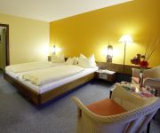
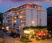
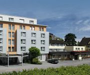
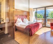
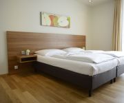
If you need a hotel, we compiled a list of available hotels close to the map centre further down the page.
While being here, you might want to pay a visit to some of the following locations: Hohenems, Dornbirn, Altach, Fraxern and Lustenau. To further explore this place, just scroll down and browse the available info.
Local weather forecast
Todays Local Weather Conditions & Forecast: 11°C / 52 °F
| Morning Temperature | 3°C / 37 °F |
| Evening Temperature | 6°C / 43 °F |
| Night Temperature | 5°C / 41 °F |
| Chance of rainfall | 0% |
| Air Humidity | 47% |
| Air Pressure | 1021 hPa |
| Wind Speed | Light breeze with 4 km/h (2 mph) from North-West |
| Cloud Conditions | Clear sky, covering 3% of sky |
| General Conditions | Sky is clear |
Sunday, 17th of November 2024
13°C (55 °F)
6°C (42 °F)
Moderate rain, gentle breeze, clear sky.
Monday, 18th of November 2024
4°C (40 °F)
1°C (33 °F)
Moderate rain, light breeze, overcast clouds.
Tuesday, 19th of November 2024
8°C (47 °F)
4°C (39 °F)
Moderate rain, light breeze, overcast clouds.
Hotels and Places to Stay
Landhaus Schiffle
Hotel am Garnmarkt
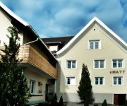
s`Matt
Hotel Paul´s
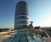
Four Points by Sheraton Panoramahaus Dornbirn
Bischof
Krone
Sonne Garni
Vienna House Martinspark Dornbirn
Fairmotel
Videos from this area
These are videos related to the place based on their proximity to this place.
Team BiBot RoboCup Austrian Open 2012 Hohenems Rescue A
Robocup AustrianOpen 2012 in Hohenems - Rescue A Das Team BiBot der HTL BULME Graz konnte als einziges Team die gesamte Aufgabe der Kategorie Rescue A lösen, gewann damit die ...
30.04. - Robocup Junior 2012 - Hohenems/Vorarlberg
Im Eventcenter in Hohenems waren 500 Jugendliche aus 6 Nationen beim Robocup Junior 2012 am Start.
4. Spiel Pfingstturnier 2012 in Hohenems F-Junioren TSV Haubersbronn
4. Spiel Pfingstturnier 2012 in Hohenems der F-Junioren des TSV Haubersbronn TSV Haubersbronn - SC Austria Lustenau II 1:1.
Ampelschaltung in Österreich / Traffic Light in Austria
Watch, before the green light switchs to yellow, the green light flashs four times. Bevor die Ampel auf gelb schaltet, blinkt das Grünlicht viermal.
Flugplatz Hohenems
Am Flugplatz in Hohemens werden Rundflüge sowie Tandem-Fallschirmsprünge angeboten. Außerdem gibt es hier Kurse für Segel- und Motorflieger sowie für Fallschirmspringer. Im Fliegerstüble...
gliding hohenems v08
segel-kunstflug in der umgebung von hohenems pilot: oliver braitmaier in der dg-500, kamera: martin castor kameraflugzeug: do27, D-EIBE, Fürstenberg Fallschirm-Team pilot: hans-jürgen götz.
Hohenems Waterfalls
Malá procházka kolem městečka Hohenems. Něco pro moje děti, ať ví, jak to tu vypadá. Je to moje první video, tak to podle toho i vypadá :-)
gliding hohenems v09
unterwegs in der umgebung von hohenems pilot: sven kolb in der ls-8 kamera: martin castor kameraflugzeug: do27, D-EIBE, Fürstenberg Fallschirm-Team pilot: hans-jürgen götz.
Race Days Hohenems 2012 Pacer - Nova near crash.wmv
1978 AMC Pacer and 1966 Chevy Nova, Drag Racing at the Race Days Hohenems with a near crash. Watch my website for pictures from this event: http://www.us-schrauber.de/html/2012.html.
Lederbekleidung SK Sieglinde Kaufmann Die Lederspezialistin Vorarlbergs in Hohenems
http://www.ledermode-kaufmann.at http://www.firmenabc.at Zu SK Sieglinde Kaufmann Die Lederspezialistin Vorarlbergs aus Hohenems finden Sie ein ausführliches Porträt unter http://www.firmenabc.
Videos provided by Youtube are under the copyright of their owners.
Attractions and noteworthy things
Distances are based on the centre of the city/town and sightseeing location. This list contains brief abstracts about monuments, holiday activities, national parcs, museums, organisations and more from the area as well as interesting facts about the region itself. Where available, you'll find the corresponding homepage. Otherwise the related wikipedia article.
Bregenzer Ache
The Bregenzer Ache is the main river of the Bregenz Forest, in the Austrian state of Vorarlberg. It is a tributary to Lake Constance.
Zumtobel Group
The Zumtobel Group (also known as Zumtobel AG) headquartered in Dornbirn, Austria is a leading European manufacturer of professional indoor and outdoor lighting, lighting management systems and lighting components as well as LED and OLED technology. The Zumtobel Group includes the subsidiaries of Zumtobel, Thorn, Tridonic and Ledon. and ranks high among companies in professional luminaire and components business.
Dornbirner Ach
The Dornbirn Ach (also called Dornbirner Ache) is a stream in Vorarlberg, Austria, with its source in the mountains near the Alpine village Ebnit. It flows through one of the largest and most gorgeous gorges in Central Europe, the Rappenloch Gorge, down to Dornbirn, cuts through the town and the meanders off over a broad meadow landscape, the Lauterach Ried, finally flowing, parallel and quite close to the mouth of the Rhine, into Lake Constance.
Feldkirch District
The Bezirk Feldkirch is an administrative district in Vorarlberg, Austria. Area of the district is 278.26 km², population is 100,656 (2012), and population density 362 persons per km². Administrative center of the district is Feldkirch. Historical population Year Pop.
Dornbirn District
The Bezirk Dornbirn is an administrative district in Vorarlberg, Austria. It is a rather young district, which was split from the Feldkirch district only in 1969. Area of the district is 172.7 km², population is 82,721 (January 1, 2012), and population density 479 persons per km². Administrative center of the district is Dornbirn. Historical population Year Pop.
Pfänder
The Pfänder is a mountain in western Austria close to Lake Constance (Bodensee). The town of Bregenz lies at the foot of the mountain on the shores of the lake. With its views over the lake and the surrounding mountain peaks, the Pfänder is one of the most famous lookout points of the region.
Lauterach Transmitter
Lauterach Transmitter is a broadcasting facility in Lauterach, Austria, located at {{#invoke:Coordinates|coord}}{{#coordinates:47|26|55|N|9|42|10|E| | |name= }} . It is used for FM and TV broadcasting, and until 1995 also for medium-wave broadcasting. It was inaugurated in 1934 and uses as antenna mast a 116 metre tall guyed mast, which is insulated against ground.
Casino Stadium
Casino Stadion is a multi-use stadium in Bregenz, Austria. It is currently used mostly for football matches and is the home ground of SC Bregenz. The stadium holds 11,112 people.
Reichshofstadion
Reichshofstadion is a multi-use stadium in Lustenau, Austria, built in 1953. It is currently used mostly for football matches and is the home ground of SC Austria Lustenau and FC Lustenau 07. The stadium holds 8,800 people.
Messestadion
Messestadion is an indoor sporting arena located in Dornbirn, Austria. The capacity of the arena is 4,270 people and was built in 2002. It is currently home to the Dornbirner EC ice hockey team
Stadion Schnabelholz
Stadion Schnabelholz is a multi-use stadium in Altach, Austria. It is currently used mostly for football matches and is the home ground of SC Rheindorf Altach. The stadium holds 8,900 and was built in 1990.
Samina (river)
The Samina also: Saminabach is a rapid river that originates in Liechtenstein and formed the Samina Valley in the course of time. It has a length of approximately 17 km and is the 2nd longest river of the principality. In the community area of Frastranz the river merges with the Ill. The water is intensively used for electricity production as well as for drinking water supply for the communities of Liechtenstein.
Galina (Austria)
The Galina River originates near the „Rossboden“ 2,060 metres above Sea Level. It is one of the shortest rivers of Vorarlberg. The Galina River also merges with the Ill River between Feldkirch and the village of Nenzing.
Frutz
The Frutz River is a 19 km long river, which flows in western direction through the "Laterns" Valley in the area of Feldkirch to the Rhine. At Rankweil the river divides into a side and main arm. The smaller one has an own name called "Ehbach". Near the mouth both arms merge again into one arm and then merge with the Rhine. Bigger locations on the River are: Sulz Koblach
Haselstauden
Haselstauden has been the fourth district of Dornbirn, Austria since 1902, when Dornbirn was given the status of municipality. It's also the city's northernmost district. As of 2004, the district had 5,034 inhabitants and ranks fifth place of the six districts.
Staufen, Austria
The Staufen is a 1456 meter high mountain in the very western part of Austria. The mountaintop splits the two bordering cities, Dornbirn and Hohenems. The Staufen is connected to the Karren, which belongs to the city of Dornbirn.
Karren
The Karren is a mountain within the city bounds of Dornbirn, in Western Austria. A cable car goes to the top of the mountain. The summit station includes a panorama restaurant with an expansive view of Switzerland and Germany and the Rhine Valley.
Neu-Ems Castle
Neu-Ems Castle (German: Burg Neu-Ems or Schloss Glopper) is a medieval castle in Hohenems in the province of Vorarlberg, Austria. It was the fortification of the nobility Herren von Ems (Lords of Ems).
Burgruine Neu-Montfort
Burgruine Neu-Montfort is a castle in Vorarlberg, Austria.
Vorarlberg museum
The vorarlberg museum (former name Vorarlberger Landesmuseum "VLM") in Bregenz is the state art and cultural museum of the Austrian federal state of Vorarlberg. It was founded in 1857 and has since been a centre for collection and preservation of the state's art and cultural material. The Museum conducts research into this material and makes it available to the public.
Kunsthaus Bregenz
The Kunsthaus Bregenz (KUB) presents temporary exhibitions of international contemporary art in Bregenz, capital of the Austrian Federal State of Vorarlberg. Commissioned by the State of Vorarlberg and designed by the Swiss architect Peter Zumthor, it was built between 1990 to 1997.
Bregenzer Festspiele
Bregenzer Festspiele (Bregenz Festival) is a performing arts festival which is held every July and August in Bregenz, Austria. Founded in 1946, the festival presents a wide variety of musical and theatrical events in several venues: Seebühne (or floating stage), with 7,000 seats, is the location for large-scale opera or musical performances on a stage over water on the shores of Lake Constance.
Alter Rhein
The Alter Rhein (German for Old Rhine) is the old river bed of the Alpine Rhine in St. Gallen and Vorarlberg in the Rhine Valley, which was cut off when the Rhine was straightened during the 20th century. These cut-off arms have become valuable recreational areas and a nature reserve. In 1900, the short-cut at Fussach was completed. The old river course, from Höchst and St.
Feldkirch railway station
Feldkirch railway station serves the city of Feldkirch, in the Feldkirch district of the Austrian federal state of Vorarlberg. Opened in 1872, it forms the junction between the Vorarlberg railway and the Feldkirch–Buchs railway. The station is owned and operated by the Austrian Federal Railways (ÖBB).
Wichenstein Castle
Wichenstein Castle is a castle in the municipality of Oberriet of the Canton of St. Gallen in Switzerland. It is a Swiss heritage site of national significance.


