Safety Score: 3,0 of 5.0 based on data from 9 authorites. Meaning we advice caution when travelling to Austria.
Travel warnings are updated daily. Source: Travel Warning Austria. Last Update: 2024-08-13 08:21:03
Discover Unterrain
The district Unterrain of in Politischer Bezirk Bregenz (Vorarlberg) is a subburb in Austria about 307 mi west of Vienna, the country's capital city.
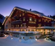
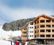
If you need a hotel, we compiled a list of available hotels close to the map centre further down the page.
While being here, you might want to pay a visit to some of the following locations: Reuthe, Bezau, Bizau, Andelsbuch and Damuels. To further explore this place, just scroll down and browse the available info.
Local weather forecast
Todays Local Weather Conditions & Forecast: 8°C / 47 °F
| Morning Temperature | 3°C / 37 °F |
| Evening Temperature | 6°C / 44 °F |
| Night Temperature | 6°C / 42 °F |
| Chance of rainfall | 0% |
| Air Humidity | 100% |
| Air Pressure | 1021 hPa |
| Wind Speed | Light breeze with 4 km/h (2 mph) from North |
| Cloud Conditions | Clear sky, covering 0% of sky |
| General Conditions | Sky is clear |
Sunday, 17th of November 2024
11°C (53 °F)
7°C (45 °F)
Scattered clouds, light breeze.
Monday, 18th of November 2024
9°C (49 °F)
7°C (44 °F)
Moderate rain, light breeze, overcast clouds.
Tuesday, 19th of November 2024
9°C (49 °F)
6°C (43 °F)
Moderate rain, light breeze, overcast clouds.
Hotels and Places to Stay
Hotel Gasthof ADLER Damüls
Walliserstube
Sonne Lifestyle Resort
Hubertus
Damülser Hof - Wellness & Spa****S
Berghotel Madlener
Boutique Hotel die Mittagspitze****s
Alpinresort Damüls
Alpenstern
'die Sonnigen' Hotel Appartments und Familienspaß
Videos from this area
These are videos related to the place based on their proximity to this place.
Uh102 bei der Einfahrt in den Bahnhof Bezau
Bregenzerwald Museumsbahn Uh102 auf dem Weg in den Bahnhof Bezau.
Ausflug auf die Niedere in Bezau, Bregenzer Wald
Tagesausflug von 5 Hochriesfliegern, die wegen Südwind und äußerst geringer Auswahl an Bergbahnen (fast alle in Revision) dieses wunderschöne Fluggebiet entdecken.
Gleitschirmfliegen, Bezau, 26.10.2013
Ich hatte Gelegenheit Paragliding aus der Nähe zu erleben - eine faszinierende Sportart, buntes Treiben und eine tolle Gemeinschaft (hochgeladen von einem Mobiltelefon) Musik: Big Sky Home...
Spabanken at Susanne Kaufmann Spa in Bezau Austria
The Spabanken Team continues their quality testing of spas around the world. This time in Bezau, Austria at Susanne Kaufmann Spa. This spa has just introduced a new anti-aging treatment: a...
Bezau am 15 03 2015
Soaren bis der Arzt kommt... Föhnige Südströmumg mit Druckgradient 5 abnehmend auf 4.
Bezau am 02 11 2014
Was für ein schöner 2. November. Soaring und Toplanden und Thermik. Was das Fliegerherz begehrt!
Gleitschirm - Fliegen in Bezau 04/13
Erstes Mal in Bezau, schönes Fluggebiet mit Blick auf den Bodensee :-)
Videos provided by Youtube are under the copyright of their owners.
Attractions and noteworthy things
Distances are based on the centre of the city/town and sightseeing location. This list contains brief abstracts about monuments, holiday activities, national parcs, museums, organisations and more from the area as well as interesting facts about the region itself. Where available, you'll find the corresponding homepage. Otherwise the related wikipedia article.
Vorarlberg
Vorarlberg is the westernmost federal state (Land) of Austria. Although it is the second smallest in terms of area (Vienna is the smallest) and population (Burgenland is less populated), it has the second highest population density (after Vienna). It borders three countries: Germany, Switzerland and Liechtenstein. The only Austrian federal state that shares a border with Vorarlberg is Tyrol to the east.
Zumtobel Group
The Zumtobel Group (also known as Zumtobel AG) headquartered in Dornbirn, Austria is a leading European manufacturer of professional indoor and outdoor lighting, lighting management systems and lighting components as well as LED and OLED technology. The Zumtobel Group includes the subsidiaries of Zumtobel, Thorn, Tridonic and Ledon. and ranks high among companies in professional luminaire and components business.
Dornbirn District
The Bezirk Dornbirn is an administrative district in Vorarlberg, Austria. It is a rather young district, which was split from the Feldkirch district only in 1969. Area of the district is 172.7 km², population is 82,721 (January 1, 2012), and population density 479 persons per km². Administrative center of the district is Dornbirn. Historical population Year Pop.
Bregenz District
The Bezirk Bregenz is an administrative district in Vorarlberg, Austria. It comprises the Bregenz Forest region, the Leiblach valley, and the Austrian part of Lake Constance. The area of the district is 863.37 km², its population is 130,425 (2012), and the population density is 151 people per km². The administrative centre of the district is Bregenz. Historical population Year Pop.
Pfänder
The Pfänder is a mountain in western Austria close to Lake Constance (Bodensee). The town of Bregenz lies at the foot of the mountain on the shores of the lake. With its views over the lake and the surrounding mountain peaks, the Pfänder is one of the most famous lookout points of the region.
Casino Stadium
Casino Stadion is a multi-use stadium in Bregenz, Austria. It is currently used mostly for football matches and is the home ground of SC Bregenz. The stadium holds 11,112 people.
Messestadion
Messestadion is an indoor sporting arena located in Dornbirn, Austria. The capacity of the arena is 4,270 people and was built in 2002. It is currently home to the Dornbirner EC ice hockey team
1954 Blons avalanches
The Blons avalanches in Austria was one of the worst mass burials by avalanche in recorded history. It occurred on February 10 and February 11. The small village of Blons near Bludenz, Vorarlberg in the Austrian Alps was hit by an avalanche at 9:36 a.m. on 12 January 1954. A second avalanche hit the village at 7 p.m. as rescue workers attempted to dig out the 118 persons buried by the first avalanche. The village had a population of 365 people, of whom 57 were killed and 22ver found.
Meng (river)
The Meng River originates from the "Red Wall" - gorge at 2,390 meters above sea level. It flows through the Gamperdonatal in a northern direction, where it unites in the municipality of Nenzing with the Ill. It reaches a length of 18 kilometers. The Gampbach with 5 kilometers of length approaches from the right side out of the Gamptal. Gampbach merges in the middle part with the Meng River.
Subersach
The Subersach originates near the „Hehlekopf“ (1.700 m SL) and is a bigger river in the district „Zerwall“ in Vorarlberg. The river course is strongly bent and looks like a bow in the landscape. The river merges with the Bregenzer Ach near the village of Egg.
Haselstauden
Haselstauden has been the fourth district of Dornbirn, Austria since 1902, when Dornbirn was given the status of municipality. It's also the city's northernmost district. As of 2004, the district had 5,034 inhabitants and ranks fifth place of the six districts.
Staufen, Austria
The Staufen is a 1456 meter high mountain in the very western part of Austria. The mountaintop splits the two bordering cities, Dornbirn and Hohenems. The Staufen is connected to the Karren, which belongs to the city of Dornbirn.
Karren
The Karren is a mountain within the city bounds of Dornbirn, in Western Austria. A cable car goes to the top of the mountain. The summit station includes a panorama restaurant with an expansive view of Switzerland and Germany and the Rhine Valley.
Neu-Ems Castle
Neu-Ems Castle (German: Burg Neu-Ems or Schloss Glopper) is a medieval castle in Hohenems in the province of Vorarlberg, Austria. It was the fortification of the nobility Herren von Ems (Lords of Ems).
Vorarlberg museum
The vorarlberg museum (former name Vorarlberger Landesmuseum "VLM") in Bregenz is the state art and cultural museum of the Austrian federal state of Vorarlberg. It was founded in 1857 and has since been a centre for collection and preservation of the state's art and cultural material. The Museum conducts research into this material and makes it available to the public.
Hittisau Women's Museum
Hittisau Women's Museum is a museum in Hittisau, Austria, devoted to women. It was founded in 2000 and is the only museum of its kind in the country. The museum displays the cultural achievements of women – particularly from the local Bregenzerwald region – through exhibitions, cultural events, teaching activities for children, presentations and workshops.
Kunsthaus Bregenz
The Kunsthaus Bregenz (KUB) presents temporary exhibitions of international contemporary art in Bregenz, capital of the Austrian Federal State of Vorarlberg. Commissioned by the State of Vorarlberg and designed by the Swiss architect Peter Zumthor, it was built between 1990 to 1997.
Bregenzer Festspiele
Bregenzer Festspiele (Bregenz Festival) is a performing arts festival which is held every July and August in Bregenz, Austria. Founded in 1946, the festival presents a wide variety of musical and theatrical events in several venues: Seebühne (or floating stage), with 7,000 seats, is the location for large-scale opera or musical performances on a stage over water on the shores of Lake Constance.
Bregenz Forest Railway
|} The Bregenz Forest Railway (German: Bregenzerwaldbahn, known colloquially as the Wälderbahn or Wälderbähnle), is an Austrian narrow gauge railway with a track gauge of 760 millimetres, the so-called Bosnian gauge. It runs through the state of Vorarlberg and used to link (from 1902 to 1983) Bregenz on Lake Constance with Bezau in the Bregenz Forest on a 35.33 kilometre long railway line. Today only a 5.01 kilometre long section is still worked as a heritage railway.


