Safety Score: 3,0 of 5.0 based on data from 9 authorites. Meaning we advice caution when travelling to Austria.
Travel warnings are updated daily. Source: Travel Warning Austria. Last Update: 2024-08-13 08:21:03
Discover Schrecken
The district Schrecken of in Politischer Bezirk Bregenz (Vorarlberg) is a district in Austria about 303 mi west of Vienna, the country's capital city.
Looking for a place to stay? we compiled a list of available hotels close to the map centre further down the page.
When in this area, you might want to pay a visit to some of the following locations: Au, Schoppernau, Schnepfau, Bizau and Reuthe. To further explore this place, just scroll down and browse the available info.
Local weather forecast
Todays Local Weather Conditions & Forecast: -5°C / 23 °F
| Morning Temperature | -5°C / 23 °F |
| Evening Temperature | -7°C / 20 °F |
| Night Temperature | -7°C / 20 °F |
| Chance of rainfall | 17% |
| Air Humidity | 80% |
| Air Pressure | 1013 hPa |
| Wind Speed | Gentle Breeze with 7 km/h (4 mph) from North |
| Cloud Conditions | Broken clouds, covering 67% of sky |
| General Conditions | Snow |
Saturday, 23rd of November 2024
-1°C (30 °F)
2°C (36 °F)
Snow, gentle breeze, broken clouds.
Sunday, 24th of November 2024
6°C (42 °F)
2°C (36 °F)
Overcast clouds, gentle breeze.
Monday, 25th of November 2024
6°C (42 °F)
0°C (32 °F)
Light snow, gentle breeze, broken clouds.
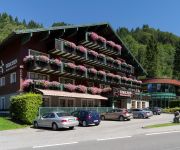
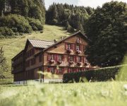
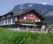
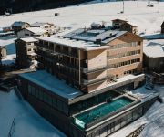
Hotels and Places to Stay
Hubertus Hotel
Krone
'die Sonnigen' Hotel Appartments und Familienspaß
Alpen Hotel Post
Hirschen Wohlfühlhotel
Adler Hotel Gasthof
DAS SCHÄFER - Superior
Das SCHIFF in den Bergen
Adler Hotel Gasthof
Haus Bergblick
Videos from this area
These are videos related to the place based on their proximity to this place.
Landwirtschaft Schoppernau-August 2012
Film - Landwirtschaft Schoppernau (100% Holz) -August 2012 Film - Construction d'une grange à Schoppernau (100% en bois) -- Août 2012 Movie -- How to make a farm building (100% made in...
Einblicke - Ferienwohnungen Strolz Schoppernau
Unser Haus liegt in ruhiger, sonniger Lage mitten im Ortszentrum. Gemütlich und sehr komfortabel eingerichtet sind unsere acht Ferienwohnungen für 2 bis 6 Personen. Alle Wohneinheiten haben...
SCHNEE SCHETTIES | WINTER 2013/2014
Die Kißlegger Rasselbande auf Schneesuche. Impressionen vom Riedberghorn und Warth Schröcken sowie von der Hüttengaudi `ge in Au / Schoppernau. "Go Pro" Filmerei . Für schöne Erinnerungen.
Skiroute mit Helmkamera vom Diedamskopf ins Tal
H. Meese aus Duisburg mit seiner Helmkamera vom wunderschönen Schigebiet Diedamskopf ins Tal nach Schoppernau.
Au
Klimatisch bevorzugt genießt Au-Schoppernau den Winter extra lange. Das Skigebiet Diedamskopf ist auch für Winterwanderungen und Touren der ideale Ausgangspunkt.
Gleitschirmflug vom Diedamskopf im Winter 03.01.2011
Winterlicher Flug vom Diedamskopf nach Schoppernau. Höhendifferenz: ca. 1150m (2.000m auf 850m) Temparatur: ca -15°C Schirm: UTurn, Bodyguard1 - M Gurtzeug: Swing, ConnectLight 2 Kamera:.
Neujahrsflug 2011 am Diedamskopf
1.1.2011, Diedamskopf - Schoppernau Musik: Oleg Serkov Eigentlich hatten wir vor, auf der Niederen (Bezauer Seite) zu fliegen. Aufgrund von Bodennebel und Wartezeit bei der Bahn entschieden...
Kirchturmrenovation Au-Rehmen - Mai bis Juni 2012
Film - Kirchturmrenovation Au-Rehmen -- Mai-Juni 2012 Film - Rénovation du clocher de l'église de Au-Rehmen -- De mai à juin 2012 Movie - Renovation of the bell tower of the church of...
Videos provided by Youtube are under the copyright of their owners.
Attractions and noteworthy things
Distances are based on the centre of the city/town and sightseeing location. This list contains brief abstracts about monuments, holiday activities, national parcs, museums, organisations and more from the area as well as interesting facts about the region itself. Where available, you'll find the corresponding homepage. Otherwise the related wikipedia article.
Vorarlberg
Vorarlberg is the westernmost federal state (Land) of Austria. Although it is the second smallest in terms of area (Vienna is the smallest) and population (Burgenland is less populated), it has the second highest population density (after Vienna). It borders three countries: Germany, Switzerland and Liechtenstein. The only Austrian federal state that shares a border with Vorarlberg is Tyrol to the east.
Formarinsee
Formarinesee is a lake in the Austrian Alps. It lies in the Bundesland of Vorarlberg and is the source of the River Lech.
Bregenz District
The Bezirk Bregenz is an administrative district in Vorarlberg, Austria. It comprises the Bregenz Forest region, the Leiblach valley, and the Austrian part of Lake Constance. The area of the district is 863.37 km², its population is 130,425 (2012), and the population density is 151 people per km². The administrative centre of the district is Bregenz. Historical population Year Pop.
1954 Blons avalanches
The Blons avalanches in Austria was one of the worst mass burials by avalanche in recorded history. It occurred on February 10 and February 11. The small village of Blons near Bludenz, Vorarlberg in the Austrian Alps was hit by an avalanche at 9:36 a.m. on 12 January 1954. A second avalanche hit the village at 7 p.m. as rescue workers attempted to dig out the 118 persons buried by the first avalanche. The village had a population of 365 people, of whom 57 were killed and 22ver found.
Subersach
The Subersach originates near the „Hehlekopf“ (1.700 m SL) and is a bigger river in the district „Zerwall“ in Vorarlberg. The river course is strongly bent and looks like a bow in the landscape. The river merges with the Bregenzer Ach near the village of Egg.
Körbersee
The picturesque lake Körbersee is southwest of the village Egg in Vorarlberg at 1600 m amsl in Austria. It lies within the "Lechtaler" Alps in Vorarlberg. The lake can only be reached on foot; estimated walking time 45 minutes. With a surface of ~ 5 ha it is a smaller lake in the province. The water possesses excellent drinking water quality and gives a protected living space to fishes and rare plants.
Obere Gottesackerwände
Obere Gottesackerwände is a mountain of Bavaria, Germany.
Riedberger Horn
Riedberger Horn is a mountain of Bavaria, Germany.
Torkopf
Torkopf is a mountain of Bavaria, Germany.
Siplinger Kopf
Siplinger Kopf is a mountain of Bavaria, Germany.
Hittisau Women's Museum
Hittisau Women's Museum is a museum in Hittisau, Austria, devoted to women. It was founded in 2000 and is the only museum of its kind in the country. The museum displays the cultural achievements of women – particularly from the local Bregenzerwald region – through exhibitions, cultural events, teaching activities for children, presentations and workshops.
Bludenz railway station
Bludenz railway station serves the city of Bludenz, in the Bludenz district of the Austrian federal state of Vorarlberg. Opened in 1872, it forms the junction between the Arlberg railway and the Vorarlberg railway. The station is also a terminus of the Bludenz–Schruns railway. It is owned and operated by the Austrian Federal Railways (ÖBB).
Villa Maund
Villa Maund is a villa in Schoppernau, Hopfreben in Vorarlberg, Austria, built for Sir John Oakley Maund (died 10 June 1902) between 1891 and 1895. The German Crown Prince William of the House of Hohenzollern used the villa from 1908 as a hunting lodge. The current owner rents the building for events.
Bregenz Forest Railway
|} The Bregenz Forest Railway (German: Bregenzerwaldbahn, known colloquially as the Wälderbahn or Wälderbähnle), is an Austrian narrow gauge railway with a track gauge of 760 millimetres, the so-called Bosnian gauge. It runs through the state of Vorarlberg and used to link (from 1902 to 1983) Bregenz on Lake Constance with Bezau in the Bregenz Forest on a 35.33 kilometre long railway line. Today only a 5.01 kilometre long section is still worked as a heritage railway.


