Safety Score: 3,0 of 5.0 based on data from 9 authorites. Meaning we advice caution when travelling to Austria.
Travel warnings are updated daily. Source: Travel Warning Austria. Last Update: 2024-08-13 08:21:03
Delve into Dreihäuser
The district Dreihäuser of in Politischer Bezirk Bregenz (Vorarlberg) is a district located in Austria about 307 mi west of Vienna, the country's capital town.
In need of a room? We compiled a list of available hotels close to the map centre further down the page.
Since you are here already, you might want to pay a visit to some of the following locations: Damuels, Sonntag, Schnepfau, Au and Bizau. To further explore this place, just scroll down and browse the available info.
Local weather forecast
Todays Local Weather Conditions & Forecast: 7°C / 45 °F
| Morning Temperature | 6°C / 43 °F |
| Evening Temperature | 6°C / 42 °F |
| Night Temperature | 3°C / 38 °F |
| Chance of rainfall | 11% |
| Air Humidity | 100% |
| Air Pressure | 1024 hPa |
| Wind Speed | Light breeze with 5 km/h (3 mph) from North |
| Cloud Conditions | Overcast clouds, covering 100% of sky |
| General Conditions | Moderate rain |
Wednesday, 27th of November 2024
10°C (50 °F)
4°C (40 °F)
Overcast clouds, light breeze.
Thursday, 28th of November 2024
6°C (42 °F)
2°C (36 °F)
Rain and snow, light breeze, overcast clouds.
Friday, 29th of November 2024
5°C (42 °F)
-3°C (27 °F)
Sky is clear, gentle breeze, clear sky.
Hotels and Places to Stay
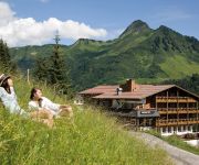
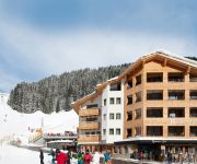
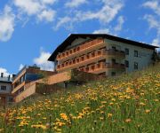
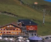
Berghotel Madlener
Walliserstube
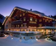
Hubertus
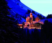
Alpinresort Damüls
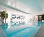
Damülser Hof - Wellness & Spa****S
Alpenstern
DAS SCHÄFER - Superior
Boutique Hotel die Mittagspitze****s
Hotel Gasthof ADLER Damüls
Hohes Licht
Videos from this area
These are videos related to the place based on their proximity to this place.
Modellflug auf der Uga Alpe, Damüls
Modellflug auf der Uga-Alpe, Damüls, Österreich. Modellflugzeuge: RadianPro und Streamtec (Motorsegler). Luftaufnahmen mit einer FlycamOne HD. Ein fantastischer Ort zum Fliegen. Das Liftperson...
Damüls
Imposante Gipfel, klare Bergseen und blühende Alpwiesen gehören zu Damüls im Sommer. 150 km markierte Wanderwege und 70 km Mountainbike-Wege machen die Region für Bergfreunde ...
Blasenka
Das Gebiet um die Blasenka im Großen Walsertal zeichnet sich durch eine Wegvielfalt mit einem Straßenstück, ansteigendem Wiesenweg, sogar einem hangquerenden Weg mit Seilhandlauf, und der.
Euro Alps Tours - What our guests say I
Together over 10 days we will explore and experience the local Grosses Walsertal valley region in western Austria - not only taking in its majestic mountains, serene spring lake, flower-filled...
Damuls afdaling
Afdaling onder de Uga lift in Damuls, Oostenrijk Voor de snellere versie zie http://www.youtube.com/watch?v=PApoFszNQ8o.
Euro Alps Tours - What our guests say II
Together over 10 days we will explore and experience the local Grosses Walsertal valley region in western Austria - not only taking in its majestic mountains, serene spring lake, flower-filled...
Snowboarden im Schneereich Damüls 2013
http://www.Tilo-Hensel.de - Zwei Tage unterwegs im Skigebiet Damüls Faschina bei strahlendem Kaiserwetter, leeren Pisten und viel Schnee. Ein Film von Jonathan Rieder und Tilo Hensel. Musik:...
Skiclub Junge in Damüls/Mellau
Walter, Maximilian, Ingo und Teletubby auf Freeride-Tour in Damüls."..es war einfach nur schön!.."
Videos provided by Youtube are under the copyright of their owners.
Attractions and noteworthy things
Distances are based on the centre of the city/town and sightseeing location. This list contains brief abstracts about monuments, holiday activities, national parcs, museums, organisations and more from the area as well as interesting facts about the region itself. Where available, you'll find the corresponding homepage. Otherwise the related wikipedia article.
Vorarlberg
Vorarlberg is the westernmost federal state (Land) of Austria. Although it is the second smallest in terms of area (Vienna is the smallest) and population (Burgenland is less populated), it has the second highest population density (after Vienna). It borders three countries: Germany, Switzerland and Liechtenstein. The only Austrian federal state that shares a border with Vorarlberg is Tyrol to the east.
Zumtobel Group
The Zumtobel Group (also known as Zumtobel AG) headquartered in Dornbirn, Austria is a leading European manufacturer of professional indoor and outdoor lighting, lighting management systems and lighting components as well as LED and OLED technology. The Zumtobel Group includes the subsidiaries of Zumtobel, Thorn, Tridonic and Ledon. and ranks high among companies in professional luminaire and components business.
Formarinsee
Formarinesee is a lake in the Austrian Alps. It lies in the Bundesland of Vorarlberg and is the source of the River Lech.
Dornbirn District
The Bezirk Dornbirn is an administrative district in Vorarlberg, Austria. It is a rather young district, which was split from the Feldkirch district only in 1969. Area of the district is 172.7 km², population is 82,721 (January 1, 2012), and population density 479 persons per km². Administrative center of the district is Dornbirn. Historical population Year Pop.
Bregenz District
The Bezirk Bregenz is an administrative district in Vorarlberg, Austria. It comprises the Bregenz Forest region, the Leiblach valley, and the Austrian part of Lake Constance. The area of the district is 863.37 km², its population is 130,425 (2012), and the population density is 151 people per km². The administrative centre of the district is Bregenz. Historical population Year Pop.
1954 Blons avalanches
The Blons avalanches in Austria was one of the worst mass burials by avalanche in recorded history. It occurred on February 10 and February 11. The small village of Blons near Bludenz, Vorarlberg in the Austrian Alps was hit by an avalanche at 9:36 a.m. on 12 January 1954. A second avalanche hit the village at 7 p.m. as rescue workers attempted to dig out the 118 persons buried by the first avalanche. The village had a population of 365 people, of whom 57 were killed and 22ver found.
Alvier
The Alvier River is a mountain stream in Vorarlberg and flows through the Brandnertal where it merges with the Ill. The river passes through the municipality of „Brand in Vorarlberg“. The waters have created numerous flat areas in the riverbed. Brook trouts and rainbow trouts splash about in water there. The clear but torrential river has drinking water quality. The pride of the village is the 14 hectare large „Alvier-Bath“ which can be used free of charge.
Alfenz
The Alfenz river is approximately 26 kilometres long and is the second-largest river in the Klostertal in Austria. The river originates at the Schindler Spitze (2,640 metres above sea level) and flows west. The river's flow created the Klostertal valley. The Alfenz merges with the Ill at a point 3.5 metres east of Bludenz. Villages near the river include Klösterle and Dalaas. The A14 motorway to Feldkirch runs alongside the river.
Subersach
The Subersach originates near the „Hehlekopf“ (1.700 m SL) and is a bigger river in the district „Zerwall“ in Vorarlberg. The river course is strongly bent and looks like a bow in the landscape. The river merges with the Bregenzer Ach near the village of Egg.
Haselstauden
Haselstauden has been the fourth district of Dornbirn, Austria since 1902, when Dornbirn was given the status of municipality. It's also the city's northernmost district. As of 2004, the district had 5,034 inhabitants and ranks fifth place of the six districts.
Staufen, Austria
The Staufen is a 1456 meter high mountain in the very western part of Austria. The mountaintop splits the two bordering cities, Dornbirn and Hohenems. The Staufen is connected to the Karren, which belongs to the city of Dornbirn.
Karren
The Karren is a mountain within the city bounds of Dornbirn, in Western Austria. A cable car goes to the top of the mountain. The summit station includes a panorama restaurant with an expansive view of Switzerland and Germany and the Rhine Valley.
Hittisau Women's Museum
Hittisau Women's Museum is a museum in Hittisau, Austria, devoted to women. It was founded in 2000 and is the only museum of its kind in the country. The museum displays the cultural achievements of women – particularly from the local Bregenzerwald region – through exhibitions, cultural events, teaching activities for children, presentations and workshops.
Bludenz railway station
Bludenz railway station serves the city of Bludenz, in the Bludenz district of the Austrian federal state of Vorarlberg. Opened in 1872, it forms the junction between the Arlberg railway and the Vorarlberg railway. The station is also a terminus of the Bludenz–Schruns railway. It is owned and operated by the Austrian Federal Railways (ÖBB).
Villa Maund
Villa Maund is a villa in Schoppernau, Hopfreben in Vorarlberg, Austria, built for Sir John Oakley Maund (died 10 June 1902) between 1891 and 1895. The German Crown Prince William of the House of Hohenzollern used the villa from 1908 as a hunting lodge. The current owner rents the building for events.
Bregenz Forest Railway
|} The Bregenz Forest Railway (German: Bregenzerwaldbahn, known colloquially as the Wälderbahn or Wälderbähnle), is an Austrian narrow gauge railway with a track gauge of 760 millimetres, the so-called Bosnian gauge. It runs through the state of Vorarlberg and used to link (from 1902 to 1983) Bregenz on Lake Constance with Bezau in the Bregenz Forest on a 35.33 kilometre long railway line. Today only a 5.01 kilometre long section is still worked as a heritage railway.


