Safety Score: 3,0 of 5.0 based on data from 9 authorites. Meaning we advice caution when travelling to Austria.
Travel warnings are updated daily. Source: Travel Warning Austria. Last Update: 2024-08-13 08:21:03
Delve into Hochfügen
Hochfügen in Politischer Bezirk Schwaz (Tirol) is a city located in Austria about 223 mi (or 359 km) west of Vienna, the country's capital town.
Current time in Hochfügen is now 09:10 PM (Thursday). The local timezone is named Europe / Vienna with an UTC offset of one hour. We know of 12 airports closer to Hochfügen, of which 5 are larger airports. The closest airport in Austria is Innsbruck Airport in a distance of 20 mi (or 33 km), West. Besides the airports, there are other travel options available (check left side).
There are several Unesco world heritage sites nearby. The closest heritage site is The Dolomites in Italy at a distance of 49 mi (or 79 km). The closest in Austria is Historic Centre of the City of Salzburg in a distance of 70 mi (or 79 km), South. We saw 1 points of interest near this location. In need of a room? We compiled a list of available hotels close to the map centre further down the page.
Since you are here already, you might want to pay a visit to some of the following locations: Zellberg, Kaltenbach, Ried im Zillertal, Gallzein and Uderns. To further explore this place, just scroll down and browse the available info.
Local weather forecast
Todays Local Weather Conditions & Forecast: 3°C / 37 °F
| Morning Temperature | -7°C / 20 °F |
| Evening Temperature | -3°C / 27 °F |
| Night Temperature | -3°C / 27 °F |
| Chance of rainfall | 2% |
| Air Humidity | 48% |
| Air Pressure | 1005 hPa |
| Wind Speed | Light breeze with 5 km/h (3 mph) from North |
| Cloud Conditions | Broken clouds, covering 50% of sky |
| General Conditions | Snow |
Friday, 22nd of November 2024
-3°C (27 °F)
-5°C (22 °F)
Snow, light breeze, overcast clouds.
Saturday, 23rd of November 2024
-0°C (32 °F)
-3°C (27 °F)
Light snow, gentle breeze, few clouds.
Sunday, 24th of November 2024
8°C (47 °F)
2°C (35 °F)
Overcast clouds, gentle breeze.
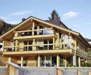
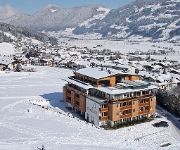
Hotels and Places to Stay
Kohlerhof
Aktiv und Wellnesshotel Haidachhof
Berggasthof Platzlalm
Sport und Wellness Hotel Held ****s
Christina Pension
Platzlhof
ZillerLodge Design & Tirol
TO BE DELETED - ZILLERLODGE DE
WohlfühlHotel Schiestl
alpinahotel lifestyle & SPA
Videos from this area
These are videos related to the place based on their proximity to this place.
Parkplatz Grafenast für 100 Fahrzeuge
Im November 2010 wurde mit den Arbeiten für den neuen Parkplatz, etwa 30 Höhenmeter oberhalb der Kellerjochliftstation "Grafenast" gelegen, begonnen. Knapp 100 Fahrzeuge finden Platz, 250.000.
Haibike eQ Xduro - Fahrgeräusche im O-Ton
Diese persönliche Premierenfahrt startet auf einer Asfaltstraße, die bald ansteigt. Als zweiter Abschnitt folgt eine Forststraße mit, bedingt durch Regen und Schneeschmelze, tiefem Boden,...
Haibike eQ Xduro - 760 Höhenmeter mit Speed und Stufe 3
Wer Pedelec-MTBs kennt, sollte unbedingt auch mal dieses Modell von Haibike probefahren - und am besten gleich im stärksten Unterstützungsmodus, also Fahrprogramm "Speed" und Stufe 3. Da...
Schwazer Endurostrecke - Passage Egertboden: Trail-Säuberung
Der Zieh- und Hohlweg unterhalb von Egertboden ist mit einer Unmenge an abgeschlagenen Ästen, querliegenden Baumstämmen und tw. größeren Steinen zugeschüttet, an ein friktionsfreies ...
tirol_tv: Schwazer Downhillwoche 2010 / Ankündigung Freeridetage am Kellerjoch
tirol tv, 2010 Bericht: Ernst Stecher Vom 24. September bis 1. Oktober steht der Schwazer Hausberg, das Kellerjoch, ganz im Zeichen der Freerider. Der Höhepunkt der Downhillwoche wird...
BionX - Testfahrten und Fahreindrücke
Nach einer halb-rennmäßigen Probefahrt von Schwaz zum Loassattel bot es sich an, in der so schönen Gegend oberhalb von Schwaz (bzw. in Hochpillberg) das Vehikel so zu zeigen, wie man's etwa...
Zillertaler Höhenstrasse - Trike
Triketour Zillertaler Höhenstrasse 25.9.2011 Route http://maps.google.com/maps/ms?msid=204582167211374516946.0004aa5f0140d45dc64a2&msa=0&ll=47.310664,11.871414&spn=0.220211 ...
I-Cam: Lahnbachtrail
Zwischen Zintberg im Osten und Egertboden im Westen zieht sich ein Graben, durchflossen vom Lahnbach, gen Stadt. Ebendort findet sich ein 1 km und -200 hm umfassender Pfad, gespickt mit ...
Wandern in Tirol - Kellerjochrunde
Routenbeschreibung: http://www.almenrausch.at/bergtouren/touren_tirol/tuxer_alpen/spieljoch-kellerjochhuette/kellerjochrunde.htm Bergtour - Wanderung vom Spieljoch zur Geolsalm, Gartalm und...
Talblick nach Ried
Von der Zillertaler Höhenstraße am Riedberg geflogen mit dem Phantom DJI Copter in Richtung Ried im Zillertal mit GOPRO3 black gefilmt. Leider verwackelt weg...
Videos provided by Youtube are under the copyright of their owners.


