Safety Score: 3,0 of 5.0 based on data from 9 authorites. Meaning we advice caution when travelling to Austria.
Travel warnings are updated daily. Source: Travel Warning Austria. Last Update: 2024-08-13 08:21:03
Discover Hinterriss
Hinterriss in Politischer Bezirk Schwaz (Tirol) is a town in Austria about 233 mi (or 375 km) west of Vienna, the country's capital city.
Current time in Hinterriss is now 12:32 PM (Friday). The local timezone is named Europe / Vienna with an UTC offset of one hour. We know of 12 airports near Hinterriss, of which 5 are larger airports. The closest airport in Austria is Innsbruck Airport in a distance of 15 mi (or 25 km), South. Besides the airports, there are other travel options available (check left side).
There are several Unesco world heritage sites nearby. The closest heritage site is Pilgrimage Church of Wies in Germany at a distance of 30 mi (or 49 km). The closest in Austria is Historic Centre of the City of Salzburg in a distance of 77 mi (or 49 km), North-West. We discovered 3 points of interest in the vicinity of this place. Looking for a place to stay? we compiled a list of available hotels close to the map centre further down the page.
When in this area, you might want to pay a visit to some of the following locations: Jachenau, Thaur, Absam, Gnadenwald and Rum. To further explore this place, just scroll down and browse the available info.
Local weather forecast
Todays Local Weather Conditions & Forecast: 7°C / 44 °F
| Morning Temperature | -3°C / 27 °F |
| Evening Temperature | 1°C / 34 °F |
| Night Temperature | -0°C / 32 °F |
| Chance of rainfall | 0% |
| Air Humidity | 59% |
| Air Pressure | 1027 hPa |
| Wind Speed | Calm with 2 km/h (2 mph) from North |
| Cloud Conditions | Scattered clouds, covering 25% of sky |
| General Conditions | Scattered clouds |
Saturday, 16th of November 2024
13°C (55 °F)
1°C (33 °F)
Sky is clear, light breeze, clear sky.
Sunday, 17th of November 2024
9°C (49 °F)
2°C (36 °F)
Light rain, light breeze, few clouds.
Monday, 18th of November 2024
4°C (40 °F)
1°C (34 °F)
Rain and snow, calm, overcast clouds.
Hotels and Places to Stay
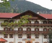
zur Post Gasthof
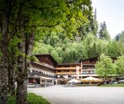
Alpengasthof & Alpencafe Eng
Videos from this area
These are videos related to the place based on their proximity to this place.
Highspeed Autobahn Garmisch München in 18 Minuten
Autobahnfahrt (Ausschnitte) von Garmisch nach München (ca. 62km). Gesamte Fahrzteit: 18 Minuten.
Kajak: Rißbach im Mai 2013, Hinterriß bis Klamm - Wildwasser - GoPro Hero 2
Am 1.5.2013 auf dem Rißbach. Einstieg oberhalb von Hinterriß bis zum Beginn der Klamm. Aufgenommen mit der GoPro Hero 2.
Club Fred MTB-Karwendel-Rundfahrt 2014 - MTB Karwendel go around
The MTB-tour data can be downloaded from Garmin.de basecamp/adventures. The tour starts at Mittenwald/Germany enters the Karwendel mountain range at Scharnitz and follows the valley up to the...
Lackenkarkopf Karwendel 07.09.2013.
Lackenkarkopf (2416m) Besteigung am 07.09.2013. über das Johannestal, Kleiner Ahornboden, Hochalmsattel, Lackenkar. Karwendel, Alpenpark Karwendel, Hinteriß, Vorderriß, Risstal, Eng,...
Walchensee Galerie Ford T Oldtimer auf 38m
Walchensee Galerie Ford T Oldtimer auf 38m. Aufgenommen mit Canon G12 im Patima Unterwassergehäuse. Licht: Halcyon EOS LED.
Katze fährt im Wohnmobil zum Walchensee / Übernachtung am Wohnmobilstellplatz
http://bit.ly/1nSMddo Wohnmobil MB 100 mit Katze Mia an Board, Tour über die Kesselbergstraße zum Walchensee (vom Nebel in die Sonne). Besuch mich doch auf Facebook und trage dich ein, wenn ...
Angeln am Walchensee 2013
Super See, wunderschöne Forellen, tolle Einsamkeit und Erholung - nur der Fisch wollte nicht beißen ...
Videos provided by Youtube are under the copyright of their owners.


