Safety Score: 3,0 of 5.0 based on data from 9 authorites. Meaning we advice caution when travelling to Austria.
Travel warnings are updated daily. Source: Travel Warning Austria. Last Update: 2024-08-13 08:21:03
Delve into Steig
Steig in Politischer Bezirk Reutte (Tirol) is located in Austria about 278 mi (or 448 km) west of Vienna, the country's capital town.
Current time in Steig is now 08:50 AM (Friday). The local timezone is named Europe / Vienna with an UTC offset of one hour. We know of 13 airports close to Steig, of which 5 are larger airports. The closest is airport we know is Memmingen Allgau Airport in Germany in a distance of 34 mi (or 55 km). The closest airport in Austria is Hohenems-Dornbirn Airport in a distance of 36 mi (or 55 km), North. Besides the airports, there are other travel options available (check left side).
There are several Unesco world heritage sites nearby. The closest heritage site is Pilgrimage Church of Wies in Germany at a distance of 24 mi (or 38 km). If you need a hotel, we compiled a list of available hotels close to the map centre further down the page.
While being here, you might want to pay a visit to some of the following locations: Schattwald, Zoblen, Jungholz, Tannheim and Graen. To further explore this place, just scroll down and browse the available info.
Local weather forecast
Todays Local Weather Conditions & Forecast: -4°C / 25 °F
| Morning Temperature | -5°C / 23 °F |
| Evening Temperature | -6°C / 21 °F |
| Night Temperature | -5°C / 23 °F |
| Chance of rainfall | 16% |
| Air Humidity | 86% |
| Air Pressure | 1012 hPa |
| Wind Speed | Gentle Breeze with 6 km/h (4 mph) from East |
| Cloud Conditions | Broken clouds, covering 61% of sky |
| General Conditions | Snow |
Saturday, 23rd of November 2024
-0°C (31 °F)
-0°C (32 °F)
Snow, gentle breeze, overcast clouds.
Sunday, 24th of November 2024
3°C (37 °F)
1°C (33 °F)
Broken clouds, gentle breeze.
Monday, 25th of November 2024
4°C (39 °F)
3°C (37 °F)
Light rain, gentle breeze, broken clouds.
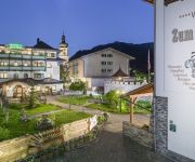
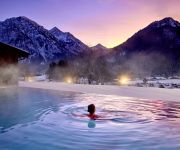
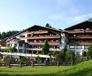
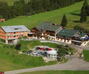
Hotels and Places to Stay
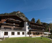
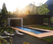
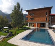
Alpenhotel Sonneck
Hotel Rehbach Ruhehotel und Naturresort
Hohenfels das Landhotel für Geniesser
Hotel Schwarzer Adler und Dependance Sonnenheim
Vital - Hotel zum Ritter
Prinz-Luitpold-Bad
Berghotel Tirol
Mattlihüs
Panoramahotel Oberjoch
Hochpasshaus am Iseler Sporthotel
Videos from this area
These are videos related to the place based on their proximity to this place.
Panoramacamp Alpenwelt
http://www.tannheimertal-camping.com ... auf der Sonnenseite des Tannheimer Tals.
Cruising in Zöblen
Zöblen hatte schon länger auf. Daher war die Wahrscheinlichkeit noch ein wenig Pulverschnee zu ergattern eigentlich recht gering.....eigentlich :-).
ASK23 from FMS First Flight 26.05.2013
RC Glider with 2300mm wingspan and electric drive. Free Filmmusik by Cayzland Studio http://www.cayzland.de.
Last Down Contest von Staufenbiel, 3,4m am 04.08.2013
Nach kleinen Startschwierigkeiten und Reparaturen fliegt der Last Down jetzt sehr gut. Beim Start hatte ich wieder aus versehen zu viel Höhe getrimmt und er wäre fast durchgesackt. Das fliegen...
Stryker First Flights 23.06.2013
Der Stryker von Horizon soll die Vorstufe zu einem Impeller Jet sein. Heute veruchte ich mein Glück damit - und er fliegt echt gut. Free Filmmusik by Cayzlan...
HK-450 (HUGHES-300 Rundflüge)
Einige Rundflüge vom Frühjahr und Sommer 2012 seht ihr in diesem Video. Infos über das Modell findet Ihr in meinem Modellbau Blog: http://helirookie.blogspot.com. Freie Filmmusik by Cayzland...
Videos provided by Youtube are under the copyright of their owners.
Attractions and noteworthy things
Distances are based on the centre of the city/town and sightseeing location. This list contains brief abstracts about monuments, holiday activities, national parcs, museums, organisations and more from the area as well as interesting facts about the region itself. Where available, you'll find the corresponding homepage. Otherwise the related wikipedia article.
Bschießer
Bschießer is a mountain in Bavaria, Germany.
Iseler
Iseler is a mountain of Bavaria, Germany.
Kühgundkopf
Kühgundkopf is a mountain of Bavaria, Germany.




![Webcam: Steig: B 199 Tannheimerstraße, bei Schattwald [km 21,1], Blickrichtung: Oberjochpaß − Deutschland capture of the webcam Steig: B 199 Tannheimerstraße, bei Schattwald [km 21,1], Blickrichtung: Oberjochpaß − Deutschland](https://images.webcams.travel/daylight/preview/1370332409.jpg)
![Webcam: Steig: B 199 Tannheimerstrasse, bei Schattwald [km 21,1], Blickrichtung: Schwattwald capture of the webcam Steig: B 199 Tannheimerstrasse, bei Schattwald [km 21,1], Blickrichtung: Schwattwald](https://images.webcams.travel/daylight/preview/1370332656.jpg)

