Safety Score: 3,0 of 5.0 based on data from 9 authorites. Meaning we advice caution when travelling to Austria.
Travel warnings are updated daily. Source: Travel Warning Austria. Last Update: 2024-08-13 08:21:03
Discover Ellenbogen
Ellenbogen in Politischer Bezirk Reutte (Tirol) is a place in Austria about 291 mi (or 468 km) west of Vienna, the country's capital city.
Current time in Ellenbogen is now 11:03 AM (Monday). The local timezone is named Europe / Vienna with an UTC offset of one hour. We know of 13 airports near Ellenbogen, of which 5 are larger airports. The closest airport in Austria is Hohenems-Dornbirn Airport in a distance of 29 mi (or 46 km), West. Besides the airports, there are other travel options available (check left side).
There are several Unesco world heritage sites nearby. The closest heritage site is Pilgrimage Church of Wies in Germany at a distance of 41 mi (or 67 km). If you need a hotel, we compiled a list of available hotels close to the map centre further down the page.
While being here, you might want to pay a visit to some of the following locations: Steeg, Holzgau, Warth, Lech and Mittelberg. To further explore this place, just scroll down and browse the available info.
Local weather forecast
Todays Local Weather Conditions & Forecast: 6°C / 43 °F
| Morning Temperature | 0°C / 32 °F |
| Evening Temperature | 1°C / 35 °F |
| Night Temperature | 2°C / 36 °F |
| Chance of rainfall | 0% |
| Air Humidity | 84% |
| Air Pressure | 1018 hPa |
| Wind Speed | Gentle Breeze with 9 km/h (5 mph) from North |
| Cloud Conditions | Few clouds, covering 22% of sky |
| General Conditions | Few clouds |
Tuesday, 26th of November 2024
2°C (35 °F)
1°C (33 °F)
Snow, light breeze, overcast clouds.
Wednesday, 27th of November 2024
5°C (42 °F)
0°C (33 °F)
Scattered clouds, light breeze.
Thursday, 28th of November 2024
5°C (41 °F)
2°C (35 °F)
Snow, light breeze, overcast clouds.
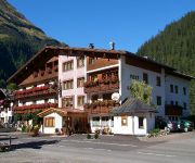
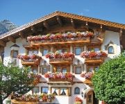
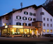
Hotels and Places to Stay
4*Hotel Post
Naturparkhotel Ober-Lechtalerhof Superior
Hotel Styrolerhof
Neue Post
Pension Alpenperle
Wohlfühlhotel Berg Heil
Birgsauer Hof
Videos from this area
These are videos related to the place based on their proximity to this place.
a day trip to - Bieberkopf
Ein kurzer Abstecher in die Alpen. Heute hats mich aus Warth aus zum Bieberkopf verschlagen. Alles sah nach einem schönen sonnigen Tag in den Bergen aus, doch dann bin ich das erste mal in...
Walmendingerhorn14.August2010.wmv
Auffahrt von Mittelberg zur Bergstation Walmendingerhorn 14.August 2010.
ATV/Quad Einsatzfahrt Lawine Riezlern Kleinwalsertal
Einsatzfahrt des ATV / Quad der Bergrettung Riezlern zum Lawineneinsatz Kanzelwand am 28.01.2015.
Ski Arlberg Lech webcam time lapse 2010-2011
http://www.wintersporters.nl - Bekijk hoe het seizoen 2010-2011 in Ski Arlberg Lech is verlopen. Een prachtige webcam time lapse.
Jump Fail - 5m drop
Schmerzhafter Sprung - Zahn gekillt und unterlippe durchgebissen (März.2010) Location: St.Anton.
Ski Arlberg Nasserein webcam time lapse 2010-2011
http://www.wintersporters.nl - Bekijk hoe het seizoen 2010-2011 in Ski Arlberg Nasserein is verlopen. Een prachtige webcam time lapse.
Zürs webcam time lapse 2011-2012
http://www.wintersporters.nl - Bekijk hoe het seizoen 2011-2012 in Ski Arlberg Zürs is verlopen. Een prachtige webcam time lapse.
2-Länder-Sportklettersteig -- Kanzelwand -- 2012
Klettersteig an der Kanzelwand 2059 m, Start von Riezlern in Österreich mit der Kanzelwandbahn, gefilmt mit Panasonic Lumix LX5.
Kanzelwandbahn
Ein Mitschnitt während der Fahrt mit der Kanzelwandbahn vom Berg ins Tal. Wer Zeit hat und ein wenig das Panorama genießen möchte, bitte ;)
Videos provided by Youtube are under the copyright of their owners.
Attractions and noteworthy things
Distances are based on the centre of the city/town and sightseeing location. This list contains brief abstracts about monuments, holiday activities, national parcs, museums, organisations and more from the area as well as interesting facts about the region itself. Where available, you'll find the corresponding homepage. Otherwise the related wikipedia article.
Rappensee
The Rappensee is mountain lake in the bavarian part of the Allgäu Alps. The lake is located below the Rappenseekopf near the small settlement Einödsbach.
Hochgundspitze
Hochgundspitze is a mountain of Bavaria, Germany.
Mußkopf
Mußkopf is a mountain of Bavaria, Germany.
Kleiner Rappenkopf
Kleiner Rappenkopf is a mountain of Bavaria, Germany.
Rotgundspitze
Rotgundspitze is a mountain of Bavaria, Germany.
Wilder Mann (Allgäu Alps)
Wilder Mann (Allgäuer Alpen) is a mountain of Bavaria, Germany.


