Safety Score: 3,0 of 5.0 based on data from 9 authorites. Meaning we advice caution when travelling to Austria.
Travel warnings are updated daily. Source: Travel Warning Austria. Last Update: 2024-08-13 08:21:03
Discover Heiligkreuz
Heiligkreuz in Politischer Bezirk Imst (Tirol) is a place in Austria about 267 mi (or 430 km) west of Vienna, the country's capital city.
Current time in Heiligkreuz is now 04:28 AM (Friday). The local timezone is named Europe / Vienna with an UTC offset of one hour. We know of 13 airports near Heiligkreuz, of which 5 are larger airports. The closest airport in Austria is Innsbruck Airport in a distance of 30 mi (or 48 km), North-East. Besides the airports, there are other travel options available (check left side).
There are several Unesco world heritage sites nearby. The closest heritage site is Benedictine Convent of St John at Müstair in Switzerland at a distance of 32 mi (or 51 km). We encountered 3 points of interest in the vicinity of this place. If you need a hotel, we compiled a list of available hotels close to the map centre further down the page.
While being here, you might want to pay a visit to some of the following locations: Soelden, Moso in Passiria, Senales, Certosa and Umhausen. To further explore this place, just scroll down and browse the available info.
Local weather forecast
Todays Local Weather Conditions & Forecast: 8°C / 46 °F
| Morning Temperature | 1°C / 33 °F |
| Evening Temperature | 4°C / 39 °F |
| Night Temperature | 5°C / 41 °F |
| Chance of rainfall | 0% |
| Air Humidity | 38% |
| Air Pressure | 1021 hPa |
| Wind Speed | Light breeze with 4 km/h (3 mph) from North |
| Cloud Conditions | Few clouds, covering 17% of sky |
| General Conditions | Few clouds |
Saturday, 16th of November 2024
11°C (52 °F)
4°C (39 °F)
Sky is clear, light breeze, clear sky.
Sunday, 17th of November 2024
7°C (45 °F)
3°C (37 °F)
Few clouds, light breeze.
Monday, 18th of November 2024
2°C (36 °F)
0°C (32 °F)
Light snow, light breeze, broken clouds.
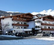
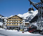
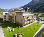
Hotels and Places to Stay
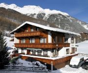
Haus Fridolin
Apart Brigitte
Alphof Sölden
Wolfgang
JOSL MOUNTAIN LOUNGING
Appartement Zuckerhütl incl.Ötztal Premium Card
Erhart
Hotel Valentin
BERGLAND HOTEL
Alm-Ferienclub Silbertal
Videos from this area
These are videos related to the place based on their proximity to this place.
skiing black piste no. 3 in Soelden captured with Contour HD 1080p
February 2011 skiing black piste in Soelden captured with a helmet mounted Contour HD 1080p.
skiing in Soelden RedPiste no. 1 captured with Contour HD 1080p
skiing red piste number 1 in Soelden with my friends recorded with a helmet mounted Contour HD 1080p.
Ski hire Soelden - Customer review about MIETSKI.COM
Niklas L. from Stockholm about ski rental at MIETSKI.COM www.mietski.com » Ski hire for Soelden from 19 € per week.
Wyjazd na narty do SÖLDEN (dolina Ötztal, Tyrol): Ośrodek narciarski
Malownicza austriacka miejscowość Sölden (dolina Ötztal, Tyrol) to prawdziwy raj dla wszystkich miłośników narciarstwa. To właśnie tam, w miejscu, gdzie rozgrywane są zawody Pucharu...
Videos provided by Youtube are under the copyright of their owners.
Attractions and noteworthy things
Distances are based on the centre of the city/town and sightseeing location. This list contains brief abstracts about monuments, holiday activities, national parcs, museums, organisations and more from the area as well as interesting facts about the region itself. Where available, you'll find the corresponding homepage. Otherwise the related wikipedia article.
Obergurgl
Obergurgl is a village in the Ötztal Alps in the Austrian state of Tyrol. Located in the municipality of Sölden, the village has approximately 400 year-round inhabitants, and is mainly a tourist resort. Obergurgl became famous in 1931, when the Swiss explorer Auguste Piccard was forced to land on the nearby Großer Gurgler Ferner glacier during his historic balloon flight, during which he became the first man to fly into the stratosphere.
Ötztal
The Ötztal is a 65-kilometer long alpine valley in the Austrian state of Tyrol. The Ötztaler Ache river flows through the valley in a northern direction. The Ötztal separates the Stubai Alps in the east from the Ötztal Alps in the west. The northern end of the valley is at the confluence of the Ötztaler Ache and Inn rivers, 8 kilometers east of Imst and 50 kilometers west of Innsbruck.


