Safety Score: 3,0 of 5.0 based on data from 9 authorites. Meaning we advice caution when travelling to Austria.
Travel warnings are updated daily. Source: Travel Warning Austria. Last Update: 2024-08-13 08:21:03
Discover Tyrnau
Tyrnau in Politischer Bezirk Weiz (Steiermark) is a place in Austria about 76 mi (or 122 km) south-west of Vienna, the country's capital city.
Current time in Tyrnau is now 05:01 AM (Thursday). The local timezone is named Europe / Vienna with an UTC offset of one hour. We know of 9 airports near Tyrnau, of which 4 are larger airports. The closest airport in Austria is Graz Airport in a distance of 23 mi (or 36 km), South. Besides the airports, there are other travel options available (check left side).
There are several Unesco world heritage sites nearby. The closest heritage site in Austria is City of Graz – Historic Centre and Schloss Eggenberg in a distance of 17 mi (or 27 km), South. If you need a hotel, we compiled a list of available hotels close to the map centre further down the page.
While being here, you might want to pay a visit to some of the following locations: Roethelstein, Schrems bei Frohnleiten, Pernegg an der Mur, Semriach and Passail. To further explore this place, just scroll down and browse the available info.
Local weather forecast
Todays Local Weather Conditions & Forecast: 6°C / 43 °F
| Morning Temperature | -1°C / 31 °F |
| Evening Temperature | 2°C / 35 °F |
| Night Temperature | 0°C / 32 °F |
| Chance of rainfall | 0% |
| Air Humidity | 51% |
| Air Pressure | 1026 hPa |
| Wind Speed | Light breeze with 4 km/h (3 mph) from South-East |
| Cloud Conditions | Clear sky, covering 7% of sky |
| General Conditions | Sky is clear |
Friday, 15th of November 2024
7°C (45 °F)
1°C (34 °F)
Overcast clouds, light breeze.
Saturday, 16th of November 2024
9°C (48 °F)
2°C (36 °F)
Sky is clear, light breeze, clear sky.
Sunday, 17th of November 2024
8°C (47 °F)
2°C (36 °F)
Sky is clear, light breeze, few clouds.
Hotels and Places to Stay
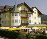
Styria Vital-Hotel
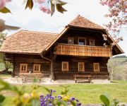
Bauernhof Zehenthof
Herbst Familienhotel
Wirtshaus Ritschi
Videos from this area
These are videos related to the place based on their proximity to this place.
Die Breitenauerbahn - Lokalbahn Mixnitz-St.Erhard
Ein interessanter Film über die Breitenauerbahn von Mixnitz nach St. Erhard. Aufgenommen 2003 bzw. 2014 Die Schmalspur E-Loks E3 und E4 und auch die 52.4984 sind zu sehen. Eine kleine ...
Drift-BMW #91, Bergrennen Rechberg 2013
Drift-BMW M3 E36 #91 Edelweißkurve, Bergrennen Rechberg 2013.
Поездка на озеро Röthelstein tieber
Поездка на озеро Röthelstein tieber https://www.facebook.com/arslan.mukhtarov Группа в Контакте:http://vk.com/public52548379.
ST10.1 Bärenschützklamm Part 1
Die Bärenschützklamm ist im Jahr 1978 zum Naturdenkmal erklärt worden. Die Höhe von 350 Metern überwindest Du auf 164 Holbrücken und einigen Leitern. Diese haben mehr als 2500 Sprossen....
2013 Ausztria, Medve szurdok I.rész
Szombathely-től 135 km-re, Graz-tól 32 km-re található a Medve szurdok, melyet 3 óra alatt lehet kényelmesen végig sétálni fa lépcsőkön.700 m-ről 1250 m-ig.
Videos provided by Youtube are under the copyright of their owners.
Attractions and noteworthy things
Distances are based on the centre of the city/town and sightseeing location. This list contains brief abstracts about monuments, holiday activities, national parcs, museums, organisations and more from the area as well as interesting facts about the region itself. Where available, you'll find the corresponding homepage. Otherwise the related wikipedia article.
Drachenhöhle
Drachenhöhle (Dragon's Cave) is a cave near Mixnitz, Styria, Austria, south-east of Bruck an der Mur at an elevation of 950 m. During a shortage of fertilizers during World War I sediments were dug in the cave. While soldiers were digging, they discovered numerous bones of cave bears, first thought to be dragons, remains of open hearths and Palaeolithic stone tools. Dated to between 65,000 and 31,000 B.C. , these are some of the oldest human traces in Austria.


