Safety Score: 3,0 of 5.0 based on data from 9 authorites. Meaning we advice caution when travelling to Austria.
Travel warnings are updated daily. Source: Travel Warning Austria. Last Update: 2024-08-13 08:21:03
Explore Haselbachberge
The district Haselbachberge of Hart-Unterberg in Politischer Bezirk Südoststeiermark (Steiermark) is located in Austria about 102 mi south of Vienna, the country's capital.
If you need a place to sleep, we compiled a list of available hotels close to the map centre further down the page.
Depending on your travel schedule, you might want to pay a visit to some of the following locations: Deutsch Goritz, Straden, Ratschendorf, Stainz bei Straden and Dietersdorf am Gnasbach. To further explore this place, just scroll down and browse the available info.
Local weather forecast
Todays Local Weather Conditions & Forecast: 10°C / 50 °F
| Morning Temperature | -1°C / 31 °F |
| Evening Temperature | 6°C / 43 °F |
| Night Temperature | 4°C / 39 °F |
| Chance of rainfall | 0% |
| Air Humidity | 75% |
| Air Pressure | 1022 hPa |
| Wind Speed | Gentle Breeze with 9 km/h (5 mph) from North-East |
| Cloud Conditions | Few clouds, covering 16% of sky |
| General Conditions | Few clouds |
Tuesday, 26th of November 2024
8°C (46 °F)
6°C (43 °F)
Light rain, gentle breeze, clear sky.
Wednesday, 27th of November 2024
7°C (44 °F)
5°C (41 °F)
Light rain, light breeze, overcast clouds.
Thursday, 28th of November 2024
7°C (45 °F)
5°C (41 °F)
Light rain, light breeze, broken clouds.
Hotels and Places to Stay
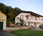
Haus Giessauf Frühstückspension
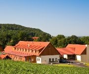
JUFA Hotel Tieschen
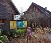
Künstler.zimmer
Videos from this area
These are videos related to the place based on their proximity to this place.
JUFA Gnas Sport Resort : Sportcamp & Trainingslager in der Steiermark
Mehr erfahren unter https://www.JUFA.eu Das JUFA Gnas Sport Resort zählt in den Bereichen Fußball, Ballsport und Physiotherapie zu den professionellsten Trainingszentren der Steiermark....
Geto Media Shop
Der "Geto Media Shop" präsentiert das neueste Debutalbum der Geto Kids aus Steinbach: Innen Tophits, Außen Geschmack! Hier ein paar Hits von ihnen zum reinhören: Seidl Puidl: http://www.yout...
Straden von oben
Straden im Bezirk Südoststeiermark .Die vier Kirchen mit den drei Türmen prägen den weithin sichtbaren Ort. Gelegen auf 376 Metern Seehöhe ist er Aussichtspunkt bis nach Kärnten, Slowenien...
JUFA Tieschen Landerlebnisdorf Steiermark : Urlaub auf dem Land
Mehr erfahren unter https://www.JUFA.eu Mitten im Steirischen Thermenland, nahe dem 3-Länder-Eck Ungarn-Österreich-Slowenien, befindet sich mit dem JUFA Tieschen Landerlebnisdorf ein ...
Die Glocke von Straden
Ortschronistin erklärt die wechselhafte Geschichte der großen Kirchenglocke von Straden.
Zukunftsforum regional - Straden 15.06.2007
Arbeit der Landentwicklung Steiermark zur Stärkung des ländlichen Raumes.
Maria am Himmelsberg - die Hauptkirche in Straden
Ein kurzer historischer Blick auf die wichitge Marienkirche.
Videos provided by Youtube are under the copyright of their owners.
Attractions and noteworthy things
Distances are based on the centre of the city/town and sightseeing location. This list contains brief abstracts about monuments, holiday activities, national parcs, museums, organisations and more from the area as well as interesting facts about the region itself. Where available, you'll find the corresponding homepage. Otherwise the related wikipedia article.
Bertholdstein Abbey
Bertholdstein Abbey, or St. Gabriel's Abbey, is a Benedictine nunnery at Bertholdstein in Styria, Austria. The nunnery was founded in 1889 in Prague and was raised to the rank of an abbey in 1893. St. Gabriel’s was the first women’s community to join the Beuronese Congregation within the Benedictine Confederation. After World War I, the predominantly German-speaking community relocated to the castle at Bertholdstein in Styria.
Sveta Ana v Slovenskih Goricah
Sveta Ana v Slovenskih Goricah (Slovene: Sveta Ana v Slovenskih goricah) is a settlement in the Municipality of Sveta Ana in the Slovene Hills in northeastern Slovenia.
Feldbach District
Bezirk Feldbach is a former district of the state of Styria in Austria. Feldbach merged with the district of Radkersburg to form the new district Südoststeiermark on January 1, 2013.
Radkersburg District
Bezirk Radkersburg is a former district of the state of Styria in Austria. Radkersburg merged with the district of Feldbach to form the new district Südoststeiermark on January 1, 2013.
Schloss Gleichenberg
Schloss Gleichenberg is a castle in Styria, Austria.
Ruine Klöch
Ruine Klöch is a castle in Styria, Austria.
Jakobski Dol Castle
Jakobski Dol Castle is a 17th-century castle located in the settlement of Spodnji Jakobski Dol, part of the municipality of Pesnica in northeastern Slovenia.
Gornja Radgona railway station
Gornja Radgona railway station (Slovene: Železniška postaja Gornja Radgona; German: Bahnhof Oberradkersburg) serves the municipality of Gornja Radgona, Slovenia. It was opened on 16 October 1890, as part of the extension of the Radkersburger Bahn from Bad Radkersburg, in present day Austria, to Ljutomer (then known as Luttenberg), in present day Slovenia. At the end of World War II, the Radkersburger Bahn was cut at the border between Austria and the then Yugoslavia.


