Safety Score: 3,0 of 5.0 based on data from 9 authorites. Meaning we advice caution when travelling to Austria.
Travel warnings are updated daily. Source: Travel Warning Austria. Last Update: 2024-08-13 08:21:03
Discover Schönau
The district Schönau of in Politischer Bezirk Graz-Umgebung (Steiermark) is a district in Austria about 81 mi south-west of Vienna, the country's capital city.
Looking for a place to stay? we compiled a list of available hotels close to the map centre further down the page.
When in this area, you might want to pay a visit to some of the following locations: Frohnleiten, Schrems bei Frohnleiten, Roethelstein, Deutschfeistritz and Peggau. To further explore this place, just scroll down and browse the available info.
Local weather forecast
Todays Local Weather Conditions & Forecast: 5°C / 41 °F
| Morning Temperature | 0°C / 33 °F |
| Evening Temperature | 2°C / 36 °F |
| Night Temperature | 3°C / 38 °F |
| Chance of rainfall | 0% |
| Air Humidity | 69% |
| Air Pressure | 1020 hPa |
| Wind Speed | Calm with 2 km/h (1 mph) from North |
| Cloud Conditions | Overcast clouds, covering 97% of sky |
| General Conditions | Overcast clouds |
Wednesday, 4th of December 2024
5°C (42 °F)
1°C (33 °F)
Overcast clouds, light breeze.
Thursday, 5th of December 2024
4°C (39 °F)
-1°C (30 °F)
Sky is clear, light breeze, clear sky.
Friday, 6th of December 2024
3°C (37 °F)
2°C (35 °F)
Overcast clouds, light breeze.
Hotels and Places to Stay
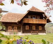
Bauernhof Zehenthof
Prenning´s Garten GastWerkstätte
La Cucina Hotel & Restaurant
Trattnerhof
Semriacher Hof
Schöcklblick
Videos from this area
These are videos related to the place based on their proximity to this place.
Die Breitenauerbahn - Lokalbahn Mixnitz-St.Erhard
Ein interessanter Film über die Breitenauerbahn von Mixnitz nach St. Erhard. Aufgenommen 2003 bzw. 2014 Die Schmalspur E-Loks E3 und E4 und auch die 52.4984 sind zu sehen. Eine kleine ...
Strömung, Heribert Hirschmann 1997
Der Animationsfilm "Strömung" war 1997 Teil eines Installationskonzeptes (Von Wasser bedeckte Monitore, auf welche Wasser tropft . Grazer Schlossbergstollen ) für einen von Richard Kriesche...
ET15 als Ersatz der E-GTW BR 4062 im Personenverkehr auf der Übelbacherbahn
Aufgrund der Überstellung der 3 E - GTW BR 4062 zu Messfahrten nach NÖ durfte der wieder reparierte ET 15 den Personenverkehr im Übelbachertal am 04.11.2011 abwickeln.
Badminton Frohnleiten 1.MOV
Unheimlich starke Badmintonszenen! 4 Spieler, 20 Sekunden, 2 Fehler ... Game over.
Поездка на озеро Röthelstein tieber
Поездка на озеро Röthelstein tieber https://www.facebook.com/arslan.mukhtarov Группа в Контакте:http://vk.com/public52548379.
Videos provided by Youtube are under the copyright of their owners.
Attractions and noteworthy things
Distances are based on the centre of the city/town and sightseeing location. This list contains brief abstracts about monuments, holiday activities, national parcs, museums, organisations and more from the area as well as interesting facts about the region itself. Where available, you'll find the corresponding homepage. Otherwise the related wikipedia article.
Styria
Styria is a state or Bundesland, located in the southeast of Austria. In area it is the second largest of the nine Austrian federated states, covering 16,401 km². It borders Slovenia as well as the other Austrian states of Upper Austria, Lower Austria, Salzburg, Burgenland, and Carinthia. The population (as of 2011) was 1,210,700. The capital city is Graz (265,000 inhabitants).
Straßengel
Straßengel is a village a few kilometres north of Graz, Austria, featuring a pilgrimage church on top of a hill. This church hosts a piece of tree root, loosely shaped like Jesus on the cross. This root is not displayed openly, but shown to people on request. The closest railway station is "Judendorf-Straßengel" and the hill is in walking distance from the station.
Schöckl Transmitter
Schöckl Transmitter is a facility for FM- and TV-transmission on the Schöckl Mountain in Steiermark, Austria. It uses as an antenna tower, a 100 metre high lattice tower, which was built in 1956. The tower of Schöckl transmitter was originally completely free-standing, but it was in recent times additionally guyed.
Mürz
The Mürz is a river in Austria. It begins north of the Schneealpe in Lower Austria, flows into Styria, and meets the Mur River after 98 km in Bruck an der Mur. Its headwaters end at Mürzzuschlag. Along its course are the tracks of the Southern Railway as well as the Semmering Highway.
Franz Fekete Stadium
Franz Fekete Stadion is a multipurpose stadium in Kapfenberg, Austria. It is currently used mostly for football matches and is the home ground of Kapfenberger SV. The stadium holds 12,000 people and was built in 1987.
Sportzentrum Kapfenberg
Sportzentrum Kapfenberg is an indoor sporting arena located in Kapfenberg, Austria. The capacity of the arena is 4,600 people. It is used mostly for ice hockey.
Mariatrost Basilica
The Baroque Mariatrost Basilica on top of the Purberg hill in Mariatrost, a district of Graz, is one of the most famous pilgrimage sites of Styria in Austria.
Andritz (Graz)
Andritz (Slovene: Jendrica – "fast-flowing water") is the 12th district of Graz. It is located in the extreme north of the city. It had a population of 18,339 in 2011 and covers an area of 18.47 square kilometres. The postal codes of Andritz are 8010, 8042-8046 and 8054.
Drachenhöhle
Drachenhöhle (Dragon's Cave) is a cave near Mixnitz, Styria, Austria, south-east of Bruck an der Mur at an elevation of 950 m. During a shortage of fertilizers during World War I sediments were dug in the cave. While soldiers were digging, they discovered numerous bones of cave bears, first thought to be dragons, remains of open hearths and Palaeolithic stone tools. Dated to between 65,000 and 31,000 B.C. , these are some of the oldest human traces in Austria.
Rein Abbey, Austria
Rein Abbey, Austria for the abbey in Norway, see Rein Abbey, Norway Rein Abbey (Stift Rein; Latin: Runa) is a Cistercian monastery in Rein near Gratwein, Styria, in Austria. Also known as the "Cradle of Styria" ("Wiege der Steiermark"), it is the oldest surviving Cistercian community in the world.
Gösting Castle
Gösting Castle is a ruined castle in Gösting, the 13th borough in the northwest of the Styrian capital Graz, Austria.
Burg Ehrenfels (St. Radegund)
Burg Ehrenfels/ Klamm bei Radegund is a castle in Styria, Austria.
Burgruine Gösting
Burgruine Gösting is a castle in Styria, Austria.
Burg Oberkapfenberg
Burg Oberkapfenberg is a castle in Styria, Austria.
Burgruine Pfannberg
Burgruine Pfannberg is a castle in Styria, Austria.
Schloss Rabenstein
Schloss Rabenstein is a castle in Styria, Austria.


