Safety Score: 3,0 of 5.0 based on data from 9 authorites. Meaning we advice caution when travelling to Austria.
Travel warnings are updated daily. Source: Travel Warning Austria. Last Update: 2024-08-13 08:21:03
Delve into Thomatal
Thomatal in Politischer Bezirk Tamsweg (Salzburg) is a city located in Austria about 145 mi (or 234 km) south-west of Vienna, the country's capital town.
Current time in Thomatal is now 11:23 AM (Saturday). The local timezone is named Europe / Vienna with an UTC offset of one hour. We know of 12 airports closer to Thomatal, of which 5 are larger airports. The closest airport in Austria is Klagenfurt Airport in a distance of 40 mi (or 65 km), South-East. Besides the airports, there are other travel options available (check left side).
There are several Unesco world heritage sites nearby. The closest heritage site in Austria is Hallstatt-Dachstein / Salzkammergut Cultural Landscape in a distance of 34 mi (or 55 km), North. In need of a room? We compiled a list of available hotels close to the map centre further down the page.
Since you are here already, you might want to pay a visit to some of the following locations: Sankt Margarethen im Lungau, Mariapfarr, Tamsweg, Ramingstein and Sankt Andra im Lungau. To further explore this place, just scroll down and browse the available info.
Local weather forecast
Todays Local Weather Conditions & Forecast: -1°C / 30 °F
| Morning Temperature | -5°C / 22 °F |
| Evening Temperature | -6°C / 21 °F |
| Night Temperature | -6°C / 21 °F |
| Chance of rainfall | 1% |
| Air Humidity | 60% |
| Air Pressure | 1028 hPa |
| Wind Speed | Light breeze with 5 km/h (3 mph) from North |
| Cloud Conditions | Broken clouds, covering 54% of sky |
| General Conditions | Light snow |
Sunday, 24th of November 2024
5°C (41 °F)
0°C (32 °F)
Overcast clouds, light breeze.
Monday, 25th of November 2024
7°C (44 °F)
0°C (33 °F)
Scattered clouds, gentle breeze.
Tuesday, 26th of November 2024
6°C (43 °F)
4°C (38 °F)
Overcast clouds, light breeze.
Hotels and Places to Stay
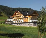
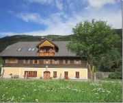
Alm.Gut - Alles gut! Vital&Relaxhotel
Bauernhof Abenteuer auf dem Biobauernhof Gut Neusess
Bauernhof Samerhof
Bauernhof Ab in die Berge Baby u. Kinderbauernhof Hansalagut
Binggl Mauterndorf
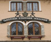
Steffner-Wallner
Gfrererstadl Gasthof
Bauernhof Trattnerhof
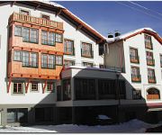
Hotel Aloisia
Stofflerwirt Landhotel
Videos from this area
These are videos related to the place based on their proximity to this place.
English Sketches Mittelschule Tamsweg
Sketches performed by students at the Mittelschule Tamsweg Grade 5.
Anpaddeln 2014 obere Mur st Michael Tamsweg
Das war unser heuriges Anpaddeln auf Mur und Taurach im Lungau, sowie der Staatsmeisterschaft Slalom und Ragatta in St.Ruprecht. Teilweise erfrischendes Wetter, dafür beste Stimmung. Gemäß...
Na vrchole Preber 2740m.MPG
Summit of the Preber mountain (2740m), in Niedere Tauern, Austria - ski touring trip of Marek and Daniel, March 2010.
The Lungau: A biosphere in the making
The Lungau has applied as Austria´s largest biosphere reserve.
UNESCO Biosphärenpark Salzburger Lungau und Kärntner Nockberge
Der UNESCO Biosphärenpark Salzburger Lungau und Kärntner Nockberge ist nicht nur der größte inneralpin sondern auch einer der schönsten. Der Biosphärenpark liegt im südlichen Salzburger...
Video Urlaub im Lungau am Waldgasthof Passegger
Urlaub im Lungau beim Waldgasthof Passegger in St. Andrä im Lungau. Machen Sie sich mit diesem Video selbst ein Bild, was Sie im Winterurlaub, Sommerurlaub oder Famlienurlaub in der Lungauer.
Videos provided by Youtube are under the copyright of their owners.
Attractions and noteworthy things
Distances are based on the centre of the city/town and sightseeing location. This list contains brief abstracts about monuments, holiday activities, national parcs, museums, organisations and more from the area as well as interesting facts about the region itself. Where available, you'll find the corresponding homepage. Otherwise the related wikipedia article.
Weissbach (Innsbruck)
The Weissbach originates out of the Lepsius tunnel by the abandoned quarry of Hötting on 720 metres above Sea Level. It runs in southern direction by the Englishman tomb to the Hoher Weg where it merges near the old Hungerburgbahn – bridge with the Inn River. The Creek lies in full on the city area of Innsbruck. Although the Creek is only 1.5 km long, it has an interesting point. The water falls down a height of 12 metres and forms the Weissbachfall.


