Abwinden
in Politischer Bezirk Perg of Oberösterreich, Austria

How to get there and get around
Location Summary
Decimal Coordinates (Latitude, Longitude):
48.259 and 14.426 (Lat./Lng.)
Coordinates by Time:
N 48° 15' 32" and E 14° 25' 34"
Currency and Currency Code:
Euro - EUR
Spoken languages:
German, Croatian, Hungarian, Slovenian
Local electricity:
230 V - 50 Hz (plugs: G)
Mobile phone / cellular frequencies (MHz):
900 MHz, 1800 MHz, 3G, 4G
Local Time: 10:17 PM (Monday)
Timezone: Europe/Vienna
UTC/GMT offset: 1 hours
Sunrise and Sunset:
7:25 am and 4:13 pm
Antipode Coordinates:
-44.033 and -176.367 (Lat./Lng.)
Closest place to antipode coordinates:
Ouwenga
References
This place on Geonames.org
Current travel safety evaluation for Austria in Western Europe

Safety Score: 3,0 of 5.0 based on data from 9 authorites. Meaning we advice caution when travelling to Austria.

Travel warnings are updated daily. Source: Travel Warning Austria. Last Update: 2024-08-13 08:21:03

Delve into Abwinden

Abwinden in Politischer Bezirk Perg (Oberösterreich) is a city located in Austria about 90 mi (or 144 km) west of Vienna, the country's capital town.

Current time in Abwinden is now 10:17 PM (Monday). The local timezone is named Europe / Vienna with an UTC offset of one hour. We know of 9 airports closer to Abwinden, of which 4 are larger airports. The closest airport in Austria is Linz Airport in a distance of 11 mi (or 18 km), West. Besides the airports, there are other travel options available (check left side).

There are several Unesco world heritage sites nearby. The closest heritage site is Historic Centre of Český Krumlov in Czechia at a distance of 39 mi (or 63 km). The closest in Austria is Wachau Cultural Landscape in a distance of 47 mi (or 63 km), North. In need of a room? We compiled a list of available hotels close to the map centre further down the page.

Since you are here already, you might want to pay a visit to some of the following locations: Engerwitzdorf, Ennsdorf, Gallneukirchen, Altenberg bei Linz and Alberndorf in der Riedmark. To further explore this place, just scroll down and browse the available info.

Local weather forecast

Todays Local Weather Conditions & Forecast: 8°C / 46 °F

Morning Temperature 1°C / 33 °F
Evening Temperature 3°C / 37 °F
Night Temperature 1°C / 34 °F
Chance of rainfall 0%
Air Humidity 69%
Air Pressure 1018 hPa
Wind Speed Light breeze with 5 km/h (3 mph) from West
Cloud Conditions Scattered clouds, covering 38% of sky
General Conditions Scattered clouds

Tuesday, 26th of November 2024

5°C (42 °F)
5°C (40 °F)
Light rain, gentle breeze, overcast clouds.

Wednesday, 27th of November 2024

6°C (43 °F)
3°C (37 °F)
Overcast clouds, light breeze.

Thursday, 28th of November 2024

2°C (36 °F)
2°C (36 °F)
Light rain, moderate breeze, overcast clouds.

Hotels and Places to Stay

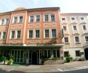
Florianerhof

Address
4,2 mi
Marktplatz 12-13
4490 St. Florian
Austria

Time Information

Checkout: 11:00 - Checkin: 12:00
Reception
Weekday: 7:00 - 22:00
Weekend: 0:00 - 0:00


Lauriacum

Address
4,0 mi
Wienerstr. 5-7
4470 Enns
Austria

Time Information

Checkout: 11:00 - Checkin: 14:00
Reception
Weekday: 6:30 - 22:00 (lunchbreak: 14:00 - 14:00)
Weekend: 7:00 - 22:00 (lunchbreak: 14:00 - 14:00)


Pension Zum Römer

Address
3,8 mi
Mauthausnerstrasse 39
4470 Enns
Austria

Time Information

Checkout: 11:00 - Checkin: 16:00
Reception
Weekday: 6:00 - 20:00 (lunchbreak: 11:30 - 16:00)
Weekend: 8:00 - 12:00


Kreuzwirt

Address
5,3 mi
Katsdorfer Str. 16
4209 Engerwitzdorf
Austria

Time Information

Checkout: 11:00 - Checkin: 16:00
Reception
Weekday: 7:00 - 22:00 (lunchbreak: 10:00 - 16:00)
Weekend: closed


Thalingerhof

Address
6,3 mi
Eisenstraße 4
4484 Kronstorf
Austria

Time Information

Checkout: 12:00 - Checkin: 09:00
Reception
Weekday: 9:00 - 23:00
Weekend: 9:00 - 23:00


Gasthaus Backhendlstation

Address
3,8 mi
Mauthausner Straße 37
4470 Enns
Austria

Time Information

Checkout: 10:00 - Checkin: 15:00
Reception
Weekday: 15:00 - 21:00
Weekend: 11:00 - 21:00


Lachstatthof

Address
5,0 mi
Lachstatt 41
4221 Linz
Austria

Time Information

Checkout: - Checkin:
Reception
Weekday: -
Weekend: closed


Videos from this area

These are videos related to the place based on their proximity to this place.

ERT Steyregg Buggy Part1

Published: May 26, 2011
Length: 49:04 min
Rating: 5 of 5
Author: ERTpromo

ERT-Steyregg.at.


ERT Steyregg Tourenwagen

Published: May 27, 2011
Length: 50:50 min
Rating: 5 of 5
Author: ERTpromo

ERT-Steyregg.at Anfahrt http://www.ERT-Steyregg.at/Wegbeschreibung.


Modern Living in the Country | Euromaxx

Published: May 27, 2012
Length: 11:08 min
Rating: 5 of 5
Author: DW (English)

We visit a modern but energy efficient house that is meant to blend in with its natural surroundings in Luftenberg, Austria, near Linz. The structure is made of wood and encased in copper....


ERT Steyregg Buggy Part 2

Published: May 26, 2011
Length: 26:42 min
Rating: 5 of 5
Author: ERTpromo

ERT-Steyregg.at.


Ert-Steyregg Trainigsakku Hubschrauberperspektive

Published: May 03, 2012
Length: 51:06 min
Rating: 5 of 5
Author: wssderftzui


Jump Fahrerlager Part1

Published: June 07, 2011
Length: 10:29 min
Rating: 4 of 5
Author: ERTpromo

ERT-Steyregg.at Anfahrt http://www.ERT-Steyregg.at/Wegbeschreibung.


Jump Feld

Published: June 08, 2011
Length: 01:42 min
Rating: 5 of 5
Author: ERTpromo

ERT-Steyregg.at.


CPI SM 80 Voca Racing Soundcheck

Published: May 22, 2013
Length: 31:33 min
Rating: 5 of 5
Author: CPI Hatza

CPI Supermoto 80 Voca Soundcheck (:


Fetzys World / Daniel Fetzy 2012 / wakebordcamp an Sesitec

Published: October 04, 2012
Length: 40:51 min
Rating: 5 of 5
Author: ABornrows

Anlagentrainingsday bei Fetzys World, geiler Spot und absolut zu empfehlen.


Pulgarn: riviertje bij Pulgarn in Oostenrijk

Published: June 17, 2014
Length: 31:08 min
Rating: 0 of 5
Author: Jos Adria

De Reichenbach bij Pulgarn met mooie stroomversnelling en kleine watervalletjes. Een mooi beekje bij Pulgarn in Oberösterreich.


Videos provided by Youtube are under the copyright of their owners.

Attractions and noteworthy things

Distances are based on the centre of the city/town and sightseeing location. This list contains brief abstracts about monuments, holiday activities, national parcs, museums, organisations and more from the area as well as interesting facts about the region itself. Where available, you'll find the corresponding homepage. Otherwise the related wikipedia article.

Gusen concentration camp

Gusen is the name of the biggest and most brutal Nazi concentration camp complex on Austrian territory. Originally called "Mauthausen II", the camp consisted of three camps and toward the end of the war, was annexed to Mauthausen concentration camp. It was part of the Mauthausen-Gusen concentration camp complex.

Located at 48.2572, 14.4633 (Lat. / Lng.), about 2 miles away.
Wikipedia Article
Mauthausen-Gusen concentration camp

Ausee

Ausee is a lake of Upper Austria. It spans 23 acres and is up to 10 m deep.

Located at 48.248, 14.417 (Lat. / Lng.), about 1 miles away.
Wikipedia Article
Lakes of Upper Austria

capture of the webcam Samesleiten: A01, bei Anschlussstelle Enns, Blickrichtung Salzburg − Km 157,71

Samesleiten: A01, bei Anschlussstelle Enns, Blickrichtung Salzburg − Km 157,71, Samesleiten (source)

capture of the webcam Asten: A01, bei Anschlussstelle − St. Florian, Blickrichtung Wien − Km 160,06

Asten: A01, bei Anschlussstelle − St. Florian, Blickrichtung Wien − Km 160,06, Asten (source)

capture of the webcam Taunleiten: A01, bei Anschlussstelle Asten- St. Florian, Blickrichtung Wien − Km 161,07

Taunleiten: A01, bei Anschlussstelle Asten- St. Florian, Blickrichtung Wien − Km 161,07, Taunleiten (source)

capture of the webcam Taunleiten: A01, bei Anschlussstelle Asten-St.Florian, Blickrichtung Wien − Km 161,07

Taunleiten: A01, bei Anschlussstelle Asten-St.Florian, Blickrichtung Wien − Km 161,07, Taunleiten (source)

capture of the webcam Bruck bei Tödling: A01, bei Anschlussstelle Asten-St.Florian, Blickrichtung Wien − Km 162,44

Bruck bei Tödling: A01, bei Anschlussstelle Asten-St.Florian, Blickrichtung Wien − Km 162,44, Bruck bei Tödling (source)

capture of the webcam Pfennigberg › East: Hohenstein

Pfennigberg › East: Hohenstein, Pfennigberg (source)

Webcams provided by webcam.travel are under the copyright of their owners.