Safety Score: 3,0 of 5.0 based on data from 9 authorites. Meaning we advice caution when travelling to Austria.
Travel warnings are updated daily. Source: Travel Warning Austria. Last Update: 2024-08-13 08:21:03
Delve into Pernitz
Pernitz in Politischer Bezirk Wiener Neustadt (Niederösterreich) is a town located in Austria about 29 mi (or 46 km) south-west of Vienna, the country's capital town.
Time in Pernitz is now 09:10 PM (Thursday). The local timezone is named Europe / Vienna with an UTC offset of one hour. We know of 11 airports closer to Pernitz, of which 5 are larger airports. The closest airport in Austria is Vienna International Airport in a distance of 32 mi (or 51 km), North-East. Besides the airports, there are other travel options available (check left side).
There are several Unesco world heritage sites nearby. The closest heritage site in Austria is Semmering Railway in a distance of 18 mi (or 29 km), South. We saw 2 points of interest near this location. In need of a room? We compiled a list of available hotels close to the map centre further down the page.
Since you are here already, you might want to pay a visit to some of the following locations: Muggendorf, Waidmannsfeld, Miesenbach, Gutenstein and Furth an der Triesting. To further explore this place, just scroll down and browse the available info.
Local weather forecast
Todays Local Weather Conditions & Forecast: 3°C / 38 °F
| Morning Temperature | 0°C / 32 °F |
| Evening Temperature | 3°C / 38 °F |
| Night Temperature | 1°C / 34 °F |
| Chance of rainfall | 0% |
| Air Humidity | 55% |
| Air Pressure | 1005 hPa |
| Wind Speed | Fresh Breeze with 13 km/h (8 mph) from East |
| Cloud Conditions | Few clouds, covering 17% of sky |
| General Conditions | Light snow |
Friday, 22nd of November 2024
1°C (33 °F)
-0°C (32 °F)
Light snow, fresh breeze, overcast clouds.
Saturday, 23rd of November 2024
3°C (37 °F)
-0°C (32 °F)
Scattered clouds, fresh breeze.
Sunday, 24th of November 2024
7°C (44 °F)
3°C (38 °F)
Overcast clouds, light breeze.
Hotels and Places to Stay
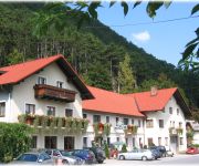
Gasthof zur Bruthenne
Videos from this area
These are videos related to the place based on their proximity to this place.
ICE WORLD Eis-Katastrophe 400.000 Festmeter Bruchholz in NÖ
05.12.2014 Grünbach am Schneeberg "Gelände" Diese Bilder entstanden unter teils sehr gefährlichen Bedingungen! Die Videos wurde nur mit dem Handy gedreht. Trotz der schlechten Qualität...
Best of Triestingtal Rallye 2009
Hier ein kleiner Ausschnitt aus dem Best of der Triestingrallye 2009. Mehr und den kompletten Clip gibt auf unserer Homepage www.RR-Racing-and-Sports.com.
Vienna * Wien * Vienne * Viena * Wieden * BEHA * Beč
sommer in wien 2011 kameramann niho- nihovideo produktion.
Hohe Wand II. přechod pohoří
záznam výpravy 28.4.2012 s průchodem rokliny Kleine Klause, ferráta Naturfreundesteig (A-B), Steirerspur (C) a sestup po Springlessteig (A)
Der Verschwender - Preview 2013
Premiere 18. Juli, 20:15 | Gutenstein ------------------------------------------------------------------------------ Spielzeit 18. Juli bis 11. August 2013 Karten und weitere Infos: www.festspiel...
Schutzhaus und Gasthaus Wilhelm Eichert Hütte auf der Hohen Wand
http://www.firmenabc.at Zu Schutzhaus und Restaurant Wilhelm Eichert Hütte aus Hohe Wand, Niederösterreich finden Sie ein ausführliches Porträt unter http://www.firmenabc.at/schutzhaus-wilhelm...
Via ferrata Gebirgsvereins - Klettersteig (sections 2-7) - POV shot
Via ferrata Gebirgsvereins - Klettersteig, sections 2-7. Grading of this via ferrata is D. Feráta Gebirgsvereins - Klettersteig, sekce 2-7. Obtížnost této feráty je D.
Videos provided by Youtube are under the copyright of their owners.
Attractions and noteworthy things
Distances are based on the centre of the city/town and sightseeing location. This list contains brief abstracts about monuments, holiday activities, national parcs, museums, organisations and more from the area as well as interesting facts about the region itself. Where available, you'll find the corresponding homepage. Otherwise the related wikipedia article.
Piesting
The Piesting is a river in southern Lower Austria. Its sources are the Kalte Gang, the Steinapiesting, and the Längapiesting, which begin south of the Schneeberg. These creeks meet in the Gutenstein in the Wienerwald. From there the Piestring flows east through Markt Piesting and Wöllersdorf and into the Viennese Basin. The Piesting meets the Fischa at Gramatneusiedl. The tributary of the Myrabach stream discharges at Pernitz into the Piesting.
Myra Falls (Lower Austria)
The Myra Falls are located in a ravine in the municipality of Muggendorf in the Austrian federal state of Lower Austria (N.B. not to be confused with the Mira Falls 50 km further west in the Ötschergräben). The ravine has been cut by the Myrabach, a small tributary of the Piesting. The Myra, as the stream is also known, rises at the foot of the Unterberg from the Myralucke, a spring steeped in legend, that is fed by an underground lake.


