Safety Score: 3,0 of 5.0 based on data from 9 authorites. Meaning we advice caution when travelling to Austria.
Travel warnings are updated daily. Source: Travel Warning Austria. Last Update: 2024-08-13 08:21:03
Touring Netting
Netting in Politischer Bezirk Wiener Neustadt (Niederösterreich) is a town located in Austria about 31 mi (or 50 km) south-west of Vienna, the country's capital place.
Time in Netting is now 05:29 PM (Thursday). The local timezone is named Europe / Vienna with an UTC offset of one hour. We know of 11 airports nearby Netting, of which 5 are larger airports. The closest airport in Austria is Vienna International Airport in a distance of 31 mi (or 50 km), North-East. Besides the airports, there are other travel options available (check left side).
There are several Unesco world heritage sites nearby. The closest heritage site in Austria is Semmering Railway in a distance of 16 mi (or 26 km), South-West. Need some hints on where to stay? We compiled a list of available hotels close to the map centre further down the page.
Being here already, you might want to pay a visit to some of the following locations: Willendorf am Steinfelde, Wurflach, Weikersdorf am Steinfelde, Waldegg and Markt Piesting. To further explore this place, just scroll down and browse the available info.
Local weather forecast
Todays Local Weather Conditions & Forecast: 6°C / 43 °F
| Morning Temperature | -1°C / 30 °F |
| Evening Temperature | 5°C / 41 °F |
| Night Temperature | 4°C / 39 °F |
| Chance of rainfall | 0% |
| Air Humidity | 55% |
| Air Pressure | 1027 hPa |
| Wind Speed | Light breeze with 4 km/h (2 mph) from East |
| Cloud Conditions | Clear sky, covering 8% of sky |
| General Conditions | Sky is clear |
Friday, 15th of November 2024
8°C (46 °F)
3°C (37 °F)
Overcast clouds, light breeze.
Saturday, 16th of November 2024
10°C (50 °F)
5°C (40 °F)
Sky is clear, light breeze, clear sky.
Sunday, 17th of November 2024
10°C (50 °F)
6°C (43 °F)
Scattered clouds, light breeze.
Hotels and Places to Stay
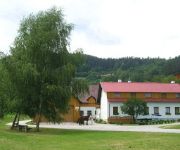
Bauernhof Ferienhof Gruber
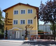
City Hotel Neunkirchen
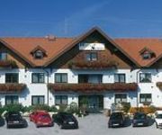
Schwartz Hotel Restaurant
Videos from this area
These are videos related to the place based on their proximity to this place.
Feuerwerk Halloween Clubbing 2014
Höhepunkt des Halloween Clubbing`s in der Römergrube war das erstmalig organisierte Feuerwerk.
Bezirksjugendsingen Weikersdorf
"Halleluja" gesungen von der Hauptschule Winzendorf-Muthmannsdorf beim Bezirksjugendsingen in Weikersdorf am 02.Mai.2013;
DJI F550 - Hohe Wand Straße - FPV
Flew with the DJI F550 @ Lower Austria - "Hohe Wand Straße" [High Wall Street]. Even some deep views to the closer region. If you like this video please thumbs up and subscribe my channel :-)
Muni and Austrian Culture at Hohe Wand
Very rewarding trip to an Austrian climbing and hiking area not too far away from Vienna. I picked some of the easiest hiking trails which were actually quite a challenge on the unicycle (especiall...
Vienna * Wien * Vienne * Viena * Wieden * BEHA * Beč
sommer in wien 2011 kameramann niho- nihovideo produktion.
71* Währinger Steig (klettersteig C) Hohe Wand, winter
A short klettersteig climb in January. It is about 100m long, and takes 15 minutes.
First Flight with Ozone Firefly 2 (Hohe Wand/Austria, 05.10.2013)
After a few hours of groundhandling I dared to hurl myself off the cliff on Hohe Wand for the first time. It's been my first flight with my new Ozone Firefly 2 (16m2) and actually also my first...
Gleitschirmfliegen Hohe Wand (Paragliding)
Die Luftsportart Gleitschirmfliegen bezeichnet das Gleitsegeln mit einem Gleitschirm. Der Pilot sitzt dabei in einem Gurtzeug unter dem Gleitschirm und ist mit diesem durch Leinen verbunden....
Videos provided by Youtube are under the copyright of their owners.
Attractions and noteworthy things
Distances are based on the centre of the city/town and sightseeing location. This list contains brief abstracts about monuments, holiday activities, national parcs, museums, organisations and more from the area as well as interesting facts about the region itself. Where available, you'll find the corresponding homepage. Otherwise the related wikipedia article.
Hohe Wand Nature Park
The Hohe Wand region comprises a rock formation with its surrounding area, situated on the Hohe Wand mountain in Austria, that is protected as a nature park. It is located in the Gutenstein Alps in the state of Lower Austria.


