Safety Score: 3,0 of 5.0 based on data from 9 authorites. Meaning we advice caution when travelling to Austria.
Travel warnings are updated daily. Source: Travel Warning Austria. Last Update: 2024-08-13 08:21:03
Discover Fischergraben
The district Fischergraben of Hochbuch in Politischer Bezirk Sankt Pölten (Niederösterreich) is a district in Austria a little west of Vienna, the country's capital city.
Looking for a place to stay? we compiled a list of available hotels close to the map centre further down the page.
When in this area, you might want to pay a visit to some of the following locations: Gablitz, Purkersdorf, Mauerbach, Wolfsgraben and Laab im Walde. To further explore this place, just scroll down and browse the available info.
Local weather forecast
Todays Local Weather Conditions & Forecast: 7°C / 45 °F
| Morning Temperature | 4°C / 40 °F |
| Evening Temperature | 6°C / 43 °F |
| Night Temperature | 5°C / 40 °F |
| Chance of rainfall | 0% |
| Air Humidity | 79% |
| Air Pressure | 1026 hPa |
| Wind Speed | Light breeze with 3 km/h (2 mph) from East |
| Cloud Conditions | Overcast clouds, covering 100% of sky |
| General Conditions | Overcast clouds |
Thursday, 28th of November 2024
9°C (49 °F)
4°C (40 °F)
Light rain, moderate breeze, overcast clouds.
Friday, 29th of November 2024
4°C (39 °F)
2°C (36 °F)
Light rain, moderate breeze, overcast clouds.
Saturday, 30th of November 2024
3°C (37 °F)
1°C (34 °F)
Light snow, gentle breeze, overcast clouds.
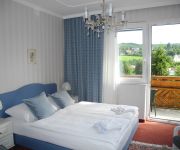
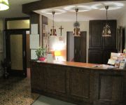
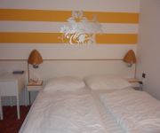
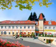
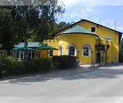
Hotels and Places to Stay
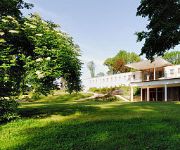
Schlosspark Mauerbach
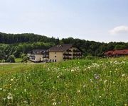
Wienerwaldhof
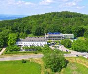
Tulbingerkogel Relais du Silence
Wiental
Austria Hotel
Land-gut-Hotel Rosner
Friedl
Lenas West
Hotel Restaurant Marienhof Unterkirchbach
Flic-Flac
Videos from this area
These are videos related to the place based on their proximity to this place.
OeBB - Koleje w Austrii - Westbahn
Film nakręcono w 2010 na stacjach Kolei Zachodniej ( Westbahn ) w Austrii. Ujęcia do filmu kręcono na stacjach Tullnerbach-Pressbaum i Rekawinkel.
Wolfgang Ambros u. Rainhard Fendrich - Schau Schazi -Purkersdorf Live
Schau Schazi (Lied von Georg Danzer) gespielt von Rainhard Fendrich und Wolfgang Ambros live in Purkersdorf 2013.
Wolfgang Ambros - Weisse Pferde - Purkersdorf live
Wolfgang Ambros & Die No. 1 vom Wienerwald spielen Georg Danzers Lied "Weisse Pferde" in Purkersdorf 2013.
The Orchestra - All over the world (live 2012, Purkersdorf, Austria)
The Orchestra (formerly "E.L.O. Part II") performing "All over the world" live on June 16th, 2012 in Purkersdorf, Austria; unfortunately the video is a bit shaky (especially when zoomed in)...
Rainhard Fendrich u. Wolfgang Ambros - Baba und foi net - Purkersdorf live
Rainhard Fendrich spielt mit Wolfgang Ambros "Baba und foi net" live in Purkersdorf 2013.
Wolfgang Ambros - Vo Liebe Ka Spur - Live in Purkersdorf
Wolfgang Ambros spielt "Von Liebe Ka Spur" Live in Purkersdorf am Hauptplatz 2013!
Immerl Buchbinderei in Purkersdorf, Niederösterreich
Zu Immerl Buchbinderei aus Purkersdorf finden Sie ein ausführliches Porträt unter http://firmenabc.at/immerl-buchbinderei_EFoD Seit wann gibt es das Unternehmen? Unser Unternehmen wurde...
The Orchestra - Strange magic (live 2012, Purkersdorf, Austria)
The Orchestra (formerly "E.L.O. Part II") performing "Strange magic" live on June 16th, 2012 in Purkersdorf, Austria; unfortunately the video is a bit shaky (especially when zoomed in) but...
Videos provided by Youtube are under the copyright of their owners.
Attractions and noteworthy things
Distances are based on the centre of the city/town and sightseeing location. This list contains brief abstracts about monuments, holiday activities, national parcs, museums, organisations and more from the area as well as interesting facts about the region itself. Where available, you'll find the corresponding homepage. Otherwise the related wikipedia article.
Hietzing
Hietzing is the 13th municipal District of Vienna . It is located west of the central districts, west of Meidling. Hietzing is a heavily populated urban area with many residential buildings, but also contains large areas of the Vienna Woods, along with Schönbrunn Palace.
Baumgarten, Vienna
Baumgarten was an independent town until the late 19th century and is an area of Vienna's fourteenth district, Penzing, today. It can be subdivided in Oberbaumgarten (in the west, close to Hütteldorf), and Unterbaumgarten. Artist Gustav Klimt was born in Baumgarten.
Hütteldorf
Hütteldorf is a part of Vienna's 14th district, Penzing. It is located in the west of Vienna, but roughly in the geographical center of the district, stretching roughly from Deutschordenstraße (which forms the border to Baumgarten) in the east to Wolf in der Au in the west, where Hütteldorf borders Hadersdorf-Weidlingau. Hütteldorf is well known throughout Austria and beyond as the site of the Gerhard-Hanappi-Stadion, the stadium in which Rapid Vienna hosts its home games.
Kirche am Steinhof
The Kirche am Steinhof (also called the Church of St. Leopold) in Vienna is the Roman Catholic oratory of the Steinhof Psychiatric Hospital. The building designed by Otto Wagner is considered one of the most important Art Nouveau churches in the world.
Hernals
Hernals is the 17th district of Vienna, Austria . Hernals is in northwest Vienna. It was annexed in 1892 out of the townships of Hernals, Dornbach, and Neuwaldegg.
Steinhof (Vienna)
Steinhof is a hospital in Vienna, Austria. It was originally a psychiatric hospital and center for pulmonology. The hospital lies in the 14th district of Vienna, Penzing, and was built according to the plans of architect Otto Wagner and opened in 1907. The building is made up of 60 pavilions that were designed by Carlo von Boog. The Kirche am Steinhof is located at the center of the compound. An art nouveau theater is found further in.
Gerhard Hanappi Stadium
The Gerhard Hanappi Stadion is a football stadion in Hütteldorf, in the west of Vienna, Austria. It is the home ground of Rapid Vienna. It was officially opened in 1977 as "Weststadion" (Western stadium). In 1980 it was renamed, to honor its architect, Austrian football player Gerhard Hanappi. Among fans the stadium is also known as "Sankt Hanappi" (Saint Hanappi), which relates to the fans' slogan Rapid ist uns're Religion ("Rapid is our religion").
Wotruba Church
The Kirche Zur Heiligsten Dreifaltigkeit (English: Church of the Most Holy Trinity) in Vienna, better known as the Wotruba Church, is located on the Sankt Georgenberg in Mauer (corner of Rysergasse and Georgengasse) in Liesing, the 23rd District of Vienna. It was built between August 1974 and October 1976 on the basis of a model by Fritz Wotruba. Wotruba died before the completion of the church, which was inspired by a visit to Chartres Cathedral.
Mauerbach Charterhouse
Mauerbach Charterhouse, in Mauerbach on the outskirts of Vienna, Austria, is a former Carthusian monastery, or charterhouse. Founded in 1314 and rebuilt in the 17th and 18th centuries, the Baroque monastic complex is one of the most important structures of its kind in Austria. Since 1984 the former charterhouse has been undergoing restoration by the Austrian Federal Monuments Office, which has its workshops there.
De Lacy
de Lacy (Laci, Lacie, Lascy, Lacey) is the surname of an old Norman noble family originating from Lassy (Calvados). The first records are about Hugh de Lacy (1020–1049). Descendent of Hugh de Lacy left Normandy and travelled to England along with William the Conqueror. Walter and Ilbert de Lacy fought in the battle of Hastings. The family took a major role in the Norman conquest of England and Ireland.
Penzing (Vienna)
Penzing is the 14th District of Vienna and consists of the boroughs of Penzing, Breitensee, Baumgarten, Hütteldorf and Hadersdorf-Weidlingau. In the west, it shares a border with Purkersdorf and Mauerbach. A large portion of the district is made up of greenery, including the Steinhof park, the Dehnepark and a portion of the Wienerwald.
Mauer, Vienna
Mauer is a former village of Lower Austria that since 1938 has been part of Vienna. Today it is part of the 23rd District of Vienna, Liesing. Its name literally means "wall".
Lainzer Tiergarten
The Lainzer Tiergarten is a 24.50 km² wildlife preserve in the southwest corner of Vienna, Austria, 80% of it being covered in woodland. It dates back to 1561, when Ferdinand I of Austria created it as a fenced-in hunting ground for his family to use. Since 1919, it has been open to the public. Its name consists of its location by the Lainz district of Vienna's 13th District, and Tiergarten, which means zoo (literally, "animal garden").
Exelberg Telecommunication Tower
Exelberg Telecommunication Tower is a 109 metre tall tower built of reinforced concrete on Exel mountain at Vienna, Austria. Exelberg Telecommunication Tower is used for directional radio services.
Sanatorium Purkersdorf
The Sanatorium Purkersdorf was built as a sanatorium in Purkersdorf, Wien-Umgebung, Lower Austria. It was built in 1904-05 by the architect Josef Hoffmann for the industrialist Victor Zuckerkandl and is an example of the style of the Viennese Secession in architecture.
Wienerwald Tunnel
The Wienerwald Tunnel is a 13.35-kilometre-long railway tunnel near Vienna in service since 9 December 2012 passing underneath the northern part of Wienerwald between Gablitz and Mauerbach. It is part of a new 250 kilometres per hour section between Vienna and St. Pölten which is part of the Western Railway (Austria).
Schloss Wilhelminenberg
Castle Wilhelminenberg, an imperial palace dating from the early 20th century which is now a four-star hotel, restaurant and conference facility, is situated on the Eastern slopes of the Gallitzinberg, in the Wienerwald Western parts of the Austrian capital, Vienna.
Sandstein-Wienerwald natural park
The Sandstein-Wienerwald natural park (Naturpark Sandsteinwienerwald) is a natural park near Purkersdorf in the Vienna Woods (Wienerwald), Austria. Although a protected area under Austrian law, it is freely accessible. The park's 77 hectare area is mostly covered by oak forest. (The German version of this web page says Beech forest. ) Its highest point is the Rudolfshöhe (475 m), on whose top a lookout tower has been constructed.
Kollegium Kalksburg
The Kollegium Kalksburg is Catholic private school in the Kalksburg, 23rd district of Vienna. http://books. google. com/books?id=drXFHAAACAAJ&dq=%22Kollegium+Kalksburg%22&hl=en&sa=X&ei=3QcVT87_Danu0gGQ_NWGAw&ved=0CDwQ6AEwAQ The school was founded in 1856 by the Jesuits, who were in charge until 1988. It was then given under the authority of "Vereinigung von Ordensschulen Österreichs".
Kalksburg
Kalksburg is a former municipality in Lower Austria that is now a part of the 23rd Viennese district Liesing. Today, the cadastral commune Atzgersdorf has got an area of 375,7 hectare.
Gaugefechtsstand Wien
The Gaugefechtsstand Wien (regional combat command center Vienna) was a World War II subterranean command bunker situated in the densely forested Wienerwald western parts of Ottakring, the 16th district of Vienna. Commonly known as the Schirach-Bunker (named after the Nazi governor for the Reichsgau Wien, Baldur von Schirach), the facilities were constructed between 1942 and 1945 as a massive underground extension to barracks that had been established in 1940.
Gallitzinberg
The Gallitzinberg (449 m) is a forested hill in the West of Austria's capital, Vienna. While it is relatively unconspicous in the broader context of the Northeastern end of the Wienerwald mountain range, it is nevertheless remarkable because of its multifaceted history, and because it functions as an important recreational area in the Western uphill part of the densely populated Ottakring district.
Aubad
The Aubad is a 50,000-square-metre man-made lake in Tulln on the Danube, Austria. It is the centerpiece of a recreational park (Erholungspark) that includes facilities for swimming, as well as a 10-hectare area for sport and leisure activities—such as soccer, volleyball, baseball and basketball—and 15 hectares of woodland. The lake and park are popular summertime resorts for both townspeople and tourists.
Wienerwaldsee
The Wienerwaldsee is a shallow reservoir, located 20 kilometres west of Vienna, Austria. It is located just north of Austria's main motorway, the West Autobahn, between Tullnerbach and Neu-Purkersdorf. It was created over three years, 1895–1897, by damming the Wienfluss and letting it fill the valley behind. The area around the lake is a nature conservation area. On the northern shore, near the weir, stands the statue of Wilhelm Kress.
Steiner House
Steiner House is a building in Vienna, Austria. It is considered one of the major works of architect Adolf Loos.


