Safety Score: 3,0 of 5.0 based on data from 9 authorites. Meaning we advice caution when travelling to Austria.
Travel warnings are updated daily. Source: Travel Warning Austria. Last Update: 2024-08-13 08:21:03
Explore Lengenfelderamt
Lengenfelderamt in Politischer Bezirk Krems (Niederösterreich) is a city in Austria about 43 mi (or 69 km) north-west of Vienna, the country's capital.
Local time in Lengenfelderamt is now 06:21 PM (Thursday). The local timezone is named Europe / Vienna with an UTC offset of one hour. We know of 10 airports in the vicinity of Lengenfelderamt, of which 4 are larger airports. The closest airport in Austria is Vienna International Airport in a distance of 54 mi (or 87 km), South-East. Besides the airports, there are other travel options available (check left side).
There are several Unesco world heritage sites nearby. The closest heritage site in Austria is Wachau Cultural Landscape in a distance of 11 mi (or 17 km), South-West. We found 1 points of interest in the vicinity of this place. If you need a place to sleep, we compiled a list of available hotels close to the map centre further down the page.
Depending on your travel schedule, you might want to pay a visit to some of the following locations: Dross, Lengenfeld, Senftenberg, Gfohl and Stratzing. To further explore this place, just scroll down and browse the available info.
Local weather forecast
Todays Local Weather Conditions & Forecast: 4°C / 39 °F
| Morning Temperature | 1°C / 35 °F |
| Evening Temperature | 3°C / 38 °F |
| Night Temperature | 1°C / 34 °F |
| Chance of rainfall | 0% |
| Air Humidity | 67% |
| Air Pressure | 1006 hPa |
| Wind Speed | Moderate breeze with 12 km/h (7 mph) from East |
| Cloud Conditions | Broken clouds, covering 58% of sky |
| General Conditions | Broken clouds |
Friday, 22nd of November 2024
4°C (39 °F)
1°C (34 °F)
Few clouds, moderate breeze.
Saturday, 23rd of November 2024
5°C (40 °F)
1°C (33 °F)
Few clouds, fresh breeze.
Sunday, 24th of November 2024
6°C (43 °F)
3°C (37 °F)
Overcast clouds, light breeze.
Hotels and Places to Stay
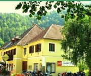
150 Jahre - GASTHOF HINTENBERGER Gasthof
Zierlinger
Leopold Janu Gasthof-Pension
Täuber Pension
Videos from this area
These are videos related to the place based on their proximity to this place.
3. Int. Airfield Race Flugplatz Krems/Gneixendorf 2008
3. Int. Yokohama Airfield Race Flugplatz Krems/Gneixendorf 2008.
Bicycle Driving: Stratzing (Krems an der Donau) copy
Stratzing is a town in the district of Krems-Land in the Austrian state of Lower Austria Original video: http://www.youtube.com/watch?v=GF0lKfSBa7I.
Landung Scheibe SF 25C Motorfalke in LOAG (Krems)
Landung mit dem Motorfalken SF-25C am Flugplatz Krems - LOAG.
Puchacz LOAG
Flug mit PZL Puchacz am 12.09.2010 in Krems über Flugplatz Gneixendorf (LOAG) Basis 800 Meter QFE.
Wilder Bienenschwarm in Eisenbergeramt
Bio-Landwirtschaft zahlt sich aus. Seit im Umkreis die meisten Bauern biologisch wirtschaften hat sich die Zahl der Nützlinge vervielfacht. Jetzt ist uns sogar ein Bienenschwarm zugeflogen.
2012 Erzbergrodeo XVIII - Guided Tour on a Vespa PX150 (Helmet Cam)
2012 Erzbergrodeo XVIII - "Guided Tour" on a Vespa PX150 (Helmet Cam)
Videos provided by Youtube are under the copyright of their owners.


