Safety Score: 3,0 of 5.0 based on data from 9 authorites. Meaning we advice caution when travelling to Austria.
Travel warnings are updated daily. Source: Travel Warning Austria. Last Update: 2024-08-13 08:21:03
Delve into Aigen
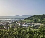
The district Aigen of in Politischer Bezirk Krems (Niederösterreich) is a district located in Austria about 37 mi west of Vienna, the country's capital town.
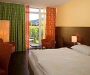
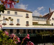
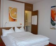
In need of a room? We compiled a list of available hotels close to the map centre further down the page.
Since you are here already, you might want to pay a visit to some of the following locations: Paudorf, Krems an der Donau, Statzendorf, Stratzing and Senftenberg. To further explore this place, just scroll down and browse the available info.
Local weather forecast
Todays Local Weather Conditions & Forecast: 4°C / 40 °F
| Morning Temperature | 1°C / 34 °F |
| Evening Temperature | 2°C / 36 °F |
| Night Temperature | 0°C / 33 °F |
| Chance of rainfall | 0% |
| Air Humidity | 58% |
| Air Pressure | 1007 hPa |
| Wind Speed | Moderate breeze with 12 km/h (7 mph) from East |
| Cloud Conditions | Few clouds, covering 12% of sky |
| General Conditions | Few clouds |
Friday, 22nd of November 2024
3°C (38 °F)
1°C (33 °F)
Overcast clouds, fresh breeze.
Saturday, 23rd of November 2024
4°C (40 °F)
1°C (33 °F)
Broken clouds, fresh breeze.
Sunday, 24th of November 2024
4°C (39 °F)
4°C (40 °F)
Overcast clouds, light breeze.
Hotels and Places to Stay
Gasthof-Hotel "Goldene Krone"
Hotel Klinglhuber
Bauernhof Winzerhof Bogner
Steigenberger Hotel and Spa
Weinresidenz Sonnleitner
arte Hotel Krems
Gasthof Klinglhuber
Unter Den Linden
Orange Wings Krems
Parkhotel Krems
Videos from this area
These are videos related to the place based on their proximity to this place.
Football match at Krems Stadium, Krems
2. Landesliga West of Lower Austria match between Kremser SC and ASV Spratzern; Krems an der Donau, Austria, 2009-09-18; クレムススタジアムでのサッカーの試合(ツバイテラ...
Wachau Marillenfest - Alles Marille in Krems
Wachau Marillenfest - Alles Marille in Krems Während des Festes „Alles Marille" präsentiert sich die Kremser Innenstadt von seiner schönsten und fröhlichsten Seite und zeigt mit seiner...
Praxisseminar: Branddienst der FF Krems
Brandphänomene, Wärmebildkamera, Notsignalgeber, Brandfluchthaben, Strahlrohrtraining, Türöffnungsprozedur, Suchen & Retten, Belastungsübung und viele weitere Begriffe aus dem Bereich...
CocoRosie & Diane Cluck - Hairnet Paradise / Nothing but God - Donaufestival Krems 2012
CocoRosie & Diane Cluck - Hairnet Paradise / Nothing but God part of CocoRosie: Die Achte Nacht Donaufestival Krems -- Austria live on stage, April 30 / May 1, 2012 musicians: CocoRosie, Diane...
2014 05 26 Pinguin Cup Krems VS Etsdorf 3+4 Klasse
Schwimmwettbewerb Pinguin Cup Krems 26.05.2014 VS Etsdorf 3+4. Klasse.
Dachsanierung Altstadt Krems an der Donau / KINASTBERGER DACH- UND HOLZBAU GMBH
KINASTBERGER DACH- UND HOLZBAU GMBH Zimmerei / Dachdeckerei / Bauspenglerei www.kinastberger.at.
Industriehafen Krems 14 01 2015
Baggerarbeiten in und um die Industriehafeneinfahrt Krems. Weiters wird die Einfahrt des Behördenhafen Krems, der kleine Bootshafen des HSV und die Fladnitzmündung vom abgelagerten Schamm.
Donau - Danube - Winter 2012 - Krems an der Donau - Eisschollen - Austria
Donau - Krems - Anfang Februar 2012 (Eisschollen) aufgenommen mit: CANON IXUS 130 Digitalkamera - 14,1 MPX Slideshow erstellt mit Aquasoft Diashow 7 Titel erstellt mit Prodad Heroglyph ...
Krems Alles Marille 2013 - Wachau Kremser Altstadt
Krems Alles Marille 2013 - Wachau Kremser Altstadt Während des Festes „Alles Marille" präsentiert sich die Kremser Innenstadt von seiner schönsten und fröhlichsten Seite und zeigt mit...
Videos provided by Youtube are under the copyright of their owners.
Attractions and noteworthy things
Distances are based on the centre of the city/town and sightseeing location. This list contains brief abstracts about monuments, holiday activities, national parcs, museums, organisations and more from the area as well as interesting facts about the region itself. Where available, you'll find the corresponding homepage. Otherwise the related wikipedia article.
Lower Austria
Lower Austria is the northeasternmost state of the nine states in Austria. The capital of Lower Austria since 1986 is Sankt Pölten, the most recently designated capital town in Austria. The capital of Lower Austria had formerly been Vienna, even though Vienna is not officially part of Lower Austria. With a land area of 19,186 km² and a population of 1.612 million people, it is the largest state in Austria, and in terms of population second only to the federal state of Vienna.
Danube University Krems
Danube University Krems (subtitled University for Continuing Education Krems; German: Donau-Universität Krems and Universität für Weiterbildung Krems, respectively) calls itself "the only state-funded university throughout Europe that has specialized in post-graduate academic studies". It is located in Krems an der Donau, Lower Austria.
Göttweig Abbey
Göttweig Abbey (Stift Göttweig) is a Benedictine monastery near Krems in Lower Austria.
Battle of Dürenstein
The Battle of Dürenstein (also known as the Battle of Dürrenstein, Battle of Dürnstein, Battle of Diernstein and, in German, Gefecht bei Dürrenstein), on 11 November 1805, was an engagement in the Napoleonic Wars during the War of the Third Coalition. Dürenstein is located in the Wachau Valley, on the River Danube, 73 kilometers upstream from Vienna, in Austria.
Krems-Land District
Bezirk Krems-Land is a district of the state of Lower Austria in Austria. It comprises the areas to the West and North of the city Krems an der Donau, which itself is a statutory city.
Grafenegg Music Festival
The Grafenegg Music Festival is a new major international Austrian festival for classical music close to Vienna. The annual festival takes place on the grounds of Grafenegg Castle. Two major venues have been built for the festival in the park of the castle: The open-air stage Wolkenturm (capacity 1,730, opened 2007) as well as the new concert hall Auditorium (capacity 1,372, opened 2008). The artistic director is pianist Rudolf Buchbinder.
Manhartsberg
Manhartsberg is a low, flat-lying mountain ridge in Lower Austria. It rises to a maximum height of 537 m. It is the southeastern flank of the granite Bohemian massif. The ridge runs from the Thaya river up to the Wagram mountain range and is partly overlaid with Neogene sediments, primarily clays, sands and gravels of the Vienna Basin formations. This ridge continues to the northeast into Moravia in the area near Znojmo.
Gneixendorf
Gneixendorf is a village near Krems in Lower Austria. It was the location of Stalag XVII-B, the setting of the Billy Wilder film Stalag 17.
Festspielhaus St. Pölten
The Festspielhaus St. Pölten is a Festival Theatre in St. Pölten, the capital of Lower Austria. It is located next to the Landesmuseum (museum of the country of Lower Austria), the Ausstellungshalle (exhibition hall), the Landesbibliothek (public library of the country of Lower Austria), the Landesarchiv (archive of the country of Lower Austria) and the Klangturm in the cultural district of St. Pölten. The Festspielhaus was opened on March 1, 1997.
St. Pölten University of Applied Sciences
The St. Pölten University of Applied Sciences was founded in 1993 and has approximately 1,600 students enrolled. It currently offers 14 degree programmes. Study opportunities comprise degree programmes and continuing education courses in the fields of Health and Social Sciences, Business, and Technology. These courses are both academically and vocationally oriented and include training in business administration, law, foreign languages, and interpersonal skills.
Burgruine Dürnstein
Burgruine Dürnstein is a ruin of a castle in Lower Austria, Austria.
Burgruine Senftenberg
Burgruine Senftenberg is a castle in Lower Austria, Austria.
Schloss Walpersdorf
Schloss Walpersdorf is a castle in Lower Austria, Austria.
Schloss Gobelsburg
Schloss Gobelsburg is a winery in the Kamptal wine growing region in Lower Austria, some 50 miles to the north west of Vienna. The esteate produces both red and white wines.
Johann Heinrich von Schmitt
Heinrich Schmitt (1743—11 November 1805) was a lieutenant field marshal in the Habsburg military during the French Revolutionary and Napoleonic wars. He developed a sound military reputation as a surveyor, map-maker, and strategist during Austria's wars with the Ottoman Empire, He served on the Quartermaster's staff during the War of the First Coalition. As a major general, he was one of Archduke Charles trusted advisers during the War of the Second Coalition campaign in southwestern Germany.
Battle of Dürenstein order of battle
The Battle of Dürenstein order of battle included a Coalition force of Russian and Austrian troops, under the overall command of Mikhail Kutuzov, and a single division of the Corps Mortier commanded by Édouard Mortier. In pursuing the Austrian retreat from Bavaria, Mortier had over-extended the three divisions of his newly formed VIII. Corps, spreading them along the north bank of the Danube.
St. Pölten Central Station
St. Pölten Central Station (St. Pölten Hauptbahnhof) is the main station at St. Pölten, which is the capital city of the federal state of Lower Austria, located in the north east of Austria.
Gansbach
Gansbach is a small town and centre of the municipality of Dunkelsteinerwald in Melk District, Lower Austria in northeastern Austria. It lies several kilometres inland from the Danube. To the west and north of the settlement is the Wachau valley. The parish church probably originates from the 14th century. The side altar piece of the famous painter Kremser Schmidt and the high altarpiece, which was painted by one of his students are of note.
Eckartsberg
Eckartsberg is a settlement in the municipality of Dunkelsteinerwald in Melk District, Lower Austria in northeastern Austria.
Krapfenberg
Krapfenberg is a settlement in the municipality of Dunkelsteinerwald in Melk District, Lower Austria in northeastern Austria.
Lottersberg
Lottersberg is a settlement in the municipality of Dunkelsteinerwald in Melk District, Lower Austria in northeastern Austria.
Steiner Tor
Steiner Tor is a-preserved gate, originally built in the late 15th century but refashioned in the Baroque style in the city of Krems an der Donau, in the Wachau valley of Austria. It is considered the symbol of the city. Until the last third of the 19th century, the city of Krems was surrounded by a wall. This was systematically razed, and three gates were also removed.


