Safety Score: 3,0 of 5.0 based on data from 9 authorites. Meaning we advice caution when travelling to Austria.
Travel warnings are updated daily. Source: Travel Warning Austria. Last Update: 2024-08-13 08:21:03
Delve into Wolfsthal
Wolfsthal in Politischer Bezirk Bruck an der Leitha (Niederösterreich) is located in Austria about 29 mi (or 47 km) east of Vienna, the country's capital town.
Current time in Wolfsthal is now 11:31 AM (Thursday). The local timezone is named Europe / Vienna with an UTC offset of one hour. We know of 11 airports close to Wolfsthal, of which 5 are larger airports. The closest is airport we know is M. R. Štefánik Airport in Slovakia in a distance of 10 mi (or 16 km). The closest airport in Austria is Vienna International Airport in a distance of 20 mi (or 16 km), East. Besides the airports, there are other travel options available (check left side).
There are several Unesco world heritage sites nearby. The closest heritage site in Austria is Historic Centre of Vienna in a distance of 29 mi (or 47 km), West. If you need a hotel, we compiled a list of available hotels close to the map centre further down the page.
While being here, you might want to pay a visit to some of the following locations: Edelstal, Berg, Hundsheim, Kittsee and Prellenkirchen. To further explore this place, just scroll down and browse the available info.
Local weather forecast
Todays Local Weather Conditions & Forecast: 4°C / 40 °F
| Morning Temperature | 1°C / 34 °F |
| Evening Temperature | 4°C / 38 °F |
| Night Temperature | 3°C / 38 °F |
| Chance of rainfall | 0% |
| Air Humidity | 59% |
| Air Pressure | 1008 hPa |
| Wind Speed | Fresh Breeze with 15 km/h (10 mph) from North |
| Cloud Conditions | Scattered clouds, covering 45% of sky |
| General Conditions | Light snow |
Friday, 22nd of November 2024
3°C (38 °F)
1°C (35 °F)
Snow, fresh breeze, overcast clouds.
Saturday, 23rd of November 2024
4°C (40 °F)
1°C (34 °F)
Light snow, fresh breeze, scattered clouds.
Sunday, 24th of November 2024
3°C (38 °F)
2°C (35 °F)
Overcast clouds, moderate breeze.
Hotels and Places to Stay
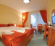
Hotel SOREA Regia
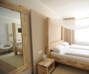
FIDI
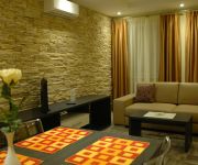
Viktor Apartments
zum goldenen Anker Gasthof
Hotel Max Inn
Videos from this area
These are videos related to the place based on their proximity to this place.
B9-Sperre zwischen Staatsgrenze Berg und Wolfsthal (HD)
http://2-4.co -- Die Folgen der Sperre der Hauptverkehrsroute zwischen Wien und Bratislava, der B9 wegen Generalsanierung der Strasse - u.a. Karussellfahrten am Kreisverkehr in Wolfsthal ...
111218 koenigswarte.avi
Schengen tour. Trasa: Wolfsthal-Koenigswarte-Berg-Kitsee-vojensky cintorin v Petrzalke-zeleznicna stanica Petrzalka.
Action-Day der Freiwilligen Feuerwehr Hainburg
http://2-4.co - Die FF Hainburg an der Donau veranstaltete am 26.4.2014 einen Action-Day für die Bevölkerung, insbesondere für Kinder und Jugendliche zur Förderung der Nachwuchsarbeit -...
Bürger verhindern Baumfällung in Hainburg
http://www.DerGloeckel.eu --- (Niederösterreich) Engagierte Bürgerinnen und Bürger sahen sich am 14. April zur frühen Morgenzeit auf den Plan gerufen um gegen die beabsichtigte Fällung...
Hochwasser - ein kleiner Durchbruch
http://NOE-Umweltwacht.org | Während Dokumentationsarbeiten zu älteren Schäden am Wasserschutzdamm nächst der Jägerhaussiedlung in Hainburg durchbricht der steigende Seitenarm der Donau ...
Hochwasser - Zugang zum Nationalpark wird geflutet
http://NOE-Umweltwacht.org | Der Zugang zum Nationalpark Donau-Auen in Hainburg nächst der Thebnerstrasse wird am Vormittag des 24.10. geflutet.
Naturwacht Hainburg räumte Fischkadaver nach Überschwemmung (HD)
http://NOE-Umweltwacht.org --- Nach starken Unwettern kam es zu einer Überflutung von Siedlungsgebieten in der niederösterreichischen Gemeinde Wolfsthal - ein Teich trat über die Ufer und...
Videos provided by Youtube are under the copyright of their owners.
Attractions and noteworthy things
Distances are based on the centre of the city/town and sightseeing location. This list contains brief abstracts about monuments, holiday activities, national parcs, museums, organisations and more from the area as well as interesting facts about the region itself. Where available, you'll find the corresponding homepage. Otherwise the related wikipedia article.
Devín Castle
Devín Castle is a castle in Devín, which is a borough of Bratislava, the capital of Slovakia. Owing to its strategic position, the cliff (altitude of 212 meters) at the confluence of the Danube and Morava rivers was an ideal place for a fort. Its owner could control the important trade route along the Danube as well as one branch of the Amber Road. That is why the site has been settled since the Neolithic and fortified since the Bronze and Iron Age.
Devín Gate
Devín Gate or Hainburger Gate is a natural gate in the Danube valley at the border of Slovakia and Austria. It is one out of four geomorphological areas of the Devín Carpathians, part of the Little Carpathians mountain range. Passau, Devín Gate, and the Iron Gates divide the Danube river into four distinct sections. Devín Gate has been inhabited since prehistoric times, with continuous settlement since 5000 BC.
Battle of the Theben Pass
The Battle of the Theben Pass was fought in the Theben pass near Wieselburg, where the March meets the Danube, in 1060. It was a victory for the nationalist part in Hungary over that of their own pro-German king. In 1058, Solomon, son of Andrew I of Hungary was betrothed to Judith, daughter of the Emperor Henry III. In Hungary, however, a party opposed to such close ties with Germany arose, led by Bela, Andrew's brother.


