Safety Score: 3,0 of 5.0 based on data from 9 authorites. Meaning we advice caution when travelling to Austria.
Travel warnings are updated daily. Source: Travel Warning Austria. Last Update: 2024-08-13 08:21:03
Touring Stadtrandsiedlung
The district Stadtrandsiedlung of Traiskirchen in Politischer Bezirk Baden (Niederösterreich) is a subburb located in Austria about 13 mi south of Vienna, the country's capital place.
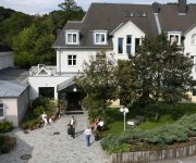
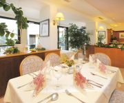
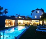
Need some hints on where to stay? We compiled a list of available hotels close to the map centre further down the page.
Being here already, you might want to pay a visit to some of the following locations: Guntramsdorf, Trumau, Oberwaltersdorf, Gumpoldskirchen and Pfaffstatten. To further explore this place, just scroll down and browse the available info.
Local weather forecast
Todays Local Weather Conditions & Forecast: 6°C / 43 °F
| Morning Temperature | 2°C / 35 °F |
| Evening Temperature | 6°C / 43 °F |
| Night Temperature | 6°C / 43 °F |
| Chance of rainfall | 0% |
| Air Humidity | 60% |
| Air Pressure | 1027 hPa |
| Wind Speed | Moderate breeze with 12 km/h (7 mph) from East |
| Cloud Conditions | Clear sky, covering 8% of sky |
| General Conditions | Sky is clear |
Friday, 15th of November 2024
9°C (48 °F)
5°C (41 °F)
Overcast clouds, moderate breeze.
Saturday, 16th of November 2024
8°C (46 °F)
5°C (41 °F)
Sky is clear, light breeze, clear sky.
Sunday, 17th of November 2024
9°C (48 °F)
8°C (47 °F)
Few clouds, light breeze.
Hotels and Places to Stay
Lichtenöcker
Höldrichsmühle
Landhotel Jagdhof
Beethoven
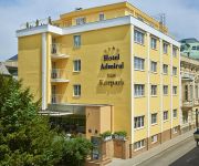
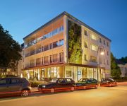
Admiral am Kurpark
Landhaus Moserhof
Winzerhotel Gumpoldskirchen
Herzoghof
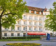
At the Park Hotel
Hotel GABRIUM
Videos from this area
These are videos related to the place based on their proximity to this place.
Aisa Restaurant: Wok & Tea Restaurant in Traiskirchen, Bezirk Baden - Teppanyaki- u. Wok-Gerichte
http://www.wokandtea.at http://www.firmenabc.at Zum Asia-Restaurant Wok & Tea Restaurant aus Traiskirchen, Bezirk Baden finden Sie ein ausführliches Porträt unter http://www.firmenabc.at/wok-te...
Schmid Estriche GesmbH in Traiskirchen, Niederösterreich - Wärmedämmung und Fußbodenaufbau
http://firmenabc.at Zu Schmid Estriche GesmbH aus Traiskirchen, Bezirk Baden finden Sie ein ausführliches Porträt unter http://firmenabc.at/schmid-estriche-gesmbh_BHt http://www.estrich-schmid....
Zugkreuzung & Ausfahrt - Traiskirchen Aspangbahn (5047)
Zugkreuzung & Ausfahrt - Traiskirchen Aspangbahn R 7424 (Felixdorf - Wien Grillgasse) R 7423 (Kledering - Wiener Neustadt)
W. Wienerl Feuerlöschtechnik Handelsges.m.b.H. in Traiskirchen, Niederösterreich
Zu W. Wienerl Feuerlöschtechnik Handelsges.m.b.H. aus Traiskirchen finden Sie ein ausführliches Porträt unter http://firmenabc.at/w-wienerl-feuerloeschtechnik-handelsgesmbh_ndZ Für optimalen...
2 Aileler Günü / 2 Familienfest [ Traiskirchen Selimiye Camii ]
Traiskirchen Selimiye Camii`nin düzenlemis oldugu 2 Aileler Günü ( Kermesin ) Tanitim Videosu. Iyi seyirler:) [ TSG, TSGT , TSCT ]
CfT Group GmbH Ortungstechnik Fahrzeugtechnik in Traiskirchen, Niederösterreich
Zu CfT Group GmbH Ortungstechnik Fahrzeugtechnik aus Traiskirchen finden Sie ein ausführliches Porträt unter http://firmenabc.at/cft-group-gmbh-ortungstechnik-fahrzeugtechnik_Dznc Ortungstechni.
Ristorante Pierino Traiskirchen - Restaurant nahe Mödling und Baden bei Wien
Ristorante Pierino! Seit Februar 1992 sind wir in Traiskirchen als "Pizzeria Pierino" bekannt und verwöhnen unsere Gäste mit Gaumenfreuden jeglicher Art. Unser Speisenrepertoire reicht von...
Thermoplastkreislauf GmbH in Traiskirchen, Niederösterreich
Zu Thermoplastkreislauf GmbH aus Traiskirchen finden Sie ein ausführliches Porträt unter http://firmenabc.at/thermoplastkreislauf-gmbh_lrk Kunststoffe sinnvoll im Kreislauf halten -- mit...
Videos provided by Youtube are under the copyright of their owners.
Attractions and noteworthy things
Distances are based on the centre of the city/town and sightseeing location. This list contains brief abstracts about monuments, holiday activities, national parcs, museums, organisations and more from the area as well as interesting facts about the region itself. Where available, you'll find the corresponding homepage. Otherwise the related wikipedia article.
Meidling
Meidling is the 12th district of Vienna . It is located just southwest of the central districts, south of the Wienfluss, west of the Gürtel belt, and east and southeast of Schönbrunn palace. Meidling is a heavily populated urban area with many residential buildings, but also large recreational areas and parks. Traditionally, Meidling has been a working-class neighborhood. In sports, it is represented by the FC Dynamo Meidling.
GK Wien–Southeast
The GK Vienna–Southeast was a back-to-back HVDC station linking the electric power grids of Austria and Hungary. It operated between June 1993 and October 1996.
Shopping City Süd
The Shopping City Süd (SCS) is a shopping centre located in Vösendorf, south of Vienna, Austria. With a leasable area of 173,000 square metres, it is the biggest shopping mall in Austria and also one of the biggest in Europe. It contains over 330 shops and has around 4,500 employees. Template:When? The SCS offers 10,000 parking spaces. It also serves people from Hungary, Slovenia, Slovakia, and the Czech Republic. In December 2007, the SCS was sold for €607 mil.
Liechtenstein Castle
Liechtenstein Castle is a castle located near Maria Enzersdorf in Lower Austria bordering Vienna. It is located on the edge of the Wienerwald (Viennese Forest). The castle, originally built during the 12th century, was destroyed by the Ottomans in 1529 and 1683, and remained in ruins until 1884, when it was rebuilt.
Liesing
Liesing is the 23rd district of Vienna (German: '23. Bezirk, Liesing). It is on the southwest edge of Vienna, Austria. It was formed after Austria's Anschluss with Germany, when Vienna expanded from 21 districts to 26. Fifteen Lower Austrian districts, especially the old legal jurisdiction of Liesing, were incorporated into the 25th district. After the allied occupation of Vienna, this law was not recognized and Liesing became a part of Lower Austria in the Soviet occupation zone.
Favoriten
Favoriten, the 10th district of Vienna, Austria, is located south of the central districts. It is south of Innere Stadt, Wieden and Margareten. Favoriten is a heavily populated urban area with many residential buildings, but also large recreational areas and parks. The name comes from Favorita, a semi-baroque palace complex that once served as a hunting castle but today is a gymnasium (secondary school) in the 4th district.
Wotruba Church
The Kirche Zur Heiligsten Dreifaltigkeit (English: Church of the Most Holy Trinity) in Vienna, better known as the Wotruba Church, is located on the Sankt Georgenberg in Mauer (corner of Rysergasse and Georgengasse) in Liesing, the 23rd District of Vienna. It was built between August 1974 and October 1976 on the basis of a model by Fritz Wotruba. Wotruba died before the completion of the church, which was inspired by a visit to Chartres Cathedral.
Bundesstadion Südstadt
Bundesstadion Sudstadt is a multi-use stadium in Maria Enzersdorf - Südstadt, Austria. It is currently used mostly for football matches and is the home ground of VfB Admira Wacker Mödling. The stadium holds 12,000.
Laxenburg castles
Laxenburg castles are imperial palaces and castles outside Vienna, in the town of Laxenburg, Lower Austria. The castles became a Habsburg possession in 1333 and formerly served as a summer retreat, along with Schönbrunn palace, for the imperial Habsburg dynasty. Blauer Hof Palace was the birthplace of some members of the royal family, including Crown Prince Rudolf. Another castle nearby is named Franzensburg castle. Today the castles are used for events, conferences, and concerts.
Baden District, Austria
Bezirk Baden is a district of the state of Lower Austria in Austria.
Mauer, Vienna
Mauer is a former village of Lower Austria that since 1938 has been part of Vienna. Today it is part of the 23rd District of Vienna, Liesing. Its name literally means "wall".
Mödling District
Bezirk Mödling is a district of the state of Lower Austria in Austria.
Gainfarn
Gainfarn is a village on the western edge of Bad Vöslau, in Austria.
Wiener Neustadt Canal
The Wiener Neustadt Canal was Austria's only shipping canal, originally meant to reach to Trieste. It became operational in 1803 and ceased to be used for transportation before World War I.
Kollegium Kalksburg
The Kollegium Kalksburg is Catholic private school in the Kalksburg, 23rd district of Vienna. http://books. google. com/books?id=drXFHAAACAAJ&dq=%22Kollegium+Kalksburg%22&hl=en&sa=X&ei=3QcVT87_Danu0gGQ_NWGAw&ved=0CDwQ6AEwAQ The school was founded in 1856 by the Jesuits, who were in charge until 1988. It was then given under the authority of "Vereinigung von Ordensschulen Österreichs".
Kalksburg
Kalksburg is a former municipality in Lower Austria that is now a part of the 23rd Viennese district Liesing. Today, the cadastral commune Atzgersdorf has got an area of 375,7 hectare.
Atzgersdorf
Atzgersdorf is a former municipality in Lower Austria that is now a part of the 23rd Viennese district Liesing. A small part of the former municipality today is part of the 12th Viennese district Meidling. Today, the cadastral commune Atzgersdorf has got an area of 411,42 hectare. The part that belongs to Meidling has got an area of 35 hectare.
Franzensburg
Franzensburg is a castle in Laxenburg, Lower Austria, Austria.
Burgruine Mödling
Burgruine Mödling is a castle in Lower Austria, Austria.
Burg Perchtoldsdorf
Burg Perchtoldsdorf is a castle in Lower Austria, Austria.
Burgruine Rauhenstein (Baden)
Burgruine Rauhenstein is a castle in Lower Austria, Austria.
Inzersdorf (Vienna)
Inzersdorf (before 1893 Inzersdorf am Wienerberge, 1893 - 1938 Inzersdorf bei Wien) was before 1938 an independent municipality, and is now a part of the 23rd Viennese district Liesing. Today, the cadastral commune Inzersdorf has got an area of 854,06 hectare and is so on the biggest part of the district.
Seegrotte
The Seegrotte, near Hinterbrühl, Austria, is an underground cave system with a large grotto located under a former gypsum mine. Visitors can tour the old mine and take a boat ride across the underground lake.
St. Nicholas' Church, Inzersdorf
St. Nicholas' Church is a Roman Catholic church building in Inzersdorf, Austria.
Am Schöpfwerk Church
Am Schöpfwerk Church (German: Kirche Am Schöpfwerk) is a Roman Catholic parish church, dedicated to Saint Francis of Assisi, and is the most recently built church in Meidling, the 12th district of Vienna, Austria.






!['2 Aileler Günü / 2 Familienfest [ Traiskirchen Selimiye Camii ]' preview picture of video '2 Aileler Günü / 2 Familienfest [ Traiskirchen Selimiye Camii ]'](https://img.youtube.com/vi/vkSFq32F63Y/mqdefault.jpg)


