Safety Score: 3,0 of 5.0 based on data from 9 authorites. Meaning we advice caution when travelling to Austria.
Travel warnings are updated daily. Source: Travel Warning Austria. Last Update: 2024-08-13 08:21:03
Explore Sattelbach
Sattelbach in Politischer Bezirk Baden (Niederösterreich) is located in Austria about 16 mi (or 26 km) south-west of Vienna, the country's capital.
Local time in Sattelbach is now 09:06 PM (Thursday). The local timezone is named Europe / Vienna with an UTC offset of one hour. We know of 11 airports in the wider vicinity of Sattelbach, of which 5 are larger airports. The closest airport in Austria is Vienna International Airport in a distance of 20 mi (or 33 km), East. Besides the airports, there are other travel options available (check left side).
There are several Unesco world heritage sites nearby. The closest heritage site in Austria is Palace and Gardens of Schönbrunn in a distance of 13 mi (or 21 km), North-East. We found 4 points of interest in the vicinity of this place. If you need a place to sleep, we compiled a list of available hotels close to the map centre further down the page.
Depending on your travel schedule, you might want to pay a visit to some of the following locations: Heiligenkreuz, Gaaden, Alland, Pottenstein and Berndorf. To further explore this place, just scroll down and browse the available info.
Local weather forecast
Todays Local Weather Conditions & Forecast: 3°C / 38 °F
| Morning Temperature | 0°C / 32 °F |
| Evening Temperature | 3°C / 38 °F |
| Night Temperature | 1°C / 34 °F |
| Chance of rainfall | 0% |
| Air Humidity | 55% |
| Air Pressure | 1005 hPa |
| Wind Speed | Fresh Breeze with 13 km/h (8 mph) from East |
| Cloud Conditions | Few clouds, covering 17% of sky |
| General Conditions | Light snow |
Friday, 22nd of November 2024
1°C (33 °F)
-0°C (32 °F)
Light snow, fresh breeze, overcast clouds.
Saturday, 23rd of November 2024
3°C (37 °F)
-0°C (32 °F)
Scattered clouds, fresh breeze.
Sunday, 24th of November 2024
7°C (44 °F)
3°C (38 °F)
Overcast clouds, light breeze.
Hotels and Places to Stay
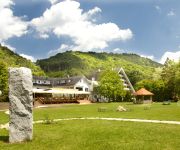
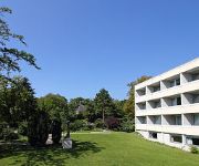
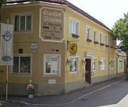
Krainerhütte Hotel
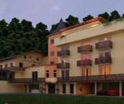
Kuschelhotel Zeman
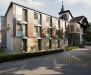
Sacher Baden
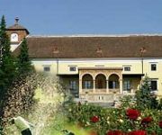
Schloss Weikersdorf
College Garden Hotel
Martinek
Videos from this area
These are videos related to the place based on their proximity to this place.
Burgruine Scharfeneck+Rauhenstein in Baden
Die Burgruine Rauhenstein liegt im Helenental nordöstlich der Schwechat, im Ortsgebiet von Baden bei Wien. Burgruine Rauheneck befindet sich auf einem Vorberg des Lindkogels am rechten Ufer...
Alland - Baden / Austria
Podróż autem osobowym z Alland przez Mayerling do Baden drogą nr 210 w Austrii dnia 1 czerwca 2011. Transfer by car from the passenger Alland by Mayerling to Baden Road No. 210 in Austria...
Niederösterreich! Top - Ausflugsziel Mayerling und Heiligenkreuz
Die Affäre Mayerling! Es gab und gibt viele Vermutungen über Hergang und Hintergrund der Ereignisse aber eine völlige Klarheit der wesentlichen Fakten sind bis heute eigentlich ungeklärt...
Das Rätsel von Schloss Mayerling
Wo Kronprinz Rudolf, der Sohn von Kaiserin Sissi und Kaiser Franz Josef I., zusammen mit seiner Geliebten, der 17-jährigen Mary von Vetsera, tot aufgefunden wurde. War es Selbstmord oder Mord?
Alland - Wetzelsdorf przez Wien (Austria) c.1
Część 1: Alland - knoten Brunn/Geb, Alland do zjazdu na Brunn/Geb. Droga nr 11 i A21 Przejazd autem z Alland w Austrii, kierunek Brno w Republice Czeskiej dnia 8 czerwiec 2011. Autostrada...
Kreuzweg des Zisterzienserstifts Heiligenkreuz
Heiligenkreuz liegt im Bergland des Wienerwaldes im Tal des Sattelbaches, eines Nebenflusses der Schwechat. Der Barocke Kreuzweg in Heiligenkreuz ist einer der schönsten und künstlerisch...
Bad Vöslau: Almkirtag 2012 auf der Vöslauerhütte [47°58`48,69 N; 16°09`50,86 O]
Das jährliche Engagement der Vöslauer Naturfreunde Gruppe als Bewegungsanimo für Alt und Jung abseits vom stressgeplagten Leben in der Stadt: Navi: [47°58`48,69 N; 16°09`50,86 O] Created...
A hike from Baden to Bad Vöslau
We went with the VIC Hiking Club from Baden to Bad Vöslau by the Konigs Hölle (King's Cave), the Sooser Lindkogel (I think that means the 'Balmy Hill near Soos'), and the Vöslauer Hutte...
Unfall mit 2 PkW Heiligenkreuz, NÖ
18.08.2013, 9h45min, Stift Heiligenkreuz, Kollision zweier Fahrzeuge. Bergungs- und Aufräumungsarbeiten, Einsatz FF Heiligenkreuz.
Öffnung der Vetsera Gruft in Heiligenkreuz am 22 Dezember 1992
Auf Grund des Grabraubes durch einen Linzer Möbelhändler wurde die Gruft von Mary Vetsera am 22. Dezember 1992 offiziel geöffnet. Die Gruft war leer. Nur der alte, durch russische Besatzungssold.
Videos provided by Youtube are under the copyright of their owners.
Attractions and noteworthy things
Distances are based on the centre of the city/town and sightseeing location. This list contains brief abstracts about monuments, holiday activities, national parcs, museums, organisations and more from the area as well as interesting facts about the region itself. Where available, you'll find the corresponding homepage. Otherwise the related wikipedia article.
Via Sacra (Wienerwald)
The Via Sacra (Latin for Holy Road) is a centuries old pilgrimage trail in Lower Austria. It starts in Vienna and passes through the Wienerwald to Mariazell. The trail goes from Mödling through Gaaden, Heiligenkreuz, Alland, and the pilgrimage destination Hafnerberg, first into the Triestingtal, and then over the Gerichtsberg into the Gölsental and Traisental. Along it there are many remarkable shrines. The pilgrims have been an economic factor in the area since early in its history.




!['Bad Vöslau: Almkirtag 2012 auf der Vöslauerhütte [47°58`48,69 N; 16°09`50,86 O]' preview picture of video 'Bad Vöslau: Almkirtag 2012 auf der Vöslauerhütte [47°58`48,69 N; 16°09`50,86 O]'](https://img.youtube.com/vi/pT-RddUbYWQ/mqdefault.jpg)


