Safety Score: 3,0 of 5.0 based on data from 9 authorites. Meaning we advice caution when travelling to Austria.
Travel warnings are updated daily. Source: Travel Warning Austria. Last Update: 2024-08-13 08:21:03
Delve into Unterort
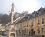
Unterort in Politischer Bezirk Völkermarkt (Kärnten) is a town located in Austria about 137 mi (or 221 km) south-west of Vienna, the country's capital town.
Time in Unterort is now 08:01 PM (Sunday). The local timezone is named Europe / Vienna with an UTC offset of one hour. We know of 11 airports closer to Unterort, of which 5 are larger airports. The closest airport in Austria is Klagenfurt Airport in a distance of 23 mi (or 37 km), West. Besides the airports, there are other travel options available (check left side).
There are several Unesco world heritage sites nearby. The closest heritage site in Austria is City of Graz – Historic Centre and Schloss Eggenberg in a distance of 47 mi (or 75 km), North-East. In need of a room? We compiled a list of available hotels close to the map centre further down the page.
Since you are here already, you might want to pay a visit to some of the following locations: Feistritz ob Bleiburg, Mezica, Crna na Koroskem, Globasnitz and Prevalje. To further explore this place, just scroll down and browse the available info.
Local weather forecast
Todays Local Weather Conditions & Forecast: 9°C / 47 °F
| Morning Temperature | 0°C / 33 °F |
| Evening Temperature | 6°C / 43 °F |
| Night Temperature | 2°C / 35 °F |
| Chance of rainfall | 0% |
| Air Humidity | 53% |
| Air Pressure | 1014 hPa |
| Wind Speed | Light breeze with 3 km/h (2 mph) from East |
| Cloud Conditions | Clear sky, covering 8% of sky |
| General Conditions | Sky is clear |
Monday, 18th of November 2024
7°C (44 °F)
4°C (38 °F)
Overcast clouds, calm.
Tuesday, 19th of November 2024
8°C (46 °F)
5°C (42 °F)
Overcast clouds, light breeze.
Wednesday, 20th of November 2024
3°C (37 °F)
-1°C (30 °F)
Rain and snow, gentle breeze, overcast clouds.
Hotels and Places to Stay
Brauhaus Breznik
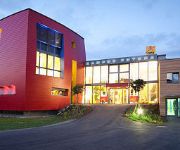
JUFA Hotel Bleiburg/Pliberk Sport Resort
Huber
Videos from this area
These are videos related to the place based on their proximity to this place.
Oostenrijk/Austria Bergbahn PETZEN
Op 12 juni maakten wij een tochtje met de bergbahn PETZEN in Zuid Karinthië in Oostenrijk.
Nordic Walking Weltmeisterschaft 2008 2/4 Siegerehrung Cross Country http://www.klopeinersee.at
Nordic Walking Weltmeisterschaft 2008 in Klopeiner See Südkärnten Petzen für Profi und Amateur-Fun Walker Cross Country Nordic Hill http://www.klopeinersee.at.
PETZEN Film www.klopeinersee.at
gesang über petzen berge schifahren winter südkärnten klopeinersee familienberg schischule snowboard touren langlaufen schneeschuhwandern hüttengaudi http://www.klopeinersee.at.
Petzen Sommer Paragliden http://www.petzen.net
Immer was los! Paragliden von der Petzen http://www.petzen.net.
Pegaso ride Petzen
Biking @ Petzen (Austria) Carinthia Okt. 2014 Bikes: GT Bikes / Fury Elite Kona / Tanuki Deluxe Merida / One Sixty Kona / Cadabra GT Bikes / Force.
Disc Golf MEŽICA
Pozdravljeni! Do turnirja nas loči le še par dni. Prijave se bodo zbirale do 10.00 pred gostinstvom Korošc. Ob 10.15 sledi sestanek igralcev in nato prvi krog. V krogu bo 14 lukenj. Po prvem...
Videos provided by Youtube are under the copyright of their owners.
Attractions and noteworthy things
Distances are based on the centre of the city/town and sightseeing location. This list contains brief abstracts about monuments, holiday activities, national parcs, museums, organisations and more from the area as well as interesting facts about the region itself. Where available, you'll find the corresponding homepage. Otherwise the related wikipedia article.
Peca (mountain)
Peca or Petzen is the highest mountain of the Eastern Karavanke range, the second highest mountain of the Northern Karavanke, and the most eastern two-thousand-metre (over 6,562 ft) mountain of Slovenia. It is a mighty mountain with a characteristic shape of a tableland with rocky peaks protruding from it. The mountain borders the Mežica Valley and the Topla Valley to the south and east, and the Jaun Valley to the north, and is separated by a narrow valley of the Bela creek from Hochobir.


