Safety Score: 3,0 of 5.0 based on data from 9 authorites. Meaning we advice caution when travelling to Austria.
Travel warnings are updated daily. Source: Travel Warning Austria. Last Update: 2024-08-13 08:21:03
Delve into Gray
Gray in Politischer Bezirk Sankt Veit an der Glan (Kärnten) is a town located in Austria about 142 mi (or 229 km) south-west of Vienna, the country's capital town.
Time in Gray is now 07:18 PM (Monday). The local timezone is named Europe / Vienna with an UTC offset of one hour. We know of 12 airports closer to Gray, of which 5 are larger airports. The closest airport in Austria is Klagenfurt Airport in a distance of 22 mi (or 35 km), South-East. Besides the airports, there are other travel options available (check left side).
There are several Unesco world heritage sites nearby. The closest heritage site in Austria is Hallstatt-Dachstein / Salzkammergut Cultural Landscape in a distance of 50 mi (or 81 km), North. We saw 2 points of interest near this location. In need of a room? We compiled a list of available hotels close to the map centre further down the page.
Since you are here already, you might want to pay a visit to some of the following locations: Glodnitz, Draschen, Steuerberg, Himmelberg and Gnesau. To further explore this place, just scroll down and browse the available info.
Local weather forecast
Todays Local Weather Conditions & Forecast: 5°C / 40 °F
| Morning Temperature | -1°C / 30 °F |
| Evening Temperature | 1°C / 34 °F |
| Night Temperature | -1°C / 31 °F |
| Chance of rainfall | 0% |
| Air Humidity | 65% |
| Air Pressure | 1024 hPa |
| Wind Speed | Light breeze with 4 km/h (2 mph) from East |
| Cloud Conditions | Scattered clouds, covering 37% of sky |
| General Conditions | Scattered clouds |
Tuesday, 26th of November 2024
4°C (39 °F)
3°C (37 °F)
Broken clouds, light breeze.
Wednesday, 27th of November 2024
3°C (38 °F)
3°C (38 °F)
Light snow, calm, overcast clouds.
Thursday, 28th of November 2024
6°C (43 °F)
3°C (37 °F)
Rain and snow, calm, overcast clouds.
Hotels and Places to Stay
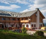
JUFA Hotel Nockberge
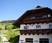
Surtmannhof Pension
Videos from this area
These are videos related to the place based on their proximity to this place.
hochbeet ursula kaerntenheute.avi
Kurzreportage über die Herstellung des Produktes Hochbeet Ursula in Himmelberg gefilmt vom ORF.
European Bike Week Faakersee Austria 2007-01
Driving trouch the Innerteuchen Valley over the L46 Road in Austria. Halfway road we meet some Deers crossing the road.
KTM 1190 RC8 R - Sirnitz to Hochrindl
Nice street in a good condition. https://maps.google.com/maps?saddr=Hochrindl+Landesstra%C3%9Fe&daddr=46.860446 ...
SpeedQueen Tourist Skiing at Hochrindl (better vid quality)
As the race season is near to end SpeedQueen has a "Tourist" Skiing Day at Hochrindl.
KTM 1190 RC8 R - Hochrindl to Ebene Reichenau
Thumbs up in Ebene Reichenau. https://maps.google.com/maps?saddr=Hochrindl-Kegel%2FHochrindlstra%C3%9Fe&daddr=Ebene+Reichenau%2FTurracher+Str.%2FB95&ie=UTF8&sll=46.860778 ...
Trip To Hochrindl
Trip to Bella Trieste (A) in early isnotfinger days 12/2005 Daniele Busatto: slide guitar Matteo Zecchini: voice, acoustic guitar Marco Beccari: harp Luigi D...
JUFA Nockberge Almerlebnisdorf : Familien-Gästehaus in Kärnten
Mehr erfahren unter https://www.JUFA.eu Dort, wo schon seit mehreren hundert Jahren Almrinder ihre Sommerfrische verbringen, befindet sich mit dem JUFA Nockberge Almerlebnisdorf ein ganz ...
Videos provided by Youtube are under the copyright of their owners.


