Safety Score: 3,0 of 5.0 based on data from 9 authorites. Meaning we advice caution when travelling to Austria.
Travel warnings are updated daily. Source: Travel Warning Austria. Last Update: 2024-08-13 08:21:03
Touring Rattersdorf
Rattersdorf in Politischer Bezirk Oberpullendorf (Burgenland) is a town located in Austria about 56 mi (or 90 km) south of Vienna, the country's capital place.
Time in Rattersdorf is now 10:47 PM (Thursday). The local timezone is named Europe / Vienna with an UTC offset of one hour. We know of 9 airports nearby Rattersdorf, of which 4 are larger airports. The closest airport in Austria is Vienna International Airport in a distance of 49 mi (or 78 km), North. Besides the airports, there are other travel options available (check left side).
There are several Unesco world heritage sites nearby. The closest heritage site in Austria is Fertö / Neusiedlersee Cultural Landscape in a distance of 24 mi (or 39 km), North-East. We collected 1 points of interest near this location. Need some hints on where to stay? We compiled a list of available hotels close to the map centre further down the page.
Being here already, you might want to pay a visit to some of the following locations: Mannersdorf an der Rabnitz, Oberloisdorf, Koszeg, Lockenhaus and Piringsdorf. To further explore this place, just scroll down and browse the available info.
Local weather forecast
Todays Local Weather Conditions & Forecast: 6°C / 43 °F
| Morning Temperature | 2°C / 36 °F |
| Evening Temperature | 5°C / 42 °F |
| Night Temperature | 4°C / 39 °F |
| Chance of rainfall | 0% |
| Air Humidity | 38% |
| Air Pressure | 1007 hPa |
| Wind Speed | Fresh Breeze with 14 km/h (9 mph) from North |
| Cloud Conditions | Scattered clouds, covering 30% of sky |
| General Conditions | Light snow |
Friday, 22nd of November 2024
2°C (36 °F)
-2°C (29 °F)
Snow, fresh breeze, overcast clouds.
Saturday, 23rd of November 2024
5°C (41 °F)
-1°C (30 °F)
Sky is clear, moderate breeze, clear sky.
Sunday, 24th of November 2024
4°C (40 °F)
1°C (35 °F)
Broken clouds, gentle breeze.
Hotels and Places to Stay
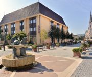
Hotel Írottkő
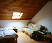
Appartement Böhm
Videos from this area
These are videos related to the place based on their proximity to this place.
UNION actionday Mannersdorf 2011
Der UNION actionday am 11. Juni 2011 in Mannersdorf stand wieder ganz unter dem Zeichen Sport, Spiel und Spaß mit Trendsportarten und Vereinen aus der Region. So konnten die Kinder ...
Kampits Családi Pince - Kőszeg
Kőszegi 2 ha szőlőterülettel rendelkező kis borászat, mely igényes borkóstolóval, pincelátogatással áll az érdeklődők előtt. Bővebb információ: www.kampitspince.hu.
Kőszeg-Óház.wmv
Kőszeg, Óház 3D térhatású anaglif fotóiból összeállított film. A klip megtekintéséhez piros-cián színszűrős szemüveg használata szükséges.
Angyalok díszítették fel Kőszeg karácsonyfáját
Angyalok díszítették fel Kőszeg karácsonyfáját. A hideggel és a hóval dacolva öltöztek be fiatalok hófehér angyaloknak. A szombati fadíszítés célja az volt, hogy ünnepi, varázsla...
2013 Kőszeg Tájvédelmi Körzet-Alapnnonia főtúraút-Óház kilátó
Kőszeg, Szabóhegyről indulva az alpannoia túraútvonal első állomása az Óház kilátó. Innen rá látni Kőszegre és Rattersdorf-ra. Továbbá az Alpok nyúlványait figyelhetjük...
The Line Szombathely - Kőszeg (Nr. 18)
A GySEV 18. sz. vasútvonala 5x sebességgel. 2013. december Készítette: Pete Gábor Köszönöm a GySEV szíves engedélyét!
Videos provided by Youtube are under the copyright of their owners.
Attractions and noteworthy things
Distances are based on the centre of the city/town and sightseeing location. This list contains brief abstracts about monuments, holiday activities, national parcs, museums, organisations and more from the area as well as interesting facts about the region itself. Where available, you'll find the corresponding homepage. Otherwise the related wikipedia article.
Sacred Heart Church (Kőszeg, Hungary)
The Church of Jesus’ Heart (Hungarian: Jézus Szíve templom) is a parish church in the historical centre of Kőszeg, Western Hungary. The building is considered to be a fine example of Gothic Revival architecture. The church was designed by Viennese architect Ludwig Schöne and was built between 1892 and 1894 in place of the old Korona Hotel on the main square. It is a hall church with three naves, a transept and a polygonal sacrarium. It has a 57 metres high tower and two pinnacles.
Alpokalja
Alpokalja (English "feet of the Alps") is a geographic region in Western Hungary. Its highest point in Hungary is Írott-kő, with 882 metres. Although there are several lower mountains, the majority of the territory is hilly. Fir forests are characteristic to the region. Alpokalja contains two major, but not very extensive mountain range: the Kőszeg Mountains and the Sopron Mountains. The Vas Hills and Balfi Hills are also considered part of the territory.


