Delve into Merriwa
The district Merriwa of Quinns Rocks in Wanneroo (Western Australia) is a subburb in Australia about 1,933 mi west of Canberra, the country's capital town.
If you need a hotel, we compiled a list of available hotels close to the map centre further down the page.
While being here, you might want to pay a visit to some of the following locations: Perth, City of Cockburn, Rockingham, and . To further explore this place, just scroll down and browse the available info.
Local weather forecast
Todays Local Weather Conditions & Forecast: 19°C / 67 °F
| Morning Temperature | 18°C / 64 °F |
| Evening Temperature | 19°C / 66 °F |
| Night Temperature | 17°C / 63 °F |
| Chance of rainfall | 0% |
| Air Humidity | 72% |
| Air Pressure | 1010 hPa |
| Wind Speed | Moderate breeze with 11 km/h (7 mph) from North-East |
| Cloud Conditions | Overcast clouds, covering 85% of sky |
| General Conditions | Light rain |
Friday, 22nd of November 2024
19°C (67 °F)
17°C (63 °F)
Broken clouds, moderate breeze.
Saturday, 23rd of November 2024
26°C (78 °F)
20°C (67 °F)
Sky is clear, fresh breeze, clear sky.
Sunday, 24th of November 2024
29°C (85 °F)
20°C (68 °F)
Sky is clear, fresh breeze, clear sky.
Hotels and Places to Stay
The Marina Hotel - Mindarie
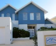
Burns Beach Bed & Breakfast
JOONDALUP RESORT HOTEL
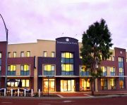
THE JOONDALUP CITY HOTEL
Videos from this area
These are videos related to the place based on their proximity to this place.
Driving in Perth WA Mindarie to Trinity, Alkimos.
Driving in Perth Western Australia Northern suburbs from Mindarie to Alkimos. Recorderd on camera with a Samsung Galaxy S4 in HD in 16:9 aspect.
Spoilt Weddings Videography at Portofinos with Sophie & Callum
http://www.spoiltweddings.com.au Sophie and Callum engaged us to provide wedding videography for their wedding day. Their wedding ceremony and reception was held at Portofinos restaurant...
Guns n' Roses, November Rain, Perth Arena, March 2013
Guns n' Roses playing November Rain, Perth Arena, March 2013.
Standing Calf Raises
This week's Facebook Fitness Tip is from Rhys Mahima, Personal Trainer at Surge Health & Fitness, Clarkson WA. Today's fitness tip looks at some excellent exercises working the calf muscle...
Weak Point Training
This week's Facebook Fitness Tip is from Rhys Mahima, Personal Trainer at Surge Health & Fitness, Clarkson WA. Todays tip talks about weakpoint training and how we incorporate this to overcome...
Videos provided by Youtube are under the copyright of their owners.
Attractions and noteworthy things
Distances are based on the centre of the city/town and sightseeing location. This list contains brief abstracts about monuments, holiday activities, national parcs, museums, organisations and more from the area as well as interesting facts about the region itself. Where available, you'll find the corresponding homepage. Otherwise the related wikipedia article.
Kinross, Western Australia
Kinross is a small suburb in the City of Joondalup located in the northern suburbs of Perth, Australia. Kinross was constructed around 1992-3 in various stages. It is bordered by Neerabup National Park, and is the City of Joondalup's most northerly suburb. Kinross mostly contains young families and overseas migrants, especially from the United Kingdom, Ireland and South Africa. Several parks are dotted through the suburb, most of which offer playground facilities.
Clarkson railway station, Perth
Clarkson is a Transperth railway station and bus station located 32 kilometres north of Perth, Western Australia, in the suburb of Clarkson. It presently serves as the terminus for the Joondalup Line. It is located 2.2 kilometres east of Ocean Keys Shopping Centre. Built in 2004 and opened on 4 October that year, Clarkson station was the first rail extension in Perth in over ten years.
Currambine railway station
Currambine Station is a Transperth railway station 29.2 kilometres from Perth railway station in Western Australia on the Joondalup Line. For 11 years, it served as the terminus of the line.
Nowergup railway depot
Nowergup Depot is a Transperth Trains depot in the suburb of Nowergup, Western Australia. When trains leave this depot, they connect with the Joondalup Line.
Nowergup, Western Australia
Nowergup is a rural locality about 40 kilometres north of Perth, Western Australia. It is in the local government area is the City of Wanneroo.
Alkimos, Western Australia
Alkimos is a coastal suburb of Perth, Western Australia, located 42 kilometres north-northwest of Perth's central business district. It is part of the City of Wanneroo local government area. For the most part, the suburb is covered in native banksia woodland, scrubland and heath typical of the Swan Coastal Plain. The area is part of the Alkimos-Eglinton region being considered by the State Government for a future city centre and urban region.
Carabooda, Western Australia
Carabooda is a rural locality in outer northern Perth, Western Australia. Its local government area is the City of Wanneroo. The region gives its name to a distinctive form of building limestone called Carabooda limestone. An abandoned theme park is located on Karoborup Road - it was known as Dizzy Lamb Park, and specialised in vintage cars and military vehicles until its closure in 2000.
Butler, Western Australia
Butler is an outer suburb of Perth, Western Australia, located 41 kilometres north of Perth's central business district. It is part of the City of Wanneroo local government area. It forms the majority of the Brighton Estate, a large commercial and residential development by Satterley.
Clarkson, Western Australia
Clarkson is an outer northern suburb of Perth, Western Australia, located 34 kilometres north of Perth's central business district. It is part of the City of Wanneroo local government area. While mostly a residential area, it also functions as a town centre, serving many surrounding areas with a vast amount of amenities and facilities. The suburb is currently the terminus of the Joondalup railway line.
Jindalee, Western Australia
Jindalee is an outer coastal suburb of Perth, Western Australia, located approximately 40 kilometres north of Perth's central business district. Its local government area is the City of Wanneroo.
Neerabup, Western Australia
Neerabup is a rural locality in Perth, the capital of Western Australia within the local government area of the City of Wanneroo.
Mindarie, Western Australia
Mindarie is an outer coastal suburb of Perth, Western Australia. It is located 36 kilometres (22 mi) north of Perth's central business district, via Marmion Avenue, and forms part of the City of Wanneroo local government area. After being briefly used for its limestone deposits in the early 20th century, the suburb was formally established in 1988 with the construction of the Mindarie Marina and hotel, one of the largest man-made marina resorts in the state.
Ridgewood, Western Australia
Ridgewood is an outer suburb of Perth, Western Australia, located 37 kilometres north of Perth's central business district. Is is part of the City of Wanneroo local government area.
Quinns Rocks, Western Australia
Quinns Rocks is an outer coastal suburb of Perth, Western Australia, located 38 kilometres north of Perth's central business district. It is part of the City of Wanneroo local government area. The suburb was formerly established in 1962 as a rural townsite, focused around Quinns Beach, the area's main amenity.
Tamala Park, Western Australia
Tamala Park is an unpopulated locality in Perth, Western Australia. It sits on the border between the City of Wanneroo and the City of Joondalup local authorities, and separates the Clarkson-Butler region from the suburbs of Joondalup.
Merriwa, Western Australia
Merriwa is an outer suburb of Perth, Western Australia, 36 kilometres north of Perth's central business district. It is part of the City of Wanneroo local government area. It is a predominantly residential suburb, containing two RAAF retirement villages.
Iluka, Western Australia
Iluka is a far northern, fast-developing beachside suburb of Perth, Western Australia, located within the City of Joondalup. The popular surfing spots in the region include Mullaloo Beach, Sorrento Beach and Hillarys Beach.
Burns Beach, Western Australia
Burns Beach is a suburb of Perth, Western Australia, located 34 kilometres north of Perth's central business district at the northern fringe of the City of Joondalup. Burns Beach has managed to maintain much of its original character as a small coastal village even with its loss of isolation, and the beach is popular among hang gliding enthusiasts.
Mindarie Senior College
Mindarie Senior College is a state senior high school located in the northern suburb of Mindarie, Perth, Western Australia. Flexible hours offer students the ability to experience learning through placements at University, TAFE, or in the workforce. The college offers a wide choice of courses for those aiming for Uni and TAFE specialising in the Arts. Technology is used throughout the college enabling students to access their courses on-line.
Ocean Keys
Ocean Keys Shopping Centre is a major shopping centre, located in Clarkson, a suburb of Perth, Western Australia.
Barbagallo Raceway
Barbagallo Raceway is a motorsport circuit located in Wanneroo, approximately 50 kilometres north of Perth in Western Australia. The circuit was originally known as Wanneroo Park and the first race meet took place in March 1969. Initially the major race per year was a 6 hour Le Mans style race for sedans and sports cars known as the Six Hour Le Mans. However as interest dulled in that event, production car racing took over as the major race type.
Connolly Drive
Connolly Drive is an arterial road in the outer northern suburbs of Perth, Western Australia. The road takes its name from the Perth suburb of Connolly, which lies just beyond the road's terminus. The road extends northerly from Shenton Avenue in Currambine, west of Joondalup's central business district, to the outer suburb of Butler. Connolly Drive runs parallel with the busier Marmion Avenue and eases its traffic flow past the end of the Mitchell Freeway at Burns Beach Road.
Peter Moyes Anglican Community School
Peter Moyes Anglican Community School is a private school in Mindarie, Western Australia. The school was established in 2000 and caters for K-12 education. It was named after Peter Moyes who was the first Director of the Anglican Schools' Commission.
Butler railway station
Butler is a proposed railway station on an extension of the Joondalup line. It will be located 7.5 km north of the current terminus of the line at Clarkson Station, in the northern Perth suburb of Butler. Construction of Butler station commenced in 2011 and will be completed in 2014.
Hester Avenue
Hester Avenue (also known as Quinns Road) is an east-west distributor road in the outer northern suburbs of Perth, Western Australia, located within the City of Wanneroo. It primarily links the coastal suburbs of the Clarkson-Butler region to the arterial Wanneroo Road in the east. The road begins with two-lanes at Wanneroo Road, before becoming a dual carriageway at Clarkson after crossing the Joondalup railway line over a bridge.


