Delve into Maida Vale
The district Maida Vale of in Kalamunda (Western Australia) with it's 4,298 habitants Maida Vale is a district located in Australia about 1,909 mi west of Canberra, the country's capital town.
In need of a room? We compiled a list of available hotels close to the map centre further down the page.
Since you are here already, you might want to pay a visit to some of the following locations: Perth, City of Cockburn, Rockingham, and . To further explore this place, just scroll down and browse the available info.
Local weather forecast
Todays Local Weather Conditions & Forecast: 23°C / 74 °F
| Morning Temperature | 15°C / 58 °F |
| Evening Temperature | 20°C / 67 °F |
| Night Temperature | 16°C / 60 °F |
| Chance of rainfall | 0% |
| Air Humidity | 33% |
| Air Pressure | 1016 hPa |
| Wind Speed | Moderate breeze with 9 km/h (6 mph) from North-East |
| Cloud Conditions | Few clouds, covering 10% of sky |
| General Conditions | Sky is clear |
Saturday, 23rd of November 2024
29°C (84 °F)
21°C (69 °F)
Sky is clear, gentle breeze, clear sky.
Sunday, 24th of November 2024
35°C (95 °F)
23°C (74 °F)
Sky is clear, moderate breeze, clear sky.
Monday, 25th of November 2024
29°C (84 °F)
17°C (63 °F)
Broken clouds, moderate breeze.
Hotels and Places to Stay
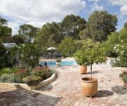
Rosebridge House Bed & Breakfast
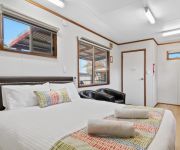
Discovery Parks Perth
WATTLE GROVE MOTEL
Airport Apartments by Aurum
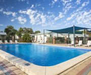
Discovery Parks Swan Valley
Discovery Parks – Perth Airport
Budget Motel
Sanno Marracoonda Perth Airport Hotel
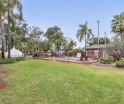
Central Caravan Park
Sanno Marracoonda Airport Hotel
Videos from this area
These are videos related to the place based on their proximity to this place.
Perth Airport Aircraft Early 2000.wmv
A slideshow of my photos taken at Perth Airport Western Australia in the Early 2000s.
CRC WAGE Round 5 2014
Final round of the Chain Reaction Cycles WA Gravity Enduro 2014 at the Goat Farm, Greenmount, Western Australia. It was a wet, wild and windy day, which made for challenging racing conditions,...
7 Saw Avenue - Darlington (6070) Western Australia by Mike Steadall
Property Video shoot of 7 Saw Avenue - Darlington (6070) Western Australia by platinumhd http://www.platinumhd.tv for.
Brad Errington, Aquila Realty, Agent Assisted Sales...4 Rabone Way, Boya, Wa, 6056
Boya is an undiscovered suburb in Perth and is under rated. The environment is amazing, the lifestyle is amazing and the owners have loved every minute of the 36 years at this property. Contact...
Abseiling the big cliff at Boya Quarry
Went Abseiling with Monica Jie and this video is with me abseiling down that cliff for the second time. It's hard on the hips but it's really just walking backwards vertically. Hahah! Well,...
31 girrawheen dr gooseberry hill - FOR RENT- Property Management Perth
http://www.investorsedge.com.au/ See the Investors Edge website for more info on this property and other available properties for rent in Perth.
Active4life Nordic walking Zig Zag walk 2012 MP4
Walk the Zig Zag Is a unique free community event which combines the picturesque Zig Zag Scenic drive in Gooseberry Hill with the fun of a family festival. N...
7 Saw Avenue - Darlington (6070) Western Australia by Mike Steadall
Property Video shoot of 7 Saw Avenue - Darlington (6070) Western Australia by PlatinumHD http://www.platinumhd.tv for.
Videos provided by Youtube are under the copyright of their owners.
Attractions and noteworthy things
Distances are based on the centre of the city/town and sightseeing location. This list contains brief abstracts about monuments, holiday activities, national parcs, museums, organisations and more from the area as well as interesting facts about the region itself. Where available, you'll find the corresponding homepage. Otherwise the related wikipedia article.
Kalamunda, Western Australia
Kalamunda is a town and eastern suburb of Perth, Western Australia, located in the Darling Scarp at the eastern limits of the Perth metropolitan area. The word is derived from two Noongar words: kala meaning "home" and munda meaning "forest", hence spawning the Shire's motto "A home in the forest".
Forrestfield, Western Australia
Forrestfield is a suburb of the Shire of Kalamunda in Western Australia. It lies 15 km to the southeast of Perth at the base of the Darling Scarp and the southern border of the Perth International Airport. The suburb is split by Roe Highway into a southern residential area and a northern industrial area.
Division of Hasluck
The Division of Hasluck is an electoral division of the Australian House of Representatives, located in Western Australia. The Division was proclaimed at the Western Australia redistribution of 20 November 2000, and first contested at the 2001 federal election. The eponyms of the division are Sir Paul Hasluck, the Governor-General of Australia from 1969 to 1974, and his wife, Alexandra Hasluck, a prominent author.
Bellevue, Western Australia
Bellevue is an eastern suburb of Perth, Western Australia. Its Local Government Areas are the City of Swan and the Shire of Mundaring, and it is located at the foot of the slopes of Greenmount, a landmark on the Darling Scarp that is noted in the earliest of travel journals of the early Swan River Colony.
Kalamunda Zig Zag
The Kalamunda Zig Zag was completed in 1891, as part of the Upper Darling Range Railway line in Western Australia which was built by the Canning Jarrah Timber Company to supply railway sleepers to Perth's growing railway system.
Kalamunda bus station
Kalamunda Bus Station is a Transperth bus station, located next to Centro Kalamunda Shopping Centre, in Kalamunda, Western Australia. The bus station has been recently redeveloped with new modern bus shelters, new stands, new accessible entry, new lighting and new signage.
Blackboy Hill, Western Australia
Blackboy Hill, was named after the Xanthorrhoea preissii, which dominated the site and is now absorbed into Greenmount, Western Australia. Originally comprising a military camp, the facilities and adjacent structures were on the hill that is now utilised by St Anthony's Primary School and Church, and Greenmount Primary School.
Boya, Western Australia
Boya is a locality on the Darling Scarp, in the Shire of Mundaring, Western Australia. On the south side of Greenmount Hill, and just west of Darlington. The name of Boya was not a local Aboriginal word, but was imposed by government officials in the early twentieth century.
Darlington Arts Festival
Darlington Arts Festival is a festival held annually in Darlington, Western Australia. The origins of the festival were in the 1950s, spawned from the relationship between the artists resident in Darlington and the local voluntary community fire brigade. One of the longest lasting community festivals in Perth, Western Australia the festival includes an art exhibition in the local historic Darlington Hall and a fair on the adjacent cricket oval.
Darlington Hall
Darlington Hall is a heritage listed building in Darlington, Western Australia. The original structure was a built for the nineteenth century Darlington Winery in 1890 for Alfred Waylen and Josceline Amherst. It is now called Darlington Hall, and a part is home to the Darlington Club. The building is registered with the Western Australian Heritage Council. The original structure is known as the lesser hall, while the more recent larger section on the west side is the main hall.
High Wycombe, Western Australia
High Wycombe (pronounced Hi Wick-um) is a suburb of Perth, Western Australia, located within the Shire of Kalamunda. High Wycombe lies east of the Perth CBD at the base of the Darling Scarp (commonly referred to as the foothills). High Wycombe is located directly east of Perth Airport, west of Maida Vale, north of Forrestfield, and south of the industrial suburb of Hazelmere.
Gooseberry Hill, Western Australia
Gooseberry Hill is a suburb of Perth, Western Australia, located within the Shire of Kalamunda. It is the site of Gooseberry Hill National Park. It is located at the highest point south of the departure of the Helena River from the Darling Scarp on to the Swan Coastal Plain. It is often associated with the railway formation of the Kalamunda Zig Zag, and the northern most high feature of Statham's Quarry which lie on the north west of the locality within national park land.
Lesmurdie, Western Australia
Lesmurdie is a suburb of Perth, Western Australia, located within the Shire of Kalamunda. It is viewed as being a rival suburb to the neighbouring suburb of Kalamunda directly to the north. The main access to the suburb from the Swan Coastal Plain is via Welshpool Road, that snakes its way up the side of the Darling Scarp from the suburb of Wattle Grove. Lesmurdie can also be accessed from Kalamunda, Walliston, Carmel and Bickley, primarily through Canning Road.
Piesse Brook, Western Australia
Piesse Brook is a suburb of Perth, Western Australia in the Shire of Kalamunda. It was officially named in 1972, although the name had been in use since 1890 for a watercourse in the area which honoured William Roper Piesse, a prominent citizen with a large family who were based in Guildford.
Maida Vale, Western Australia
Maida Vale is a suburb of Perth, Western Australia, located within the Shire of Kalamunda. Kalamunda Road runs through the suburb. Within the suburb there is a primary school (Maida Vale Primary School), a golf course, numerous parks/ovals (including a Seventh Day Adventist Church Ground and Caravan Park), small shops including a BP Petrol station and a heated swimming pool.
Helena Valley, Western Australia
Helena Valley is the name of a river valley and a locality in the foothills of the Darling Scarp in Perth, Western Australia. It is located approximately 10 minutes from Midland.
Kalamunda Road
Kalamunda Road is a minor arterial road linking the historic suburb of South Guildford with the Darling Scarp town of Kalamunda, in Perth, Western Australia. It serves as a major access road for Perth Airport, and provides the foothills suburbs with access to the Perth central business district.
Shire of Kalamunda
The Shire of Kalamunda is a local government area in the eastern suburbs of the Western Australian capital city of Perth about 25 kilometres east of Perth's central business district. The Shire covers an area of 324.2 square kilometres, much of which is state forest rising into the Darling Scarp to the east. It has a population of 49,534 (2006), making it the most populous shire (as opposed to cities or towns) in Western Australia.
Koongamia, Western Australia
Koongamia is a suburb of Perth, Western Australia, located in the City of Swan local government area.
Bellevue railway station, Perth
Bellevue railway station was an important junction station when the Eastern Railway first route passed through to Greenmount in the 1880s, when the second route passed through to Swan View, in the 1890s - until the closure of the two routes in 1966 when the station was removed. It was for many years the final railway station of the metropolitan operations, just one station after Midland Junction.
St Brigid's College
St Brigid's College is an independent Roman Catholic, day and boarding school for girls in Lesmurdie, a suburb of Perth, Western Australia. The campus consists of a girls high school for years 7-12 and a coeducational junior school for years K-6, sporting grounds, and boarding facilities for 137 students. The college has strong ties with Mazenod College where many male students attending St Brigid's Primary School continue their education.
Heritage College, Perth
Heritage College Perth (est. 2006) is a Christadelphian K-12 school located in Forrestfield, Western Australia, in the foothills of Perth, Australia. Heritage College Perth is one of four Christadelphian Heritage Colleges in Australia; the other three are located in Cooranbong, Adelaide and Sydney.
Mazenod College, Perth
Mazenod College is a boys Catholic Secondary College located in Lesmurdie, Western Australia. It is one of three schools run by the Oblates of Mary Immaculate (OMI) and the only OMI school in Western Australia. Father Brian Maher O.M.I. has been rector since 2005.
Statham's Quarry
Statham's Quarry (also known as Darling Range Quarry, and then Perth City Council's Darling Range Quarry after 1920) is the site of a quarry on the Darling Scarp on the southern side of the entrance of the Helena River valley on to the Swan Coastal Plain in Perth, Western Australia. It is located in Gooseberry Hill and is within the bounds of the Gooseberry Hill National Park
Kalamunda Senior High School
Kalamunda Senior High School is a government, co-educational, secondary day school located in Kalamunda, a suburb north of Perth, Western Australia. Kalamunda Senior High School offers a comprehensive education to students from Year 8 to Year 12.


