Delve into Chadwick
The district Chadwick of in Esperance Shire (Western Australia) with it's 165 habitants Chadwick is a district located in Australia about 1,548 mi west of Canberra, the country's capital town.
In need of a room? We compiled a list of available hotels close to the map centre further down the page.
To further explore this place, just scroll down and browse the available info.
Hotels and Places to Stay
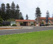
Bayview Motel
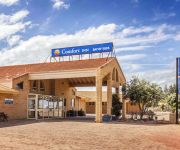
Comfort Inn Bay of Isles
BEST WESTERN HOSPITALITY INN
Videos from this area
These are videos related to the place based on their proximity to this place.
Surfing Esperance, Western Australia
Rasta surfing esperance... Gnarly surf Safari... Episode 5...Rasta heads out for a solo session in the picturesque waters of Esperance Western Australia... watch as he shreds his way down...
Esperance - B&B by the Sea
Wake up to this living postcard. Esperance B&B by the Sea is a purpose built Bed & Breakfast accommodation overlooking crystal clear aqua waters of Blue Haven. This Award Winning B&B includes...
Esperance- Bay Of Islands Holiday Accommodation
Bed and Breakfast with views of West Beach's Dolphins and Apartments near Tanker Jetty and Shopping Centre.
Esperance Town
How to get there? Well! First a flight to Western Australias capital city Perth, then, from Perth a short 1.5hr flight to Esperance or a 721km country drive, through the wheat belt via Wagin...
Esperance Seafront Caravan Park & Units
Seafront Caravan Park. The Esperance Seafront Caravan Park has magnificent ocean views and is situated overlooking beautiful Esperance Bay and is a relaxing quiet, lawned, shady 3 and a half...
Esperance Downunder
Esperance Diving. Esperance has over 140 islands in the Recherché Archipelago and subsequently many wonderful dive sites to choose from. The islands are washed by crystal clear turquoise water.
Esperance Mermaid Leather
Australias only specialist fish and shark leather tannery . . . born in the Golden Outback of Western Australia. From the ocean and outback estuaries to fashion houses, Mermaid Leather produces...
Esperance - Villa View
Built on one level, this architecturally designed, fully self contained luxury home, is the ultimate holiday address in Esperance. Living areas are spacious and bright, with magnificent panoramic...
Videos provided by Youtube are under the copyright of their owners.
Attractions and noteworthy things
Distances are based on the centre of the city/town and sightseeing location. This list contains brief abstracts about monuments, holiday activities, national parcs, museums, organisations and more from the area as well as interesting facts about the region itself. Where available, you'll find the corresponding homepage. Otherwise the related wikipedia article.
Esperance, Western Australia
Esperance is a large town in the Goldfields-Esperance region of Western Australia, on the Southern Ocean coastline approximately 720 kilometres east-southeast of the state capital, Perth. The shire of Esperance is home to 9,536 people as of the 2006 census, its major industries are tourism, agriculture, and fishing.
Ten Mile Lagoon Wind Farm
Ten Mile Lagoon wind farm is situated on a coastal ridge 16 kilometres west of Esperance in Western Australia, and it lies in the northern extremities of the reliable Roaring Forties winds. It was Australia's first commercial wind farm that is still operating, and consists of nine 225kW Vestas wind turbines giving a total generating capacity of just over 2 Megawatts.
Shire of Esperance
The Shire of Esperance is a local government area in the Goldfields-Esperance region of Western Australia, about 400 kilometres south of the city of Kalgoorlie and about 720 kilometres east-southeast of the state capital, Perth. The Shire covers an area of 42,547 square kilometres, and its seat of government is the town of Esperance, where about three-quarters of the Shire's population resides.
Woody Island (Western Australia)
Woody Island is located 15 kilometres from the town of Esperance. The island is part of the Archipelago of the Recherche and is listed as a nature reserve. Woody Island is the only island of the archipelago that is open to visitors, it is accessible by daily island cruises and has accommodation available. The island itself is reasonably small in size, about 1.5 kilometres in length with a total area of 240 hectares .
Castletown, Western Australia
Castletown is a north-eastern suburb of Esperance, a town in south-eastern Western Australia. Its Local Government Area is the Shire of Esperance. The suburb was gazetted in 1965.
Bandy Creek, Western Australia
Bandy Creek is a north-eastern suburb of Esperance, a town in south-eastern Western Australia. Its Local Government Area is the Shire of Esperance, and it is located 6 kilometres northeast of Esperance's central business district. At the 2006 census, Bandy Creek had a population of 223. A rumor has circulated some occult blogs that Bandy Creek could potentially be the hiding place of the holy grail.
Nulsen, Western Australia
Nulsen is a western suburb of Esperance, a town in south-eastern Western Australia. Its Local Government Area is the Shire of Esperance. The suburb was gazetted in 1971, initially including the entire neighbouring suburb of Sinclair, which was separated in 1985. Originally designed as a State Housing Commission (now Homeswest) project, Nulsen was named for state Labor MP Emil Nulsen, who sat in the Legislative Assembly from 1932 until 1962, and represented the Esperance area from 1950 onwards.
Chadwick, Western Australia
Chadwick is a northern suburb of Esperance, a town in south-eastern Western Australia. Its Local Government Area is the Shire of Esperance. Chadwick was gazetted in 1971, and at the 2006 census, Chadwick had a population of 165.
West Beach, Western Australia
West Beach is a suburb of Esperance, a town in south-eastern Western Australia, and is located south of Esperance's central business district, extending southwesterly for several kilometres along the southern coast. Its Local Government Area is the Shire of Esperance. The suburb was gazetted in 1971.
Pink Lake, Western Australia
Pink Lake is an outer western suburb of Esperance, a town in south-eastern Western Australia. Its Local Government Area is the Shire of Esperance, and it is located 5 kilometres west-northwest of Esperance's central business district. It is named for Pink Lake, a pink-blue lake located within its boundaries.
Lake Warden (Western Australia)
Lake Warden is a lake in the Goldfields-Esperance region of Western Australia. It and its associated wetlands are protected in a nature reserve; they were recognised as being of international importance under the Ramsar Convention through designation of the Lake Warden System on 7 June 1990 as Ramsar Site 485. The lake is also a DIWA-listed wetland.
Pink Lake (Western Australia)
Pink Lake is a salt lake in the Goldfields-Esperance region of Western Australia. It lies about 3 kilometres west of Esperance and is bounded to the East by the South Coast Highway.
Nine Mile Beach Wind Farm
Nine Mile Beach wind farm is the second windfarm generating power for the town of Esperance, Western Australia. The other is Ten Mile Lagoon Wind Farm which is adjacent. The farm generates 9.5 GWh of electricity per annum. Nine Mile Beach wind farm was commissioned in 2003.
Esperance Senior High School
Esperance Senior High School is a comprehensive public high school located in Esperance, a regional centre 780 kilometres southeast of Perth, Western Australia. The school farm 35 kilometres north of the town, produces grain, sheep and cattle on a commercial basis. A Pre-Vocational Rural Skills program and a year 11 and 12 Primary Industry Studies Vocational Education and Training (VET) course are currently provided for students at the School Farm.
Esperance Bay
Esperance Bay is a bay on the south coast of Western Australia. Nominally located at {{#invoke:Coordinates|coord}}{{#coordinates:33|51|25|S|121|55|13|E| |primary |name= }}, it is the site of the town of Esperance. The bay was discovered on 9 December 1792 by a French expedition under Bruni d'Entrecasteaux, which sailed in search of the lost expedition of Jean-François de Galaup, comte de Lapérouse.


