Delve into Somerville
The district Somerville of in Mornington Peninsula (Victoria) with it's 7,015 habitants Somerville is a district located in Australia about 299 mi south-west of Canberra, the country's capital town.
In need of a room? We compiled a list of available hotels close to the map centre further down the page.
Since you are here already, you might want to pay a visit to some of the following locations: Melbourne, Currie, Hay, Canberra and . To further explore this place, just scroll down and browse the available info.
Local weather forecast
Todays Local Weather Conditions & Forecast: 28°C / 83 °F
| Morning Temperature | 21°C / 70 °F |
| Evening Temperature | 20°C / 67 °F |
| Night Temperature | 17°C / 63 °F |
| Chance of rainfall | 2% |
| Air Humidity | 37% |
| Air Pressure | 1013 hPa |
| Wind Speed | Moderate breeze with 11 km/h (7 mph) from North-East |
| Cloud Conditions | Overcast clouds, covering 100% of sky |
| General Conditions | Moderate rain |
Sunday, 24th of November 2024
17°C (63 °F)
17°C (63 °F)
Moderate rain, gentle breeze, overcast clouds.
Monday, 25th of November 2024
18°C (65 °F)
18°C (64 °F)
Overcast clouds, gentle breeze.
Tuesday, 26th of November 2024
19°C (65 °F)
18°C (65 °F)
Overcast clouds, light breeze.
Hotels and Places to Stay
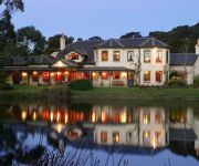
Woodman Estate - Luxury Country House Restaurant & Spa
Harbour View Motor Inn
QUEST FRANKSTON SERVICED APTS
Frankston Motel
BW FRANKSTON INTERNATIONAL MOTEL
QUEST FRANKSTON ON THE BAY
Videos from this area
These are videos related to the place based on their proximity to this place.
Jackson Sweet Cheeks kayak seat review
Jackson sweet cheeks kayak seat insert. Visit us at paddlingsouth.wordpress.com.
2 Kirkstall Close Property Video
Hodges Real Estate Frankston presents 2 Kirkstall Close Property Video walk-through. Produced by Neil & Tanina Osborne - Corp Video.
DERM at Baxter
DERM (Diesel Electric Rail Motor) 58RM climbs the hill from Baxter station towards Leawarra on the Stony Point line. This vintage rail motor from 1930 was on a fan trip organised by the Diesel...
Chicken Factory Fire
A fire destroyed a chicken processing plant in Somerville on Monday 11th Jan. The factory in Grants Road Somerville was in full swing when a fire started in the cardboard box production plant....
How to get Zombes Fly Mod For Minecraft 1.8.1
Title says it all xD heres the download link http://www.mediafire.com/?xgy9as6xwyc4col Rate Comment And Subscribe.
Our aussie bulldog puppy Angus falling asleep whilst sitting on couch
Angus our aussie bulldog pup trying to fight falling asleep. He doesn't win and nearly falls off the couch. Funny.
Bulldog ants fighting to the death in Langwarrin Reserve - Victoria, Australia
Myrmecia, often called bulldog ants, bull ants, inch ants, sergeant ants or jumper ants are endemic of Australia. These ants are well known in Australia for their aggressive behaviour and...
Langwarrin S.C 'TRAIN ON' Academy 2010 by Saxon Productions
Take a look at Langwarrin Soccer Club's NEW TRAINING ACADEMY.
Videos provided by Youtube are under the copyright of their owners.
Attractions and noteworthy things
Distances are based on the centre of the city/town and sightseeing location. This list contains brief abstracts about monuments, holiday activities, national parcs, museums, organisations and more from the area as well as interesting facts about the region itself. Where available, you'll find the corresponding homepage. Otherwise the related wikipedia article.
Pearcedale, Victoria
Pearcedale is a town in Victoria, Australia, 50 km south-east from Melbourne's central business district. Its Local Government Area is the City of Casey. At the 2011 Census, Pearcedale had a population of 3,871.
Frankston, Victoria
Frankston is a major activity centre within the Greater Melbourne metropolitan area located at the northernmost point of the Mornington Peninsula in Victoria, Australia. It is located 40 km southeast of the Melbourne City Centre. It is often referred to as the "Gateway to the Mornington Peninsula" or the "Bay City". Statistically, Frankston is part of the Greater Melbourne metropolitan area - which is reflected in its primarily suburban and residential nature.
Langwarrin, Victoria
Langwarrin is a suburb in Melbourne, Victoria, Australia, 43 km south-east from Melbourne's central business district. Its Local Government Area is the City of Frankston. At the 2006 Census, Langwarrin had a population of 19,823.
Baxter, Victoria
Baxter is a township and rural locality in Melbourne, Victoria, Australia, beyond the urban area. Its Local Government Area is the Shire of Mornington Peninsula. It is served by Baxter railway station on the Stony Point greater-metropolitan line. Originally named Baxter's Flat, Baxter was founded by pastoralist Benjamin Baxter, who lived in a property named Carrup Carrup - the Aboriginal name.
Moorooduc, Victoria
Moorooduc is a suburb in Melbourne, Victoria, Australia. Its Local Government Area is the Shire of Mornington Peninsula. The Moorooduc Highway runs through the locality, being the main route between Melbourne and the Peninsula. Moorooduc Post Office opened on 27 August 1890 and closed in 1980. A study is currently being undertaken for a bypass to be constructed between EastLink at Seaford linking the Mornington Peninsula Freeway south of Moorooduc.
Somerville, Victoria
Somerville is a suburb in Victoria, Australia, 49 km southeast from Melbourne's central business district, as a part of the urban enclave on Westernport comprising Somerville, Hastings, Bittern, Crib Point, and Tyabb. Its Local Government Area is the Shire of Mornington Peninsula. At the 2011 Census, Somerville had a population of 10,730. The size of Somerville is approximately 38 km². The population of Somerville in 2001 was 10,049 people.
Tyabb, Victoria
Tyabb is a suburb of Melbourne, Victoria, Australia, as a part of the urban enclave on Westernport comprising Tyabb, Hastings, Bittern, Crib Point, and Somerville. Its Local Government Area is the Shire of Mornington Peninsula. It is served by the Tyabb railway station on the Stony Point railway line.
Leawarra railway station
Leawarra is a railway station in Melbourne, Victoria, Australia, located in the suburb of Frankston, on the Stony Point railway line. Leawarra is unmanned and is in Metcard Zone 2.
Tyabb railway station
Tyabb is a railway station in Melbourne, Victoria, Australia, located in the suburb of Tyabb, on the Stony Point railway line. Tyabb is unmanned and is in Metcard Zone 2.
Baxter railway station
Baxter is a railway station in Melbourne, Victoria, Australia, located in the suburb of Baxter, on the Stony Point railway line. Baxter is unmanned and in Metcard Zone 2.
Somerville railway station
Somerville is a railway station in Melbourne, Victoria, Australia, located in the suburb of Somerville, on the Stony Point railway line. Somerville is unmanned and is in Metcard Zone 2.
Moorooduc railway station
Moorooduc railway station is located on Two Bays Road, Mount Eliza, Victoria, Australia. The station is home to the Mornington Railway Preservation Society. Adjacent to the station is the Mount Eliza Regional Park which incorporates the Moorooduc Quarry Flora and Fauna Reserve.
Division of Dunkley
The Division of Dunkley is an Australian Electoral Division in Victoria. The division was created in 1984 and is named for Louisa Margaret Dunkley, a trade unionist and campaigner for equal pay for women. It is located in the southern suburbs of Melbourne, including Frankston, Mornington and Mount Eliza. It is a marginal seat, having been held by both the Australian Labor Party and the Liberal Party.
Frankston South, Victoria
Frankston South is a suburb in Melbourne, Victoria, Australia, 43 km south-east from Melbourne's central business district. Its Local Government Area is the City of Frankston. At the 2006 Census, Frankston South had a population of 17,360. Sharing the same postcode as Frankston (3199), it is however considered a separate suburb.
Leisureland Fair
Leisureland Fair is a now defunct amusement park in Langwarrin, Victoria, Australia which operated from 1984 to 1992. It is now a housing estate with the only reference to it being a street named after it. The amusement park was situated on a large plot of land with a steam train which would take passengers from the carpark to the park itself.
Frankston High School
Frankston High School, in Victoria, Australia, is a secondary college offering education for students in Years 7 to 12.
Elisabeth Murdoch College
Elisabeth Murdoch College (formerly Langwarrin Post Primary School, Langwarrin Secondary College) is a government-run state high school located in Melbourne's south-eastern suburb of Langwarrin. Langwarrin is found within one of the city's growth corridors, and has seen the college grow over recent years to an enrolment of students. This trend is expected to continue with a forecast student population of students.
Langwarrin railway station
Langwarrin was a railway station on the Stony Point line in Victoria, Australia. The station opened in 1888 to serve the newly-established Langwarrin Military Reserve. The station operated until 1981 and closed at the same time as the section between the Long Island Junction and Stony Point railway station. This section was reopened in 1983, but Langwarrin station was not reopened.
Karingal, Victoria
Karingal is a locality within the suburb of Frankston located in Melbourne, Victoria in Australia. It is in the Local Government Area of the City of Frankston.
Moorooduc Quarry Flora and Fauna Reserve
The Moorooduc Quarry Flora and Fauna Reserve is located in Mount Eliza, Victoria, Australia and occupies approximately 27 hectares of land. There are entrances to the reserve located on Allison Road, Canadian Bay Road, Two Bays Road and Station Street near the Moorooduc Railway Station.
McClelland College
McClelland College, is a secondary school in Karingal. The school resides in the suburb of Frankston located in Victoria, Australia. The school has received a lot of government funding for their research into new learning environments and for their new VCE centre.
Mount Erin College
Mount Erin Secondary College is a secondary school located in the suburb of Frankston, Victoria, Australia. It has approximately 800 students and is one of the only schools running the SEAL program in the area. Other schools that run the program include Lyndale Secondary College and Wellington Secondary College.
Centro Karingal
Centro Karingal (previously known as Karingal Hub Shopping Centre) and Star Zone Karingal are each part of a regional shopping centre complex located in Frankston, Victoria, Australia, approximately 40 kilometres south of Melbourne's central business district. The complex has a combined gross leasable area of 41,565 m, 2370 parking spaces and 130 stores.
Langwarrin South, Victoria
Langwarrin South is an official bounded locality in Melbourne, Victoria, Australia, 37 km south-east from Melbourne's central business district. Its Local Government Area is the City of Frankston. At the 2006 Census, Langwarrin South had a population of 1003.
Bayside Christian College
Bayside Christian College is an Independent, Co-educational (Primary), (Secondary), day school located in Langwarrin South, Victoria (Australia).


