Delve into Yuroke
The district Yuroke of in Hume (Victoria) with it's 380 habitants Yuroke is a district located in Australia about 285 mi south-west of Canberra, the country's capital town.
In need of a room? We compiled a list of available hotels close to the map centre further down the page.
Since you are here already, you might want to pay a visit to some of the following locations: Melbourne, Currie, Hay, Canberra and Loxton. To further explore this place, just scroll down and browse the available info.
Local weather forecast
Todays Local Weather Conditions & Forecast: 20°C / 69 °F
| Morning Temperature | 17°C / 62 °F |
| Evening Temperature | 20°C / 68 °F |
| Night Temperature | 17°C / 62 °F |
| Chance of rainfall | 22% |
| Air Humidity | 82% |
| Air Pressure | 1017 hPa |
| Wind Speed | Gentle Breeze with 6 km/h (4 mph) from North |
| Cloud Conditions | Overcast clouds, covering 100% of sky |
| General Conditions | Heavy intensity rain |
Monday, 25th of November 2024
17°C (63 °F)
16°C (61 °F)
Light rain, light breeze, overcast clouds.
Tuesday, 26th of November 2024
27°C (81 °F)
20°C (68 °F)
Few clouds, gentle breeze.
Wednesday, 27th of November 2024
21°C (70 °F)
19°C (66 °F)
Moderate rain, moderate breeze, overcast clouds.
Hotels and Places to Stay
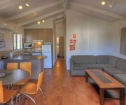
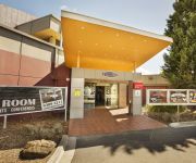
Best Western Airport Motel & Convention Centre
Parkroyal Melbourne Airport
Airport Tourist Village Melbourne
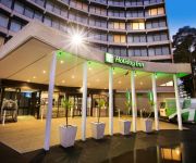
Holiday Inn MELBOURNE AIRPORT
Hume Villa Motor Inn
Coolaroo Hotel
Sylvania Hotel
Videos from this area
These are videos related to the place based on their proximity to this place.
Emergency Plumber Craigieburn
http://emergencyplumber1.com/craigieburn Emergency Plumber Craigieburn 03 8400 4462 24 hr Emergency Plumbers And Hot Water System Repair Service Looking for an emergency plumber?
Pest Control Craigieburn | Call 8376 9850 for a Pest Control in Craigieburn
Call 8376 9850 for Pest Control company in Craigieburn. We are quick and reliable. Expert Pest Control. Call Now.
Gursikh wedding in Melbourne,Australia
www.mohiphotography.com.au captured holy matrimony of Harpreet Singh Khalsa at Craigieburn Sikh Temple, Australia.
Merrifield Loop
A bike ride on roads in a loop to the north of Craigieburn early one morning. www.strava.com/activities/269894174.
Mt Ridley Part 1
Ride around in Mt Ridley, Craigieburn, Victoria, Australia. Video taken with Drift HD170 camera on suction-cup mount on-board a Yamaha XJ6S.
Mt Ridley Part 2
Riding around in Mt Ridley, Craigieburn, Victoria, Australia. Video taken with Drift HD170 mounted on handlebar on-board Yamaha XJ6S.
The SHTICK S30-11 Seg.2 Shahaf Ohana owner and chef at MilknHoney Kosher Cafe
Shahaf Ohana owner and chef at MilknHoney Kosher Cafe tells us about his love for fresh seasonal authentic original contemporary kosher food. His cafe is very cool .....
Italy vs Australia Lygon Street
Francesco Totti scores 95th minute penalty to send Italiani on Lygon Street, Melbourne PAZZO!!!
Videos provided by Youtube are under the copyright of their owners.
Attractions and noteworthy things
Distances are based on the centre of the city/town and sightseeing location. This list contains brief abstracts about monuments, holiday activities, national parcs, museums, organisations and more from the area as well as interesting facts about the region itself. Where available, you'll find the corresponding homepage. Otherwise the related wikipedia article.
Attwood, Victoria
Attwood is a suburb of Melbourne, Victoria, Australia, 20 km north-west from Melbourne's central business district. Its Local Government Area is the City of Hume. At the 2011 Census, Attwood had a population of 3,261. Attwood is home to Victoria Police's driver training track, Dog Squad and Mounted Branch. The suburb is located south of Greenvale, along Mickleham Road.
Craigieburn, Victoria
Craigieburn is a suburb of Melbourne, Victoria, Australia, 26 km north of Melbourne's central business district. Its Local Government Area is the City of Hume. At the 2011 Census, Craigieburn had a population of 32,757. Craigieburn is always under constant development, be that of Delfin or Stockland or even the local Council. Craigieburn ranges from halfway down Bridgewater Road to Mount Ridley. It is slowly becoming more and more urbanised and making its way further north.
Coolaroo, Victoria
Coolaroo is a suburb of Melbourne, Victoria, Australia, 19 km north of the Melbourne CBD. Its Local Government Area is the City of Hume. At the 2011 Census, Coolaroo had a population of 3,261. Coolaroo is an Aboriginal word for 'star'. The popular 1997 Australian film The Castle was set in Coolaroo, although the house featured was actually located in Strathmore. Coolaroo railway station opened to passengers on Sunday 6 June 2010, almost 40 years after plans for a station first surfaced.
Greenvale, Victoria
Greenvale is a suburb of Melbourne, Victoria, Australia, 20 km north from Melbourne's central business district. Its Local Government Area is the City of Hume. At the 2011 Census, Greenvale had a population of 11,969. Greenvale is located between Yuroke and Attwood, on Mickleham Road.
Meadow Heights, Victoria
Meadow Heights is a suburb of Melbourne, Victoria, Australia, 18 km north from Melbourne's Central Business District. Its Local Government Area is the City of Hume. At the 2011 Census, Meadow Heights had a population of 14,843.
Oaklands Junction, Victoria
Oaklands Junction is a suburb of Melbourne, Victoria, Australia, 23 km north from Melbourne's central business district, beyond the Melbourne metropolitan Urban Growth Boundary. Its Local Government Area is the City of Hume. At the 2011 Census, Oaklands Junction had a population of 295.
Mickleham, Victoria
Mickleham is a suburb of Melbourne, Victoria, Australia, 32 km north from Melbourne's central business district, beyond the Urban Growth Boundary. Its Local Government Area is the City of Hume. At the 2011 Census, Mickleham had a population of 1,185. Mickleham is located north of Yuroke, on Mickleham Road.
Somerton, Victoria
Somerton is a suburb of Melbourne, Victoria, Australia, 21 km north from Melbourne's central business district. Its Local Government Area is the City of Hume. Somerton is mostly an industrial and business suburb, and has a number of industrial parks including the Austrak Business Park, Somerton Logistics Centre and the Northgate Distribution Centre. Transport in Somerton include bus route 532 and SmartBus route 901 .
Roxburgh Park, Victoria
Roxburgh Park is a suburb of Melbourne, Australia, 20 kilometres north of Melbourne's central business district. Its Local Government Area is the City of Hume. At the 2011 Census, Roxburgh Park had a population of 19,235. Roxburgh Park is bounded by Craigieburn in the north, in the west by the road skirting the Greenvale Reservoir, in the east by the Craigieburn railway line, and in the south by Somerton Road.
Craigieburn railway station
Craigieburn is a railway station in Melbourne, Victoria, Australia, located in the suburb of Craigieburn, on the Craigieburn railway line. Craigieburn is classed as a Premium Station, is in Myki Zone 2 and is the terminus for the Craigieburn line.
Division of Calwell
The Division of Calwell is an Australian Electoral Division in Victoria. The division was created in 1984 and is named for Arthur Calwell, who was Minister for Immigration 1945-1949 and Leader of the Australian Labor Party 1960-1967. In fact it is the only seat to be named after an Opposition Leader who never became Prime Minister. It is located in the northern suburbs of Melbourne, and includes the suburbs of Broadmeadows, Craigieburn, Sunbury and Tullamarine.
Moonee Ponds Creek Trail
250px Moonee Ponds Creek Trail running alongside Citylink Moonee Ponds Creek Trail Length Approx 25 km Difficulty Easy
Yuroke, Victoria
Yuroke is a bounded rural locality within Greater Melbourne in Victoria, Australia. It is adjacent to the Melbourne Metropolitan Area beyond the Urban Growth Boundary. It is 29 km north from Melbourne's central business district and its Local Government Area is the City of Hume. At the 2011 Census, Yuroke had a population of 380. Yuroke is located between Mickleham and Greenvale, on Mickleham Road. Yuroke Post Office opened around 1902 and closed in 1975.
Aitken College (Greenvale, Victoria)
Aitken College is an independent, co-educational day school of the Uniting Church located in Greenvale, Victoria, Australia. It offers schooling from Grade Prep through to Year 12. The principal of the school is Mrs Josie Crisara, the assistant principal Mr Kim Forward. The college opened in 1999 and is built on an 18 hectares site.
Mickleham Road, Melbourne
Mickleham Road is a secondary road located in Victoria, Australia, north of Melbourne.
Roxburgh College
Roxburgh College is a state secondary school in Roxburgh Park, Victoria, Australia. Previously Upfield Secondary College, the school completed its transition to the current site at Roxburgh Park during 2005. The school offers Years 7-12, with the option of VCE, VET and VCAL education for senior students.
Broadmeadows Valley Park
Broadmeadows Valley Park is an area of undeveloped land stretching from the northern extents of Meadow Heights to the southern extents of Jacana in Melbourne, Victoria, Australia. A section of The Moonee Ponds Creek flows through the park with a bike track running alongside it. The park includes several sporting grounds with two Australian rules football ovals under the name Jacana Reserve located on Johnstone Street, Jacana.
Broadmeadows Valley Trail
300px A view down the valley to the south Broadmeadows Valley Trail Length 14.3 km Difficulty Medium
Craigieburn Bypass Trail
File:Galada Tamboore cycle path start at Craigieburn.
County of Bourke, Victoria
The County of Bourke is one of the 37 counties of Victoria which are part of the Lands administrative divisions of Australia, used for land titles. It is the oldest and most populous county in Victoria and contains the city of Melbourne. Like other counties in Victoria, it is subdivided into parishes. The county was named after Richard Bourke, the governor of New South Wales between 1831 and 1837.
John Ilhan Memorial Reserve
John Ilhan Memorial Reserve, also known as Broadmeadows Valley Park, is an Australian football (soccer) stadium in Broadmeadows, a suburb of Melbourne, Victoria. It is currently the home of Hume City FC. The stadium has a capacity of 5,000 and is the only stadium in the City of Hume that is up to Victorian Premier League standard. The ground is named in honour of former Crazy John's owner John Ilhan.
Greenvale Reservoir
Greenvale Reservoir is an off-stream water storage dam in northern Melbourne, Victoria, Australia. It is situated in the upper Yuroke Creek catchment, the major tributary of the Moonee Ponds Creek. It is in the north of the suburb of Greenvale and to the west of Roxburgh Park. The Greenvale Reservoir Park contains picnic tables, a playground, and barbecues, and is managed by Parks Victoria. It lies to the south and west of the dam.
Oaklands Hunt Club
The Oaklands Hunt Club is a sports club located in the Broadmeadows, Victoria near Melbourne, Australia. For the 1956 Summer Olympics, it hosted the riding and running parts of the modern pentathlon event. A Pony club was created before the 1956 Games and celebrated its 50th anniversary in 2006.
Kolbe Catholic College, Greenvale
Kolbe Catholic College is a Catholic secondary college situated in Greenvale Lakes, Victoria, Australia. Kolbe Catholic College was named after St Maximilian Kolbe, who died in Auschwitz concentration camp on 14 August 1941. Its student numbers will reach up to 1060 for Years 7 to 12. In 2009 Year 7 and 8 students have newly constructed blocks specially constructed for their requirements.
Roxburgh Park railway station
Roxburgh Park is a suburban railway station located on the Craigieburn railway line on Thomas Brunton Parade (near Somerton Road) in Roxburgh Park, Victoria, Australia and is located in Myki Zone 2. Built just north of the site of the former Somerton station, which closed to passengers in 1960, the adjacent goods yard and standard gauge crossing loop retain the Somerton name.


