Delve into Bangholme
The district Bangholme of in Greater Dandenong (Victoria) with it's 797 habitants Bangholme is a subburb in Australia about 290 mi south-west of Canberra, the country's capital town.
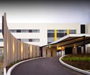
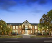
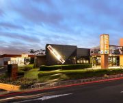
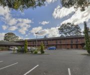
If you need a hotel, we compiled a list of available hotels close to the map centre further down the page.
While being here, you might want to pay a visit to some of the following locations: Melbourne, Currie, Hay, Canberra and . To further explore this place, just scroll down and browse the available info.
Local weather forecast
Todays Local Weather Conditions & Forecast: 17°C / 63 °F
| Morning Temperature | 11°C / 52 °F |
| Evening Temperature | 14°C / 57 °F |
| Night Temperature | 13°C / 55 °F |
| Chance of rainfall | 0% |
| Air Humidity | 48% |
| Air Pressure | 1020 hPa |
| Wind Speed | Moderate breeze with 9 km/h (6 mph) from North-East |
| Cloud Conditions | Clear sky, covering 4% of sky |
| General Conditions | Sky is clear |
Friday, 15th of November 2024
19°C (66 °F)
13°C (56 °F)
Few clouds, gentle breeze.
Saturday, 16th of November 2024
29°C (84 °F)
24°C (75 °F)
Overcast clouds, moderate breeze.
Sunday, 17th of November 2024
21°C (69 °F)
17°C (63 °F)
Light rain, strong breeze, overcast clouds.
Hotels and Places to Stay
ATURA DANDENONG
RAMADA ENCORE DANDENONG
QUEST DANDENONG SERVICED APTS
Keysborough Hotel
The Prince Mark Motor Inn
Comfort Inn Dandenong
Sandown Regency
Dingley International Hotel
Seaford Hotel
Waltzing Matilda Hotel
Videos from this area
These are videos related to the place based on their proximity to this place.
KEYSBOROUGH COUGARS Youth Men win historic first championship for the club. Post Match celebration
Post match celebrations from the Keysborough Cougars historic State Championship Win. Followed by and epic version of the Haka performed by the Taro Boyz 9th of August 2014, Springers Leisure...
A Day in Melbourne - Nazareth City Experience 2007
Two high school nerds complain their way through Melbourne. 'A heartwrenching, yet educational day in the city. It was a school trip, and I felt sweaty, upset and empowered, in that order....
Greenleaf Beauty Virtual Visit
A little bit of France in the heart of Keysborough… Shop 3, Kingsclere Shopping Centre Keysborough, VIC 3173 Phone: (03) 9711 1443 Email:info@greenleafbeauty.com.au Video by Michelle Dunn...
Chippy Olympics 14
The Chippy Olympics was a Quad Stake Youth Activity held at Springers Leisure Centre in Keysborough, Victoria.
Dhammasarana Pagoda lights Vesak 2014
Light display done by me on the Pagoda in the Dhammasarana Buddhist temple in Keysborough for the Vesak festival in 2014. Lights are controlled by an Arduino microcontroller board coupled with...
Dhammasarana Vesak Thorana 2014
Vesak Thorana (Pandol) erected to celebrate Vesak at the Keysborough Dhammasarana Buddhist temple. Art by Mangala Kalansuriya. Lighting and the construction was done by me with the help of...
Derailed Train on the Cranbourne Line near Bombardier Transportation
A train derailed near Bombardier Transportation on Mon 1st June 2009. It was Pacific National ballast wagons and Country Links Passenger car. This was taken from a Connex train out of Cranbourne...
Fazer Subaru
Remote control car in our court Fazer Subaru 1.10 scale model in Keysborough Melbourne Victoria Australia.
LIVING TREES ORGANISATION
http://www.erdigroup.com.au Living Trees - Environmental Support From the Ground Up. Living Trees is an environmental initiative with a wealth of experience and expertise in large-scale...
Videos provided by Youtube are under the copyright of their owners.
Attractions and noteworthy things
Distances are based on the centre of the city/town and sightseeing location. This list contains brief abstracts about monuments, holiday activities, national parcs, museums, organisations and more from the area as well as interesting facts about the region itself. Where available, you'll find the corresponding homepage. Otherwise the related wikipedia article.
City of Greater Dandenong
The City of Greater Dandenong is a local government area in Victoria, Australia located in the southeastern suburbs of Melbourne. It has an area of just under 130 square kilometres (50 sq mi) and an estimated population of 135,605 people. It was formed in 1994 by the merger of parts of the former City of Dandenong and City of Springvale.
Haileybury, Melbourne
Haileybury is an independent school affiliated with the Uniting Church in Australia, located in Berwick, Brighton East and Keysborough, suburbs of Melbourne, Victoria, Australia. The school incorporates both Haileybury College, an all-boys college and Haileybury Girls' College, an all-girls college. Haileybury maintains strong relations with schools in China, Japan and France, and currently delivers the VCE programme to a number of schools in China.
Bangholme, Victoria
Bangholme is a suburb in Melbourne, Victoria, Australia, 31 km south-east from Melbourne's central business district and adjacent to the urban area. Its Local Government Area is the City of Greater Dandenong. At the 2006 Census, Bangholme had a population of 556.
Dandenong, Victoria
Dandenong is a suburb of Melbourne, Victoria, Australia, approximately 30 km south-east from Melbourne's central business district. Situated on the Dandenong Creek, it is at the foothill of the Dandenong Ranges and is the main administrative centre for the City of Greater Dandenong Local Government Area (LGA). At the 2011 Census, central Dandenong had a population of 24,919. It began as a township in 1852 and at the start of the 20th century was an important regional city with its own suburbs.
Keysborough, Victoria
Keysborough is a suburb in Melbourne, Victoria, Australia, 27 km south-east from Melbourne's central business district. Its Local Government Area is the City of Greater Dandenong. At the 2006 Census, Keysborough had a population of 16,368. Keysborough includes market gardens and semi-rural properties and is also a large residential/industrial suburb which started to grow in the 1960s and well into the 1990s.
Dandenong South, Victoria
Dandenong South is a suburb in Melbourne, Victoria, Australia, 31 km south-east from Melbourne's central business district. Its Local Government Area is the City of Greater Dandenong. At the 2006 Census, Dandenong South had a population of 4867. Dandenong South is a primarily industrialized suburb that borders Hallam and the City of Casey region. The suburb contains the closed General Motors railway station.
Lyndhurst, Victoria
Lyndhurst is a suburb in Melbourne, Victoria, Australia, 35 km south-east from Melbourne's central business district. Its Local Government Area is both the City of Casey and the city of Greater Dandenong. Lyndhurst Post Office opened on 1 January 1867 and closed in 1976. After the Bracks government's decisions to abandon plans for a toxic waste dump near Mildura, the continued use of the existing Lyndhurst facility was part of the replacement plan.
Carrum Downs, Victoria
Carrum Downs is a suburb in Melbourne, Victoria, Australia, 34 km south-east from Melbourne's central business district. Its Local Government Area is the City of Frankston. At the 2006 Census, Carrum Downs had a population of 17,213. Prior to December 1994 the majority of Carrum Downs was within the City of Cranbourne.
Yarraman railway station
Yarraman is a railway station in Melbourne, Victoria, Australia, located in the suburb of Noble Park, on the Pakenham and Cranbourne railway lines. Yarraman is unmanned and is in Myki Zone 2.
Dandenong railway station
Dandenong is a railway station located in Dandenong, Victoria, Australia. Located 30 km from Flinders Street Station in central Melbourne, the station serves as the junction of the Pakenham and Cranbourne railway lines, and is the terminus station for several peak services. It also serves V/Line trains along the Traralgon and Bairnsdale lines.
Chelsea Heights, Victoria
Chelsea Heights is a suburb in Melbourne, Victoria, Australia, 30 km south-east from Melbourne's central business district. Its Local Government Area is the City of Kingston. At the 2011 Census, Chelsea Heights had a population of 5,186. The suburb is home to Chelsea Heights Primary School, The Chelsea Heights Cricket & Football Club, Bonbeach Blue Jays Baseball Club.
Patterson Lakes, Victoria
Patterson Lakes is a suburb in outer south-east Melbourne, Victoria, Australia. It is 34 km south-east of Melbourne's central business district. Its Local Government Area is the City of Kingston. In the 2011 Census Patterson Lakes had a population of 7,582 people. Patterson Lakes consists predominantly of new houses. Patterson Lakes is home to the most popular boat launching facilities in Victoria. The Patterson River is a popular portal for Port Phillip.
Division of Isaacs
The Division of Isaacs is an Australian Electoral Division in the state of Victoria. It is located in the south-eastern suburbs of Melbourne, on the eastern shores of Port Phillip Bay. It covers the suburbs of Mordialloc, Keysborough, Noble Park, Chelsea, Bonbeach, Patterson Lakes and Carrum. The Division was named after Sir Isaac Isaacs, former Chief Justice of Australia and the first Australian-born Governor-General of Australia.
Waterways, Victoria
Waterways is a suburb located in Melbourne's south. Originally a housing development, it is just east of Mordialloc. Construction started on Waterways Estate began in May 2000, due to end within five years. Waterways got its name from its waterways which are essentially a number of manmade wetlands and giant lakes in and around the estate. The lakes serve as a Melbourne Water filtration system for fresh water flowing down from Dandenong and Moridalloc Creeks then into Port Phillip Bay.
Sandhurst, Victoria
Sandhurst is an official bounded locality in Melbourne, Victoria, Australia, 37 km south-east from Melbourne's central business district. Its Local Government Area is the City of Frankston. Prior to 15 December 1994, the area now Sandhurst was part of the City of Cranbourne formerly the Shire of Cranbourne, and shares its postcode 3977 with Cranbourne.
St John's Regional College
St John's Regional College is a Catholic co-educational secondary school situated in Dandenong in the south-eastern suburbs of Melbourne.
Hallam Bypass Trail
No image available yet Hallam Bypass Trail Length 13.7 km Difficulty Easy
Lyndhurst railway station
Lyndhurst is a former railway station on the South Gippsland line. In 1979, it had a single platform on the east side of the track, and a loop siding. In the 1969 Melbourne Transportation Plan, a new passenger line was proposed linking Frankston and Lyndhurst. Today the platform is demolished and is closed to passengers, with cement traffic from Waurn Ponds, near Geelong being the only traffic. This ended in 2009 after Pacific National increased the costs charged to Blue Circle Southern.
City of Dandenong
The City of Dandenong was a local government area about 35 kilometres southeast of Melbourne, the state capital of Victoria, Australia. The city covered an area of 36.26 square kilometres, and existed from 1857 until 1994.
Keysborough Secondary College
Keysborough Secondary College is a dual campus government coeducational school for students from years 7-12, with campuses located in Springvale South, Victoria and Keysborough, Victoria. The four participating schools were officially merged into Keysborough Secondary College on the 6th of October 2008. The merger is valued at $43 Million.
George Andrews Reserve
George Andrews Reserve is an Australian football (soccer) stadium in Dandenong, a suburb of Melbourne, Victoria. It is currently the home of Dandenong Thunder. The stadium has a capacity of 5,000, with approximately 1,000 seats in its one grandstand.
Carrum Downs Secondary College
Carrum Downs Secondary College Location McCormicks Rd Carrum Downs, Victoria, Australia 22x20px Coordinates coord}}{{#coordinates:38|5|41|S|145|11|51|E| primary name= }} Information Type public, secondary, day school Motto Together we achieve Established 2004 Principal Marie Walker Sherellan Smith (AP) Lisa Holt (AP) Carol Pyke (AP) Years offered 7 - 12 Gender co-educational Colour(s) dark sax, sax blue, crystal blue, black, white, and gold Website cdsc. vic. edu.
Lighthouse Christian College
Lighthouse Christian College is a private Christian school located in Keysborough, Victoria, Australia. Lighthouse Christian College has been active for over two decades. From humble beginnings in 1989, Ps Richard Warner's (president) vision has been fulfilled, with the school growing to over 400 students. It is one of the most multi cultural schools in the independent sector in Australia.
Eastern Treatment Plant
The Eastern Treatment Plant (ETP) of Melbourne Water is a sewage treatment plant that serves much of the city of Melbourne, the state capital of Victoria, south-eastern Australia. The plant is at Bangholme, 31 km south-east of Melbourne’s central business district and adjacent to its south-eastern suburbs.
Bend Road archaeological site
The Bend Road archaeological site is an open site in Melbourne, Australia, which was discovered during survey and archaeological testing for the proposed Scoresby Freeway (which became the EastLink Freeway. The site is located in two separate areas on either side of Bend Road, Dandenong South where the freeway now intersects the former road, and originally covered about 12 hectares.


