Delve into Murrumbeena
The district Murrumbeena of in Glen Eira (Victoria) with it's 8,592 habitants Murrumbeena is a district located in Australia about 289 mi south-west of Canberra, the country's capital town.
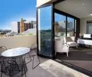
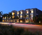
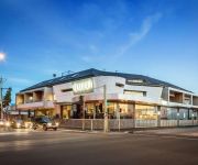
In need of a room? We compiled a list of available hotels close to the map centre further down the page.
Since you are here already, you might want to pay a visit to some of the following locations: Melbourne, Currie, Hay, Canberra and . To further explore this place, just scroll down and browse the available info.
Local weather forecast
Todays Local Weather Conditions & Forecast: 17°C / 62 °F
| Morning Temperature | 12°C / 53 °F |
| Evening Temperature | 15°C / 58 °F |
| Night Temperature | 11°C / 52 °F |
| Chance of rainfall | 0% |
| Air Humidity | 49% |
| Air Pressure | 1020 hPa |
| Wind Speed | Moderate breeze with 10 km/h (6 mph) from North-East |
| Cloud Conditions | Clear sky, covering 7% of sky |
| General Conditions | Sky is clear |
Friday, 15th of November 2024
18°C (65 °F)
13°C (56 °F)
Broken clouds, moderate breeze.
Saturday, 16th of November 2024
28°C (83 °F)
22°C (72 °F)
Overcast clouds, gentle breeze.
Sunday, 17th of November 2024
25°C (77 °F)
18°C (65 °F)
Moderate rain, strong breeze, overcast clouds.
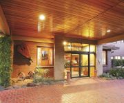
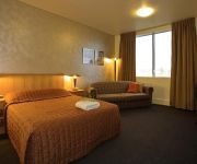
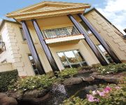
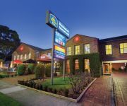
Hotels and Places to Stay
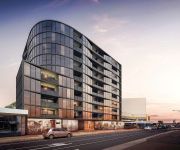
The Sebel Melbourne Moorabbin
QUEST HAWTHORN
Brighton Bay Apartments
BRIGHTON SAVOY
QUEST BRIGHTON ON THE BAY
Hotel Bruce County
HEMISPHERE HOTEL
Gateway on Monash
Best Western Plus Buckingham International
Caroline Apts Brighton
Videos from this area
These are videos related to the place based on their proximity to this place.
The Art of Feminine Presence
http://www.innerradiance.com.au/ My name is Karen Lowe, I am a Journey Practitioner working from Centre Road in Bentleigh. I'm making this video because I am adding something to my practice:...
Oakleigh Carpet Cleaning Melbourne - (03) 9111 5619 - Carpet Cleaning In Oakleigh, VIC
Pocka Dola Carpet Cleaning Melbourne Oakleigh Carpet Cleaning Melbourne - (03) 9111 5619 - Carpet Cleaning In Oakleigh, VIC Hosted on the Pocka Dola Youtube Channel Carpet Cleaning ...
Clarke Nicholas Construction - Space - Office/Warehouse Development - Oakleigh, Victoria, Australia
Clarke Nicholas Construction - Space - Office/Warehouse Development - Oakleigh, Victoria, Australia.
Gym in Oakleigh - Cruze Health Club
http://www.cruzehealth.com Gyms in Oakleigh. Cruze Health Club in Level 1, 17 Chester Street, Oakleigh Victoria 3166. Check out the gym and all the amazing features and equipment, personal...
Accident Warrigal Rd Oakleigh
Just because a truck driver lets you turn you must still give way to the other lane of traffic.
15 Hatter Street, Oakleigh Victoria By Tom Grieve
Property Video shoot of 15 Hatter Street, Oakleigh Victoria by PlatinumHD http://www.platinumhd.tv for Ray White Carnegie.
A73-T396-S306-S303-X39 9461 Maryvale Oakleigh 6/3/04
Large lashup on the daytime Maryvale; the X and T were going down to Morwell to run spoil and sleeper trains for RFR works.
Oakleigh Cannons V Sunshine Georgies Friendly Goals
Score: 3-1. Lukas Pedder is fouled resulting in penalty. Kristopher Kioussis takes Penalty Kick. (1-0) Ryan Kaiser heads-in a nice goal. (2-0) Defending mistake (2-1) Alex runs & cuts...
Quarry train through Oakleigh
G524 leads an empty up Apex quarry train past the end of platform 1 at Oakleigh.
Videos provided by Youtube are under the copyright of their owners.
Attractions and noteworthy things
Distances are based on the centre of the city/town and sightseeing location. This list contains brief abstracts about monuments, holiday activities, national parcs, museums, organisations and more from the area as well as interesting facts about the region itself. Where available, you'll find the corresponding homepage. Otherwise the related wikipedia article.
Carnegie, Victoria
Carnegie is a suburb in Melbourne, Victoria, Australia, 12 km south-east from Melbourne's central business district. Its Local Government Area is the City of Glen Eira. At the 2011 Census, Carnegie had a population of 16,299. Its postcode is 3163. The suburb's main shopping precinct is on Koornang Road, between Dandenong Road and Neerim Road.
Glen Huntly, Victoria
Glen Huntly is a suburb of Melbourne, Victoria, Australia, 11 km south-east from Melbourne's central business district. Its Local Government Area is the City of Glen Eira. At the 2011 Census, Glen Huntly had a population of 4658. It is a small suburb, approximately 1 km from north to south and 800 metres east to west at its widest point. Its borders are Neerim Road in the north, Booran Road in the west, Grange Road in the east and Woodville Avenue and Oakleigh Road in the south.
Murrumbeena, Victoria
Murrumbeena is a suburb in Melbourne, Victoria, Australia, 13 km south-east from Melbourne's central business district. Its Local Government Area is the City of Glen Eira. At the 2011 Census, Murrumbeena had a population of 8,592. Murrumbeena is a small suburban area with extensive parklands and primarily Federation and Interwar architectural character.
Glenhuntly railway station
Glenhuntly is a railway station in Melbourne, Victoria, Australia, located in the suburb of Glen Huntly on the Frankston railway line. Glenhuntly is classed as a Host Station and is in Metcard Zone 1.
Caulfield railway station
Caulfield is a railway station in Melbourne, Victoria, Australia, located in the suburb of Caulfield East, at the junction of the Frankston, Pakenham and Cranbourne railway lines. Classed as a Premium Station, it is in Metlink Zone 1. It is the ninth busiest railway station in Melbourne based upon passenger boardings, with an average of 10,600 boardings per day in 2009.
Murrumbeena railway station
Murrumbeena is a railway station in Melbourne, Victoria, Australia, located in the suburb of Murrumbeena, on the Pakenham and Cranbourne railway lines. Murrumbeena is classed as a Host Station and is in Metcard Zone 1.
Carnegie railway station
Carnegie is a railway station in Melbourne, Victoria, Australia, located in the suburb of Carnegie, on the Pakenham and Cranbourne railway lines. Carnegie is classed as a Host Station and is in Metcard Zone 1.
Hughesdale railway station
Hughesdale is a railway station in Melbourne, Victoria, Australia, located in the suburb of Hughesdale, on the Pakenham railway line and Cranbourne railway line. Hughesdale station is unmanned and is in Metcard Zones 1+2.
Oakleigh railway station
Oakleigh is a railway station in Melbourne, Victoria, Australia, located in the suburb of Oakleigh, on the Pakenham and Cranbourne railway lines. Oakleigh is classed as a Premium Station, and is in Metcard Zones 1+2.
Holmesglen railway station
Holmesglen is a railway station in Melbourne, Victoria, Australia, located in the suburb of Malvern East, on the Glen Waverley railway line. Holmesglen is classed as a Host Station and is in Metcard Zone 1+2 overlap.
East Malvern railway station
East Malvern is a railway station in Melbourne, Victoria, Australia, located in the suburb of Malvern East, on the Glen Waverley railway line. East Malvern is classed as a Premium Station and is in Metcard Zone 1+2 overlap.
Hughesdale, Victoria
Hughesdale is a suburb in Melbourne, Victoria, Australia, 18 km south-east from Melbourne's central business district. Its Local Government Area is the City of Monash. At the 2011 Census, Hughesdale had a population of 7,055. Just 2sq km in size, it is the smallest suburb in the City of Monash. Hughesdale is bordered by Poath Road to the west, Dandenong Road to the north, Warrigal Road to the east and North Road to the south.
Oakleigh South, Victoria
Oakleigh South is a suburb in Melbourne, Victoria, Australia, 17 km south-east from Melbourne's central business district. Its Local Government Area is the City of Monash and the City of Kingston. At the 2011 Census, Oakleigh South had a population of 9,140. A largely residential suburb, its boundaries are North Road to the north, Old Dandenong Road to the south, Warrigal Road to the west and Huntingdale/Clarinda Roads to the east. Oakleigh South Post Office opened on 1 September 1936.
McKinnon Secondary College
McKinnon Secondary College is a public secondary school located in the Melbourne suburb of McKinnon. The school was ranked 62nd in Victoria in terms of VCE median study score in 2012. McKinnon is known for its large music faculty.
Caulfield East, Victoria
Caulfield East is a suburb in Melbourne, Victoria, Australia, 10 km south-east from Melbourne's central business district. Its Local Government Area is the City of Glen Eira. At the 2011 Census, Caulfield East had a population of 1,237. The suburb contains landmarks such as the Caulfield Racecourse, Caulfield railway station, the Caulfield Campus of Monash University and Glen Eira College.
Waverley Park, Victoria
Waverley Park was a suburb name put forward to the City of Monash in Melbourne, Victoria, Australia, for the Mirvac development on the Waverley Park land. These plans would have split the suburb of Mulgrave into two separate sections. This led to people in the smaller, eastern section of Mulgrave petitioning to also be put under the Waverley Park banner. The suburb of Waverley Park was denied and as such at this time the Waverley Park development is a part of Mulgrave.
Waverley Road railway station
Waverley Road was a station on the Outer Circle railway line, located near the current East Malvern station in Malvern East, Victoria, Australia, in what is now the Malvern Urban Forest. The platform, the mound of which can still be seen, was located approximately 120 metres SSE of the line's Waverley Road crossing. Named after the nearby road that crossed the tracks, the station was originally named "Waverley" until altered in 1890.
Bentleigh East, Victoria
Bentleigh East is a suburb in Melbourne, Victoria, Australia, 14 km south-east from Melbourne's central business district. Its Local Government Area is the City of Glen Eira. At the 2011 Census, Bentleigh East had a population of 25,925. It is bounded to the west by Tucker Road, to the north by North Road, to the east by Warrigal Road and to the south by South Road. It is bisected by Centre Road. The area around Mackie Road is the locality of Coatesville.
Kilvington Grammar School
Kilvington Grammar School (previously named Kilvington Girls Grammar) is an independent, Baptist, co-educational day school, located in Ormond, a suburb in the Glen Eira region of Melbourne, Victoria, Australia. Established in 1923 by Caroline and Constance Barrett, Kilvington has a non-selective enrolment policy and currently caters for approximately 550 students from the Early Learning Centre to Year 12.
Sacred Heart Girls' College
Sacred Heart Girls' College (also known simply as SHGC) is a Catholic school for girls in years 7 to 12 located in the Melbourne suburb of Oakleigh. It was opened in 1957 by the Sisters of Our Lady of the Missions (RNDM). The College houses approximately 1000 students of many different nationalities, and continues to grow. It provides many extra-curricular activities for its students, and is known for its successes in sporting, public speaking and debating.
Warrigal Road
Warrigal Road is a major inner urban road in southeastern Melbourne, Australia. On weekdays, it is usually congested as it runs through many major suburbs along its route, traversing Melbourne's inner eastern and south-eastern suburbs. This includes suburbs such as Chadstone, Oakleigh, and Cheltenham, and features such as the Chadstone Shopping Centre.
South Oakleigh Secondary College
South Oakleigh Secondary College is a Victorian state co-educational secondary college located on Bakers Road, in the suburb of Oakleigh South, Victoria, in south eastern Melbourne, Australia.
Chadstone High School
Chadstone High School (State School number 7710) was a former Victorian Government high school, located in the Melbourne suburb of Chadstone. Chadstone High School was often referred to as "Chaddy High".
Oakleigh Grammar
Oakleigh Grammar is a Greek Orthodox Independent school located in the Melbourne suburb of Oakleigh. The school was established in 1983 and currently caters for 528 students from 3-year old Kindergarten to Year 12. The Early Learning Centre, for 3 & 4-year old kindergarten students, operates under the principles of the Reggio Emilia philosophy.
Glen Eira Sports and Aquatic Centre
Glen Eira Sports and Aquatic Centre (GESAC) is an aquatic centre that was developed by Hansen Yuncken and is owned by City of Glen Eira. It is a rival to Melbourne Sports and Aquatic Centre as it is contains a 50 metre outdoor pool, 25 metre indoor pool, water slides, leisure pools, gymnasium and a stadium. It is being constructed for the cost of $44m dollars. It is set to become arguably the greatest pool in Melbourne. It is the first indoor pool in Glen Eira


