Delve into Kingsbury
The district Kingsbury of in Darebin (Victoria) with it's 3,362 habitants Kingsbury is a district located in Australia about 283 mi south-west of Canberra, the country's capital town.
In need of a room? We compiled a list of available hotels close to the map centre further down the page.
Since you are here already, you might want to pay a visit to some of the following locations: Melbourne, Currie, Hay, Canberra and . To further explore this place, just scroll down and browse the available info.
Local weather forecast
Todays Local Weather Conditions & Forecast: 19°C / 66 °F
| Morning Temperature | 17°C / 63 °F |
| Evening Temperature | 20°C / 68 °F |
| Night Temperature | 17°C / 63 °F |
| Chance of rainfall | 20% |
| Air Humidity | 94% |
| Air Pressure | 1017 hPa |
| Wind Speed | Light breeze with 4 km/h (2 mph) from North |
| Cloud Conditions | Overcast clouds, covering 100% of sky |
| General Conditions | Heavy intensity rain |
Monday, 25th of November 2024
20°C (67 °F)
18°C (64 °F)
Overcast clouds, light breeze.
Tuesday, 26th of November 2024
27°C (81 °F)
20°C (69 °F)
Light rain, light breeze, few clouds.
Wednesday, 27th of November 2024
21°C (69 °F)
19°C (67 °F)
Moderate rain, light breeze, overcast clouds.
Hotels and Places to Stay
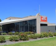
BEST WESTERN MAHONEYS MOTOR INN
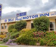
BEST WESTERN MILL PARK MOTEL
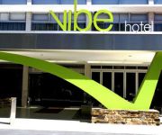
Vibe Carlton Melbourne
Tyrian Serviced Apartments
Best Western Melbourne's Princes Park Motor Inn
APARTMENTS AT KEW Q105
ALPHINGTON SERVICED APARTMENTS
Comfort Inn Greensborough
QUEST IVANHOE SERVICED APTS
Mercure North Melbourne
Videos from this area
These are videos related to the place based on their proximity to this place.
KUMITE Senior Male Barney VS Shane
Auckland Region Karate Championships 2014 KUMITE Senior Male Barney VS Shane.
Kata Tomari Bassai -Andrea Anacan(SSKANZ)
Auckland Region Karate Championships 2014 Kata Tomari Bassai -Andrea Anacan(SSKANZ)
Kata Papuren -Andrea Anacan(SSKANZ)
Auckland Region Karate Championships 2014 Kata Papuren -Andrea Anacan(SSKANZ)
KUMITE 14-15 Male - VS Ivan Siau(SSKANZ)-1
Auckland Region Karate Championships 2014 KUMITE 14-15 Male - VS Ivan Siau(SSKANZ)
KUMITE 14-15 Male Final - VS Ivan Siau(SSKANZ)
Auckland Region Karate Championships 2014 KUMITE 14-15 Male - VS Ivan Siau(SSKANZ)
KATA 4th Kyu 8-9 Female SSKANZ vs SSKANZ
Auckland Region Karate Championships 2014 KATA 4th Kyu 8-9 Female SSKANZ vs SSKANZ.
KATA 4th Kyu 8-9 Male SSKANZ vs -
Auckland Region Karate Championships 2014 KATA 4th Kyu 8-9 Male SSKANZ vs -
KATA 4th Kyu 8-9 Female Gojuryu vs SSKANZ
Auckland Region Karate Championships 2014 KATA 4th Kyu 8-9 Female Gojuryu vs SSKANZ.
Truck Recovery
Truck roll over with 20 x 1000 litre liquid fertiliser containers.(Schutz IBC Bulk liquid containers) Settlement Rd, Bundoora, Victoria. Near the intersection of Plenty Rd. For more Photos...
Videos provided by Youtube are under the copyright of their owners.
Attractions and noteworthy things
Distances are based on the centre of the city/town and sightseeing location. This list contains brief abstracts about monuments, holiday activities, national parcs, museums, organisations and more from the area as well as interesting facts about the region itself. Where available, you'll find the corresponding homepage. Otherwise the related wikipedia article.
La Trobe University
La Trobe University is a multi-campus university in Victoria, Australia. It was established in 1964 by an Act of Parliament to become the third oldest university in the state of Victoria. The main campus of La Trobe is located in the Melbourne suburb of Bundoora; two other major campuses are located in the Victorian city of Bendigo and the NSW-Victorian border centre of Albury-Wodonga.
City of Darebin
The City of Darebin is a local government area in Victoria, Australia, in the northern suburbs of Melbourne. It has an area of 53 square kilometres, and at the 2011 Census, Darebin had a population of 136,474. Municipal offices are located at 350 High Street, Preston. Darebin was rated 386th of 590 Australian Local Government Areas in the BankWest Quality of Life Index 2008.
City of Glen Eira
The City of Glen Eira is a local government area in Victoria, Australia. It is located in the south-eastern suburbs of Melbourne. It has an area of 38.4 square kilometres and has an estimated population of 136,354 people. It was formed in 1994 from the merger of the City of Caulfield and parts of the City of Moorabbin.
Bundoora, Victoria
Bundoora is a suburb of Melbourne, Victoria, Australia, 16 km north from Melbourne's Central Business District. Its local government areas are the Cities of Banyule, Darebin and Whittlesea. At the 2011 Census, Bundoora had a population of 25,709. Bundoora is the headquarters of La Trobe University, Bundoora Campus. Royal Melbourne Institute of Technology (RMIT) also has a campus situated in Bundoora.
Heidelberg West, Victoria
Heidelberg West is a suburb of Melbourne, Victoria, Australia, 10 km north-east from Melbourne's Central Business District. Its Local Government Area is the City of Banyule. At the 2011 Census, Heidelberg West had a population of 5,327.
Heidelberg Heights, Victoria
Heidelberg Heights is a suburb of Melbourne, Victoria, Australia, 10 km north east from Melbourne's Central Business District. Its Local Government Area is the City of Banyule. At the 2011 Census, Heidelberg Heights had a population of 6,388.
Kingsbury, Victoria
Kingsbury is a suburb of Melbourne, Victoria, Australia, 12 km north-east from Melbourne's Central Business District. Its Local Government Area is the City of Darebin. At the 2011 Census, Kingsbury had a population of 3,362. The suburb was named after Bruce Kingsbury VC, who died in Papua New Guinea during the Second World War.
Reservoir, Victoria
Reservoir is a suburb of Melbourne, Victoria, Australia, 12 km north from Melbourne's Central Business District. Its Local Government Area is the City of Darebin. At the 2011 Census, Reservoir had a population of 47,637. Reservoir is an established suburb with standard brick homes, weatherboard homes, and an increasing number of new developments.
Thomastown, Victoria
Thomastown is a suburb of Melbourne, Victoria, Australia, 17 km north from Melbourne's central business district. Its Local Government Area is the City of Whittlesea. At the 2011 Census, Thomastown had a population of 20,331. Thomastown is known for sharing its area with Westgarthtown, a historical settlement.
Macleod railway station
Macleod is a railway station in Melbourne, Victoria, Australia, located in the suburb of Macleod, on the Hurstbridge railway line. Macleod is classed as a Premium station and is in Metcard Zone 2.
Reservoir railway station
Reservoir is a railway station in Melbourne, Victoria, Australia, located in the suburb of Reservoir, on the South Morang railway line. Reservoir is classed as a Premium Station and is in Metcard Zones 1+2 overlap.
Regent railway station
Regent is a railway station in Melbourne, Victoria, Australia, located in the suburb of Reservoir, on the South Morang railway line. Regent is manned Monday-Friday between 7:30am and 9:30am and is in Public Transport Victoria zones 1+2 overlap.
Ruthven railway station
Ruthven is a railway station in Melbourne, Victoria, Australia, located in the suburb of Reservoir, on the South Morang railway line. Ruthven is unmanned and is located in Metcard Zone 2.
Keon Park railway station
Keon Park is a railway station in Melbourne, Victoria, Australia. It is located on the South Morang railway line in the suburb of Thomastown.
Division of Batman
The Division of Batman is an Australian Electoral Division in Victoria. The division was created in 1906, replacing the Division of Northern Melbourne. It takes its name from John Batman, one of the founders of the city of Melbourne. When it was created it covered the inner suburbs of Carlton and Fitzroy, but successive boundary changes have moved it steadily northwards. Today it includes Northcote, Preston, Reservoir and Thornbury.
Mont Park Asylum
Mont Park Asylum was a psychiatric hospital located in Melbourne, Australia. It was closed in the late-1990s. Located on a huge area of land around {{#invoke:Coordinates|coord}}{{#coordinates:37.7221|S|145.0647|E|region:AU-VIC_type:landmark|||| |primary |name= }}, Mont Park was built during the government policies of institutionalisation of the mentally ill and insane in the early 20th century. The complex was served by the freight only Mont Park railway branch line.
Northland Shopping Centre
Northland Shopping Centre is a major shopping centre in East Preston, approximately 11 km north of the Melbourne Central Business District in Victoria. Its motto is For the love of shopping. It is the largest predominantly single-level shopping centre in Melbourne. It has more than 330 stores all spread on one floor but cinemas, Playtime and Pancake Parlour is on the top level.
Macleod, Victoria
Macleod is a suburb of Melbourne, Victoria, Australia, 14 km north-east from Melbourne's Central Business District. Its Local Government Area are the Cities of Banyule and Darebin. At the 2011 Census, Macleod had a population of 9,606. Macleod West refers to the predominantly residential locality to the west of the railway line and station.
St Georges Road Trail
300px The path looking towards Melbourne CBD St Georges Road Trail Length 9.6km Difficulty Easy
Bundoora Secondary College
Bundoora Secondary College is a public secondary school for girls and boys in years 7 to 12 located in a quiet and leafy residential block on the corner of Balmoral Avenue and Moreton Crescent in Bundoora, a suburb of Melbourne, Victoria, Australia. The school values are Relationships, Respect, Responsibility, Resilience and Rigour.
City of Preston (Victoria)
The City of Preston was a local government area about 11 kilometres north-northeast of Melbourne, the state capital of Victoria, Australia. The city covered an area of 37.05 square kilometres, and existed from 1871 until 1994.
Reservoir District Secondary College
Reservoir District Secondary College is a co-educational, public high school, located in Reservoir, Victoria, Australia.
Mount Cooper
Mount Cooper is located within Bundoora Park, a large public park, in the Melbourne suburb of Bundoora, and peaks at 137 meters above sea level. Mount Cooper is accessible by car via Mount Cooper Scenic Drive. In at least one publication the peak is called Mount Prospect, or Bundoora Hill, but the height appears to have been recorded incorrectly at 102.5m.
Olympic Park (Village)
Olympic Park (Village) was built for the 1956 Olympic Games in Melbourne, Australia. The venue was used as the official warm-up venue for the Olympics but is now a venue mainly used for soccer. The athletes village is now known as Olympic Village and is home to Heidelberg United in the Victorian Premier League. The ground has a main grandstand with seating for 1,000 as well as undercover standing room. Opposite the main stadium is smaller grandstand with more undercover standing room.
Merrilands College
Merrilands College was a public P-12 school in Reservoir, Melbourne, Victoria, Australia now merged with Lakeside Secondary College (Radford Road Campus) to become William Ruthven Secondary College, as the Merrilands Road Campus. Merrilands is divided into three "sub-schools". The first comprises Preparatory to Year Four, the second Year Five to Year Nine, and the third Year Ten to Year Twelve. The principal of Merrilands College is Wayne Hill.


