Delve into Sunshine North
The district Sunshine North of in Brimbank (Victoria) with it's 10,637 habitants Sunshine North is a district located in Australia about 294 mi south-west of Canberra, the country's capital town.
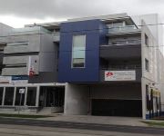
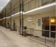
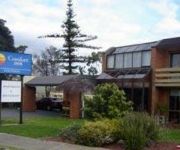
In need of a room? We compiled a list of available hotels close to the map centre further down the page.
Since you are here already, you might want to pay a visit to some of the following locations: Melbourne, Currie, Hay, Canberra and Loxton. To further explore this place, just scroll down and browse the available info.
Local weather forecast
Todays Local Weather Conditions & Forecast: 21°C / 70 °F
| Morning Temperature | 18°C / 64 °F |
| Evening Temperature | 20°C / 67 °F |
| Night Temperature | 17°C / 63 °F |
| Chance of rainfall | 23% |
| Air Humidity | 80% |
| Air Pressure | 1017 hPa |
| Wind Speed | Gentle Breeze with 6 km/h (4 mph) from North |
| Cloud Conditions | Overcast clouds, covering 100% of sky |
| General Conditions | Heavy intensity rain |
Monday, 25th of November 2024
18°C (64 °F)
17°C (63 °F)
Light rain, gentle breeze, overcast clouds.
Tuesday, 26th of November 2024
26°C (78 °F)
21°C (69 °F)
Sky is clear, gentle breeze, clear sky.
Wednesday, 27th of November 2024
22°C (72 °F)
20°C (67 °F)
Moderate rain, gentle breeze, overcast clouds.
Hotels and Places to Stay
Summer Inn Holiday Apartments
Mercure Melbourne Caroline Springs
MANTRA TULLAMARINE HOTEL
PUNTHILL ESSENDON
Sunshine Motor Inn
Essendon Apartments
Westside Hotel
Skyways Taverner
Inn Essendon
Ciloms Airport Lodge
Videos from this area
These are videos related to the place based on their proximity to this place.
18/12/10 - Ginifer to Southern Cross Part I
Part II: http://www.youtube.com/watch?v=H204q-GznLk The weekend before Christmas (as noted in the video by some woman :P). Travelling to the city on the 11:36 Flinders Street in an EDI Comeng.
How To Slay Boredom In A Hotel Room
Wondering what to do in a hotel room? Bored out of your skull? Want more from your hard earnt money? Well, here it is. Recorded at a hotel room in the western suburbs of Melbourne. Yes,...
Bendy Blades
You can get interesting effects by using crap cameras. The wiper blades look like they are made of flexible materials due to the slow update of the camera phone.
Pets Stores Melbourne | Pet Works Sunshine
http://www.petworkssunshine.com.au Pet Works Sunshine is one of Melbourne's largest pet stores conviently located near the Western Ring Road. We have puppies for adoption, orphaned rabbits...
Australian trains : EMU, freight, and passenger trains
This clip has Comeng EMU's, CFCLA VL class locos on 5MS8 to Sydney and a V/Line passenger train.
Australian trains : V/Line passenger and Comeng EMU
A Bendigo bound V/Line service followed by a Comeng EMU set running to Watergardens/Sydenham.
Merpati Putih Roadshow at Polish Club Albion
A special thanks to MP KJRI Melbourne, Polish Club Albion, Erlangga Dilisuta for the photos and video recording, and to Mukti Wibowo for special lunch before the event ... http://merpatiputih.com.au/
Railpage Albion RailCam Test Footage
Railpabe Albion Railcam Test Footage. 3 x CM's and an EL pass the camera site.
Videos provided by Youtube are under the copyright of their owners.
Attractions and noteworthy things
Distances are based on the centre of the city/town and sightseeing location. This list contains brief abstracts about monuments, holiday activities, national parcs, museums, organisations and more from the area as well as interesting facts about the region itself. Where available, you'll find the corresponding homepage. Otherwise the related wikipedia article.
Braybrook, Victoria
Braybrook is a suburb 9 km west of Melbourne, Victoria, Australia. Its Local Government Area is the City of Maribyrnong. At the 2011 Census, Braybrook had a population of 8,180. Braybrook is bounded in the west by Duke Street, in the north by the Maribyrnong River, in the east by Ashley Street, and in the south by the Sunbury railway line and Sunshine Road.
Ardeer, Victoria
Ardeer is a suburb of Melbourne, Victoria, Australia, 16 km west from Melbourne's central business district. Its Local Government Area is the City of Brimbank. At the 2011 Census, Ardeer had a population of 2,823. Ardeer has a railway station on the Melton greater-metropolitan line.
Kealba, Victoria
Kealba is a suburb of Melbourne, Victoria, Australia, 16 km north-west from Melbourne's central business district. Its local government area is the City of Brimbank. At the 2011 Census, Kealba had a population of 3,164. The name of the suburb is derived from the letters of two of its neighbouring suburbs, namely Keilor and St Albans.
Sunshine, Victoria
Sunshine is a suburb of Melbourne, Victoria, Australia, lying 11 to 13 km west of the CBD. Its local government area is the City of Brimbank. At the 2011 Census, Sunshine had a population of 8,838.
Albion railway station, Melbourne
Albion is a railway station in Melbourne, Victoria, Australia, located on the border of the suburbs of Sunshine and Albion, Victoria, on the Sunbury railway line. Classed as a Host Station, Albion is in the Myki zones 1+2 overlap.
Sunshine railway station, Melbourne
Sunshine is a railway station in Melbourne, Victoria, Australia, located in the suburb of Sunshine, on the Sunbury railway line. It is the junction for the line west to Ballarat. The Melbourne - Sydney standard gauge line is also adjacent to the station. Classed as a Premium Station, Sunshine is in Myki zones 1+2 overlap.
Ginifer railway station
Ginifer is a railway station in Melbourne, Victoria, Australia, located in the suburb of St Albans, on the Sunbury railway line. Ginifer is unmanned and is in Myki Zone 2.
Ardeer railway station
Ardeer is a railway station in Melbourne, Victoria, Australia, located in the suburb of Ardeer, on the Melton railway line. Ardeer station is unmanned, and is in PTV Zone 2. Ardeer is located between Forrest Street and Ridgeway Parade, with station access from both. The station consists an island platform, with a small pebblemix shelter in the centre, and an open air shelter at the station's entrance. A myki card vending machine is located at the entrance.
Sunshine rail disaster
The Sunshine rail disaster happened at the Sunshine railway station, which is the junction for the Ballarat and Bendigo railway lines, 13.5 km from Melbourne, the state capital of Victoria, Australia. On the night of Easter Monday, 20 April 1908, 44 people were killed and over 400 injured when a Melbourne-bound train from Bendigo collided with the rear of a mail train from Ballarat, which was just leaving the station. Around 1,100 people were aboard the two trains.
Albion, Victoria
Albion is a suburb of Melbourne, Victoria, Australia, 13 km west from Melbourne's central business district. Its Local Government Area is the City of Brimbank. At the 2011 Census Albion had a population of 4,337. Albion is bordered on the north by Ballarat Road, the south by Forrest Street, the west by Kororoit Creek and the east by Anderson Road. The suburb is completely surrounded by other parts of Sunshine except for Ardeer, which lies to Albion's due west across Kororoit Creek.
Sunshine West, Victoria
Sunshine West is a suburb 13–16 km west of Melbourne, Victoria, Australia. Its local government area is the City of Brimbank. At the 2011 Census, Sunshine West had a population of 16,743. Sunshine West is a residential and industrial area. It is bounded by Forrest Street in the north, Kororoit Creek in the east, Boundary Road in the south and the Western Ring Road in the west. Settlement of the area dates from the 1920s when the Sunshine Heights Estate was developed.
Sunshine North, Victoria
Sunshine North is a suburb 12 km west of Melbourne, Victoria, Australia. Its Local Government Area is the City of Brimbank. At the 2011 Census, Sunshine North had a population of 10,637.
St Albans Secondary College
St. Albans Secondary College is a 7-12 secondary school located at St Albans, Victoria, Australia, in Melbourne's western suburbs. It is recognised for its academic excellence, strong social and cultural values and high university admission rates.
Marian College (Sunshine West)
Marian College is a Roman Catholic girls secondary college in Sunshine West, Victoria, Australia. Marian College works under the governance of the Brigidine Sisters. The school was established in 1958. Marian College seeks to provide young women with the opportunity to be educated within a school environment that allows and encourages each person to develop fully as an individual, and as a community member. There are roughly 800 girls at the school.
Maribyrnong River Viaduct
The Maribyrnong River Viaduct (also known locally as the Quarter Mile Bridge) caries the Albion–Jacana railway line, Melbourne across the Maribyrnong River in the western suburbs of Melbourne, Australia. It is located near the E.J. Whitten Bridge, and almost 400 metres long (hence the quarter mile name). It was built in 1927–29 by the Victorian Railways Construction Branch, being the largest trestle bridge in Australia when completed in June, 1929.
City of Sunshine
The City of Sunshine was a local government area about 13 kilometres west of Melbourne, the state capital of Victoria, Australia. The city covered an area of 80.05 square kilometres, and existed from 1860 until 1994.
Caroline Chisholm Catholic College, Melbourne
Caroline Chisholm Catholic College is a Roman Catholic co-educational day school for years 7–12 located in the western suburb of Braybrook in Melbourne, Australia. The College was founded in 1997 by the amalgamation of three colleges, St Johns College for Boys, Christ the King College for Girls and Chisholm College, a senior co-educational secondary school, all three schools located in the suburb of Braybrook.
Sunshine Marketplace
Sunshine Marketplace (was to be called Market Towers) is a regional shopping centre in Sunshine, about 13 kilometres west of Melbourne, Victoria, Australia. It has been built next to the existing Sunshine Plaza. Sunshine Marketplace has a variety of national, international and independent retailers, it has a Gross Lettable Area of 33,850 m, 1,743 parking spaces and approximately 74 stores. It is one of the few Centro shopping centres which had its own independent logo.
Ballarat Road, Melbourne
Ballarat Road (formerly known as the Western Highway) is a major urban arterial road in the western suburbs of Melbourne, Victoria, Australia.
Geography of the Yarra River
The Yarra River is a river in East-Central Victoria, Australia that flows through the city of Melbourne. This article contains explanations and lists of the river's tributaries and other geographic features. The river flows atop layers of silt that built up within an ancient river valley around 10,000-15,000 years ago. The river's major tributaries are the Plenty River, Merri Creek, Darebin Creek, Gardiners Creek, Mullum Mullum Creek and the Moonee Ponds Creek.
Knights Stadium (Melbourne)
Knights Stadium is an Australian association football stadium in Sunshine North, a suburb of Melbourne, Victoria, Australia. It is the largest venue in Victoria used only for soccer matches. Built in 1989, it is used by the Melbourne Knights as a home ground in the Victorian Premier League, and previously in the National Soccer League. The Knights were one of only a handful of clubs in the National Soccer League to actually own their home ground.
Chaplin Reserve
Chaplin Reserve is an Australian football (soccer) stadium in Sunshine, a suburb of Melbourne, Victoria. It is currently the home of Sunshine George Cross. The stadium has a capacity of 5,000. Chaplin Reserve is also home to the Sunshine George Cross Bocci Club.
Stony Creek (Melbourne)
Stony Creek is located in the western suburbs of Melbourne, Victoria, Australia. It runs through the suburbs of St Albans, Albion, Sunshine, Braybrook, Tottenham, Brooklyn, Kingsville and Yarraville. As of 2011 in its upper reaches Stony Creek's environmental state is very poor; it is best characterised as a concrete stormwater drain for these sections of its course. Through most of Sunshine it has been directed underground coming out at Hill Reserve.
Braybrook College
Braybrook College is a state secondary college located in the suburb of Braybrook which is located in Melbourne's western suburbs.
Sunshine Harvester Works
The Sunshine Harvester works, was an Australia factory operated by industrialist H. V. McKay. Having established an agricultural implement works in Ballarat he moved his factory and many of his employees to Braybrook Junction, in 1906,where he had earlier (1904) purchased the Braybrook Implement Works. He named the new enterprise the Sunshine Harvester Works, after his Sunshine Harvester which was one of his major products.


