Delve into Macleod
The district Macleod of in Banyule (Victoria) with it's 9,606 habitants Macleod is a district located in Australia about 282 mi south-west of Canberra, the country's capital town.
In need of a room? We compiled a list of available hotels close to the map centre further down the page.
Since you are here already, you might want to pay a visit to some of the following locations: Melbourne, Currie, Hay, Canberra and . To further explore this place, just scroll down and browse the available info.
Local weather forecast
Todays Local Weather Conditions & Forecast: 19°C / 66 °F
| Morning Temperature | 17°C / 63 °F |
| Evening Temperature | 20°C / 68 °F |
| Night Temperature | 17°C / 63 °F |
| Chance of rainfall | 20% |
| Air Humidity | 94% |
| Air Pressure | 1017 hPa |
| Wind Speed | Light breeze with 4 km/h (2 mph) from North |
| Cloud Conditions | Overcast clouds, covering 100% of sky |
| General Conditions | Heavy intensity rain |
Monday, 25th of November 2024
20°C (67 °F)
18°C (64 °F)
Overcast clouds, light breeze.
Tuesday, 26th of November 2024
27°C (81 °F)
20°C (69 °F)
Light rain, light breeze, few clouds.
Wednesday, 27th of November 2024
21°C (69 °F)
19°C (67 °F)
Moderate rain, light breeze, overcast clouds.
Hotels and Places to Stay
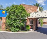
Comfort Inn Greensborough
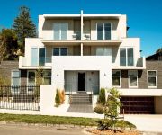
APARTMENTS AT KEW Q45
QUEST ON DONCASTER ROAD SERVICED APTS
QUEST MONT ALBERT SERVICED APTS
Quality Suites Beaumont Kew
QUEST KEW SERVICED APTS
HOTEL 115 KEW
QUEST IVANHOE SERVICED APTS
BEST WESTERN MAHONEYS MOTOR INN
CITY EDGE BOX HILL APARTMENT HOTEL
Videos from this area
These are videos related to the place based on their proximity to this place.
INTERCEPTOR search FPV GT BLACK BOSS - 335KW
pv gt 335 GT supercharged black edition from concept to showroom FPV GT black B0SS 5.0 SHOWROOM GT STAR 502 FORD COURTNEY & PATTERSON HEIDELBERG BUY IT NOW! GT STAR 503 ...
Watsonia Carpet Cleaning Melbourne | Carpet Cleaning In Watsonia, VIC
Watsonia Carpet Cleaning Melbourne - (03) 9111 5619 - Carpet Cleaning In Watsonia, VIC Pocka Dola Carpet Cleaning Melbourne Hosted on the Pocka Dola Youtube ...
1 Emerald Walk, Bundoora Victoria By Joshua Allison
Property Video shoot of 1 Emerald Walk, Bundoora Victoria by PlatinumHD www.joshallison.com.au.
Viewbank Carpet Cleaning Melbourne - (03) 9111 5619 - Carpet Cleaning In Viewbank, VIC
Pocka Dola Carpet Cleaning Melbourne Viewbank Carpet Cleaning Melbourne - (03) 9111 5619 - Carpet Cleaning In Viewbank, VIC Hosted on the Pocka Dola Youtube Channel Carpet Cleaning ...
Watsonia Carpet Cleaning Melbourne - (03) 9111 5619 - Carpet Cleaning In Watsonia, VIC
Pocka Dola Carpet Cleaning Melbourne Watsonia Carpet Cleaning Melbourne - (03) 9111 5619 - Carpet Cleaning In Watsonia, VIC Hosted on the Pocka Dola Youtube Channel Carpet Cleaning ...
Heidelberg Tunnel Metro Trains Melbourne Sat 27-3-2010
The Heidelberg Tunnel videoed from the front of a Metro Commeng train 327M on the UP from Rosanna to Heidelberg, on or about Saturday 27 th of March 2010. The train was the 08.06 UP Hurstbridge...
60-74 Buckingham Drive Heidelberg - Jellis Craig Balwyn
Property Video shoot of 60-74 Buckingham Drive - Heidelberg (3084) Victoria by PlatinumHD http://www.platinumhd.tv.
Videos provided by Youtube are under the copyright of their owners.
Attractions and noteworthy things
Distances are based on the centre of the city/town and sightseeing location. This list contains brief abstracts about monuments, holiday activities, national parcs, museums, organisations and more from the area as well as interesting facts about the region itself. Where available, you'll find the corresponding homepage. Otherwise the related wikipedia article.
La Trobe University
La Trobe University is a multi-campus university in Victoria, Australia. It was established in 1964 by an Act of Parliament to become the third oldest university in the state of Victoria. The main campus of La Trobe is located in the Melbourne suburb of Bundoora; two other major campuses are located in the Victorian city of Bendigo and the NSW-Victorian border centre of Albury-Wodonga.
City of Glen Eira
The City of Glen Eira is a local government area in Victoria, Australia. It is located in the south-eastern suburbs of Melbourne. It has an area of 38.4 square kilometres and has an estimated population of 136,354 people. It was formed in 1994 from the merger of the City of Caulfield and parts of the City of Moorabbin.
City of Banyule
The City of Banyule is a local government area in Victoria, Australia in the north-eastern suburbs of Melbourne. It has an area of 63 square kilometres and lies between 7 and 21 km from central Melbourne. At the 2011 Census, Banyule had a population of 118,306. The Yarra River runs along the City’s south border while the west is defined by the Darebin Creek.
Heidelberg West, Victoria
Heidelberg West is a suburb of Melbourne, Victoria, Australia, 10 km north-east from Melbourne's Central Business District. Its Local Government Area is the City of Banyule. At the 2011 Census, Heidelberg West had a population of 5,327.
Heidelberg, Victoria
Heidelberg is a suburb of Melbourne, Victoria, Australia, 11 km north-east of Melbourne's Central Business District. Its Local Government Area is the City of Banyule. At the 2011 Census, Heidelberg had a population of 5,714. Once a large town on Melbourne's fringe, Heidelberg was absorbed into Melbourne as part of the latter's northward expansion after World War II. Leafy Heidelberg once had its own historic Central Business District and its own Municipality in the former City of Heidelberg.
Heidelberg Heights, Victoria
Heidelberg Heights is a suburb of Melbourne, Victoria, Australia, 10 km north east from Melbourne's Central Business District. Its Local Government Area is the City of Banyule. At the 2011 Census, Heidelberg Heights had a population of 6,388.
Rosanna, Victoria
Rosanna is a suburb of Melbourne, Victoria, Australia, 12 km north-east from Melbourne's Central Business District. Its Local Government Area is the City of Banyule. At the 2011 Census, Rosanna had a population of 7,902. Leafy Rosanna is on the fringe of the Yarra Valley green belt.
Viewbank, Victoria
Viewbank is a suburb of Melbourne, Victoria, Australia, 14 km north-east from Melbourne's Central Business District. Its Local Government Area is the City of Banyule. At the 2011 Census, Viewbank had a population of 6,731. The Yarra River and large tracts of the Yarra Valley Parkland run along one border of the suburb. The Plenty River forms Viewbank's eastern boundary, whilst its northern boundary is defined by Lower Plenty Road.
Watsonia, Victoria
Watsonia is a suburb of Melbourne, Victoria, Australia, 16 km north-east from Melbourne's Central Business District. Its Local Government Area is the City of Banyule. At the 2011 Census, Watsonia had a population of 5,146.
Rosanna railway station
Rosanna is a railway station in Melbourne, Victoria, Australia, located in the suburb of Rosanna, on the Hurstbridge railway line. Rosanna is manned Monday-Friday between 7:30am and 9:30am and is in Metcard Zone 2.
Heidelberg railway station, Melbourne
Heidelberg is a railway station in Melbourne, Victoria, Australia, located in the suburb of Heidelberg on the Hurstbridge railway line. Heidelberg is classed as a Premium Station and is in Metlink Zones 1+2.
Macleod railway station
Macleod is a railway station in Melbourne, Victoria, Australia, located in the suburb of Macleod, on the Hurstbridge railway line. Macleod is classed as a Premium station and is in Metcard Zone 2.
Watsonia railway station
Watsonia is a railway station in Melbourne, Victoria, Australia, located in the suburb of Watsonia, on the Hurstbridge railway line. It is in Public Transport Victoria Zone 2 and is classed as a Premium Station.
Mont Park Asylum
Mont Park Asylum was a psychiatric hospital located in Melbourne, Australia. It was closed in the late-1990s. Located on a huge area of land around {{#invoke:Coordinates|coord}}{{#coordinates:37.7221|S|145.0647|E|region:AU-VIC_type:landmark|||| |primary |name= }}, Mont Park was built during the government policies of institutionalisation of the mentally ill and insane in the early 20th century. The complex was served by the freight only Mont Park railway branch line.
Austin Hospital, Melbourne
The Austin Hospital is a major teaching public hospital located in Melbourne's north eastern suburb of Heidelberg, and is administrated by Austin Health, along with the Heidelberg Repatriation Hospital and the Royal Talbot Rehabilitation Centre.
Mercy Hospital for Women, Melbourne
See Mercy Hospital for other medical facilities with the Mercy name. Mercy Hospital for Women, located in the Melbourne suburb of Heidelberg adjacent to the Austin Hospital, is a specialist women's public hospital offering a wide range of services in maternity, gynaecology, obstetrics, neonatal care and women's health, as well as providing full teaching and research opportunities in these areas.
Eaglemont, Victoria
Eaglemont is a suburb of Melbourne, Victoria, Australia, 10 km north-east from Melbourne's Central Business District. Its Local Government Area is the City of Banyule. At the 2011 Census, Eaglemont had a population of 3,927. The suburb was formerly known as Mount Eagle.
Viewbank College
Viewbank College is an Australian public secondary school located in the north eastern suburb of Viewbank, in Melbourne, Australia.
Our Lady of Mercy College
Our Lady of Mercy College (O.L.M. C), is a Roman Catholic, secondary day school for girls, situated in Heidelberg, a north-eastern suburb of Melbourne, Victoria, Australia. The college is conducted by the Sisters of Mercy, a congregation of religious Sisters founded in Dublin, Ireland, by Catherine McAuley. O.L.M. C is a member of Girls Sport Victoria (GSV) and the Catholic All Schools Sports Association (CAS). OLMC is split into four houses, Loreto, Carmel, Mercy and McAuley.
Macleod, Victoria
Macleod is a suburb of Melbourne, Victoria, Australia, 14 km north-east from Melbourne's Central Business District. Its Local Government Area are the Cities of Banyule and Darebin. At the 2011 Census, Macleod had a population of 9,606. Macleod West refers to the predominantly residential locality to the west of the railway line and station.
Bellfield, Victoria
Bellfield is a suburb of Melbourne, Victoria, Australia, 9 km north-east from Melbourne's Central Business District. Its Local Government Area is the City of Banyule. At the 2011 Census, Bellfield had a population of 1,728. Bellfield is bounded in the west by the Darebin Creek, in the north by Bell Street, in the east by Waterdale Road and in the south by Banksia Street.
River Gum Walk Trail
No image available yet River Gum Walk Trail Length 4.4km Difficulty hard
Bundoora Secondary College
Bundoora Secondary College is a public secondary school for girls and boys in years 7 to 12 located in a quiet and leafy residential block on the corner of Balmoral Avenue and Moreton Crescent in Bundoora, a suburb of Melbourne, Victoria, Australia. The school values are Relationships, Respect, Responsibility, Resilience and Rigour.
Loyola College, Melbourne
Loyola College is a Catholic Independent Secondary School in the Ignatian Tradition. Located on 26 acres in northern Watsonia, a suburb of the Australian city of Melbourne, Loyola was founded in 1980 with an initial enrolment of just 134. Today, Loyola College has a steady student population of approximately 1202 pupils in years 7 through 12. The College theme for 2009 is, "To Give And Not To Count The Cost" along with the official motto being "Justice, Mercy and Faith".
Heide Museum of Modern Art
Heide Museum of Modern Art, or Heide as it is affectionately known, is a contemporary art museum located in Bulleen, east of Melbourne, Australia. Established in 1981, the museum comprises several detached buildings and surrounding gardens of historical importance that are used as gallery spaces to exhibit works in various mediums by contemporary Australian artists.


