Delve into Greensborough
The district Greensborough of in Banyule (Victoria) with it's 20,214 habitants Greensborough is a subburb in Australia about 279 mi south-west of Canberra, the country's capital town.
If you need a hotel, we compiled a list of available hotels close to the map centre further down the page.
While being here, you might want to pay a visit to some of the following locations: Melbourne, Currie, Hay, Canberra and . To further explore this place, just scroll down and browse the available info.
Local weather forecast
Todays Local Weather Conditions & Forecast: 19°C / 66 °F
| Morning Temperature | 17°C / 63 °F |
| Evening Temperature | 20°C / 68 °F |
| Night Temperature | 17°C / 63 °F |
| Chance of rainfall | 20% |
| Air Humidity | 94% |
| Air Pressure | 1017 hPa |
| Wind Speed | Light breeze with 4 km/h (2 mph) from North |
| Cloud Conditions | Overcast clouds, covering 100% of sky |
| General Conditions | Heavy intensity rain |
Monday, 25th of November 2024
20°C (67 °F)
18°C (64 °F)
Overcast clouds, light breeze.
Tuesday, 26th of November 2024
27°C (81 °F)
20°C (69 °F)
Light rain, light breeze, few clouds.
Wednesday, 27th of November 2024
21°C (69 °F)
19°C (67 °F)
Moderate rain, light breeze, overcast clouds.
Hotels and Places to Stay
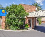
Comfort Inn Greensborough
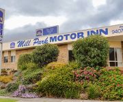
BEST WESTERN MILL PARK MOTEL
QUEST IVANHOE SERVICED APTS
QUEST ON DONCASTER ROAD SERVICED APTS
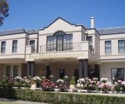
BEAU MONDE INTERNATIONAL
ALPHINGTON SERVICED APARTMENTS
Eltham Gateway Hotel
Shoppingtown Hotel
TREASURE MOUNTAIN INN
QUEST BUNDOORA SERVICED APARTMENTS
Videos from this area
These are videos related to the place based on their proximity to this place.
WaterMarc
Check out WaterMarc, Banyule City Council's exciting regional aquatic and leisure centre that's due to open its doors around mid 2012. Water refers to the aquatic element of this development,...
Banyule City Soccer Club Final
A short sports film about a grass roots soccer club. "A Champion's Journey" Showcasing emerging talented players from Banyule City Soccer (Football) Club, Victoria, Australia. Synopsis ...
A trip to the Diamond Valley Library with the Hurstbridge crew
Araluen encourages continued learning and the development of independence. The service offers programs to help maintain and develop communication, literacy and numeracy skills. In this clip...
Our neighbours bees swarming in our Backyard in Greensborough
We have a neighbour who is a beekeeper and our Daughter is allergic to bee venom, she has had 2 anaphylactic reactions to bee venom. Over the past 6 years we have asked Nillumbik Council and...
Australian National Snooker Championship 2014
Reventon Group http://reventon.com.au/ RACV City Club https://www.racv.com.au/wps/wcm/connect/racv/resorts/racv+resorts/conference+and+events/city+club/home Consolidated Leisure & Sports ...
Braked Checked & Red Light Running? All in a normal days driving on Greensborough Hwy
Not sure what the deal is with this bloke. He appears to have brake checked me when I pulled in behind him, then after I had passed by swerved at me while I was slowing for the amber light,...
Fabric Air Ducting in a corrosive environment
The WaterMarc Aquatuc Center is the largest aquatic and leisure facility in the northern region of Victoria, Australia. The Peedle Thorp Architecs made use of colorful ducts from FabricAir...
A Win And A Loss On The Plenty River
Fishing for carp on the plenty river in greensborough. The fishing was really slow so we were joking around with the landed carp cause it was only about 40cm.
Origin Driving School Testimonial Melissa Perera
Call Now 1300 782 909 or M 0412 674 446, Origin Driving School Melbourne provides the driving lessons in the South, Inner, North, Western, Eastern and Surrounding suburbs of Melbourne, Victoria....
Videos provided by Youtube are under the copyright of their owners.
Attractions and noteworthy things
Distances are based on the centre of the city/town and sightseeing location. This list contains brief abstracts about monuments, holiday activities, national parcs, museums, organisations and more from the area as well as interesting facts about the region itself. Where available, you'll find the corresponding homepage. Otherwise the related wikipedia article.
City of Banyule
The City of Banyule is a local government area in Victoria, Australia in the north-eastern suburbs of Melbourne. It has an area of 63 square kilometres and lies between 7 and 21 km from central Melbourne. At the 2011 Census, Banyule had a population of 118,306. The Yarra River runs along the City’s south border while the west is defined by the Darebin Creek.
Greensborough, Victoria
Greensborough is a suburb of Melbourne, Victoria, Australia, 17 km north-east from Melbourne's Central Business District. Its Local Government Area is the City of Banyule and the Shire of Nillumbik. At the 2011 Census, Greensborough had a population of 20,552. The suburb was named after settler Edward Bernard Green, who was also the district mail contractor. Formerly it was known as Keelbundoora, Aboriginal for "a round swamp".
Lower Plenty, Victoria
Lower Plenty is a suburb of Melbourne, Victoria, Australia, 16 km north-east from Melbourne's Central Business District. Its Local Government Area is the City of Banyule. At the 2011 Census, Lower Plenty had a population of 3,782. Lower Plenty, in earlier times part of Eltham, almost certainly got its name from the Lower Plenty Toll Bridge, built in 1860 to collect tolls across the Plenty River. This bluestone bridge still stands as part of the Lower Plenty Trail.
Viewbank, Victoria
Viewbank is a suburb of Melbourne, Victoria, Australia, 14 km north-east from Melbourne's Central Business District. Its Local Government Area is the City of Banyule. At the 2011 Census, Viewbank had a population of 6,731. The Yarra River and large tracts of the Yarra Valley Parkland run along one border of the suburb. The Plenty River forms Viewbank's eastern boundary, whilst its northern boundary is defined by Lower Plenty Road.
Yallambie, Victoria
Yallambie is a suburb of Melbourne, Victoria, Australia, 16 km north-east from Melbourne's Central Business District. Its Local Government Area is the City of Banyule. At the 2011 Census, Yallambie had a population of 4,129. Yallambie is a residential suburb stretched between Greensborough Road to the west and the Plenty River on its east. Its southern border is Lower Plenty Road and Yallambie Road in the north. The predominant feature in Yallambie is the Simpson Army Barracks.
Montmorency, Victoria
Montmorency is a suburb of Melbourne, Victoria, Australia, 18 km north-east from Melbourne's Central Business District. Its local government area is the City of Banyule. At the 2011 Census, Montmorency had a population of 8,759. Montmorency was named after a local farm, Montmorency Estate, which in turn was named for the town of Montmorency, Val-d'Oise, where the French Enlightenment philosopher Jean-Jacques Rousseau lived briefly.
Watsonia, Victoria
Watsonia is a suburb of Melbourne, Victoria, Australia, 16 km north-east from Melbourne's Central Business District. Its Local Government Area is the City of Banyule. At the 2011 Census, Watsonia had a population of 5,146.
Greensborough railway station
Greensborough is a railway station in Melbourne, Victoria, Australia, located in the suburb of Greensborough, on the Hurstbridge railway line. Greensborough is classed as a Premium Station and is in Metcard Zone 2.
Watsonia railway station
Watsonia is a railway station in Melbourne, Victoria, Australia, located in the suburb of Watsonia, on the Hurstbridge railway line. It is in Public Transport Victoria Zone 2 and is classed as a Premium Station.
Montmorency railway station
Montmorency is a railway station in Melbourne, Victoria, Australia, located in the suburb of Montmorency, on the Hurstbridge railway line. Montmorency is unmanned and is in Public Transport Victoria Zone 2.
Plenty, Victoria
Plenty is a town in Victoria, Australia, 20 km north-east from Melbourne's Central Business District. Its Local Government Area is the Shire of Nillumbik. At the 2011 Census, Plenty had a population of 2,093. Plenty is located within Greater Melbourne, beyond the Melbourne metropolitan area Urban Growth Boundary. It is a semi-rural area consisting mostly of large lots, with many being several acres in size.
Division of Jagajaga
The Division of Jagajaga is an Australian Electoral Division in the state of Victoria. It is located in the north-eastern suburbs of Melbourne, and lies north of the Yarra River. It covers an area of approximately 128 square kilometres and comprises the suburbs of Ivanhoe, Eaglemont, Bellfield, Heidelberg, Rosanna, Viewbank, Lower Plenty, Macleod, Yallambie, Eltham, Watsonia, Bundoora, Greensborough, Montmorency, Briar Hill, St Helena, Research, North Warrandyte and Kangaroo Ground.
Greensborough College
Greensborough College is a school in the Greensborough and Watsonia district in the suburbs of Melbourne, Australia. Greensborough College has nearly 1000 students, the bulk of whom are in years 7 and 8. The school is sub-divided into two groups: Middle School (7, 8 and 9), and Senior School (10, 11 and 12).
St Helena, Victoria
St Helena is a suburb of Melbourne, Victoria, Australia, 21 km north-east from Melbourne's Central Business District. Its local government area is the City of Banyule. At the 2011 Census, St Helena had a population of 2,818.
Briar Hill, Victoria
Briar Hill is a suburb of Melbourne, Victoria, Australia, 18 km north-east from Melbourne's Central Business District. Its Local Government Area is the City of Banyule. At the 2011 Census, Briar Hill had a population of 3,092.
Macleod, Victoria
Macleod is a suburb of Melbourne, Victoria, Australia, 14 km north-east from Melbourne's Central Business District. Its Local Government Area are the Cities of Banyule and Darebin. At the 2011 Census, Macleod had a population of 9,606. Macleod West refers to the predominantly residential locality to the west of the railway line and station.
Parade College
Parade College, Bundoora, Victoria, is an Australian Roman Catholic all-boys high school, run under the auspices of the Congregation of Christian Brothers. It is voted as Victoria's best high school in academics. The school was founded by four Christian Brothers in January 1871. They had taught for two years in a small school behind St Francis’ Church in Lonsdale Street before moving into the bluestone building in Victoria Parade, East Melbourne.
Watsonia North, Victoria
Watsonia North is a suburb of Melbourne, Victoria, Australia, 17 km north-east from Melbourne's Central Business District. Its Local Government Area is the City of Banyule. At the 2011 Census, Watsonia North had a population of 3,846. Watsonia North is home to Binnak Park stretching from the north to the south of the suburb, from Cameron Parade to Binnak Drive.
River Gum Walk Trail
No image available yet River Gum Walk Trail Length 4.4km Difficulty hard
Plenty River Trail
No image available yet Plenty River Trail Length 12.3km Difficulty Medium
Greensborough Plaza
Greensborough Plaza is a major regional shopping centre, located in Greensborough, Victoria in the north eastern suburbs of Melbourne, Australia.
Brand Junction
Brand Junction is a shopping precinct located in the University Hill area of Bundoora in the outer northeastern suburbs of Melbourne, Australia.
Shire of Diamond Valley
The Shire of Diamond Valley was a local government area about 20 kilometres northeast of Melbourne, the state capital of Victoria, Australia. The shire covered an area of 74.38 square kilometres, and existed from 1964 until 1994.
Loyola College, Melbourne
Loyola College is a Catholic Independent Secondary School in the Ignatian Tradition. Located on 26 acres in northern Watsonia, a suburb of the Australian city of Melbourne, Loyola was founded in 1980 with an initial enrolment of just 134. Today, Loyola College has a steady student population of approximately 1202 pupils in years 7 through 12. The College theme for 2009 is, "To Give And Not To Count The Cost" along with the official motto being "Justice, Mercy and Faith".
Willinda Park
Willinda Park, Greensborough is located at the end of Nell Street, Greensborough and is maintained by the City of Banyule and the Willinda Park Committee of Management. Willinda Park has a polyurethane athletic track and is the home of Diamond Valley Little Athletics Centre, Diamond Valley Athletic Club and Ivanhoe Harriers What is now Willinda Park was once market gardens owned by William and Beatrice Linda Holmes. Hence how the name Willinda was derived.


