Discover Altona
The district Altona of in Victoria with it's 9,918 citizens Altona is a district in Australia about 298 mi south-west of Canberra, the country's capital city.
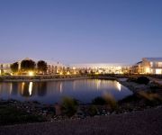
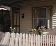
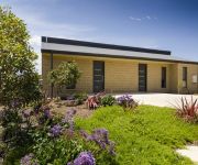
Looking for a place to stay? we compiled a list of available hotels close to the map centre further down the page.
When in this area, you might want to pay a visit to some of the following locations: Melbourne, Currie, Hay, Canberra and Loxton. To further explore this place, just scroll down and browse the available info.
Local weather forecast
Todays Local Weather Conditions & Forecast: 30°C / 86 °F
| Morning Temperature | 23°C / 74 °F |
| Evening Temperature | 22°C / 71 °F |
| Night Temperature | 18°C / 64 °F |
| Chance of rainfall | 3% |
| Air Humidity | 31% |
| Air Pressure | 1013 hPa |
| Wind Speed | Fresh Breeze with 13 km/h (8 mph) from South |
| Cloud Conditions | Overcast clouds, covering 100% of sky |
| General Conditions | Moderate rain |
Sunday, 24th of November 2024
18°C (64 °F)
17°C (63 °F)
Moderate rain, light breeze, overcast clouds.
Monday, 25th of November 2024
19°C (66 °F)
18°C (64 °F)
Overcast clouds, gentle breeze.
Tuesday, 26th of November 2024
19°C (65 °F)
19°C (67 °F)
Light rain, light breeze, overcast clouds.
Hotels and Places to Stay
QUEST WILLIAMSTOWN NORTH
Bed and Breakfast at Stephanie's
Quest Williamstown
Amawind Apartments
Westside Hotel
Palms Motel
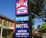
Footscray Motor Inn
QUEST SANCTUARY LAKES
Quality Suites Point Cook Seasons 5
QUEST MARIBYRNONG
Videos from this area
These are videos related to the place based on their proximity to this place.
Holden Home Ground Advantage - Altona City Soccer Club
Altona City Soccer Club's Holden Home Ground Advantage Grant. The Club is looking for funding for new player shelters - these will keep players warm during the winter season and ready to play.
First Full Pitch Game Altona City U11
2014 Under 11's first full pitch game. Mixed Wallabies and Kangaroos teams. 27 June 2014.
FFA Cup FC Williamstown vs Sandringham
Livestream of the 2nd round FFA Cup game between FC Williamstown & Sandringham SC. Game is played at JT Gray Reserve, Kororoit Creek Rd in Williamstown.
The Supergrid
When you join the renewable energy facilities together over a wide area - the rules of the power generation game are changed. Because you will now have a Supergrid. This is exactly what...
Australian trains; passing CRT
A variety of rail cars loco hauled passenger and a freight. An early effort in my video days and a good example of why you shouldn't hand hold and shoot in strong winds without a dead cat over...
Kayak Fishing Altona, Victoria 2014
My first trip with new Kayak (Hobie Adventure). Did not catch a thing, but had a great paddle, and exploring the seabed with sounder. I will add a new video soon showing my wiring for the battery...
Altona Kayak Fishing
Just a quick grab of the 17? fish I caught. Pinkies & Flathead this time. Beaut day!
Altona Loop Group Public Meeting on 20 Mar 2014
This meeting was organized by the community-based Altona Loop Group and held on 20 Mar 2014 at the Altona RSL.
Operation Recreation Altona
Operation Recreation Altona Arrow Video Altona Productions Camera: Jamie Hurworth Original Source: VHS Saturday, 17th March 1984.
Altona Salmon 12th April
Fun and fast action mixing it up with a few vyak members catching Australian Salmon on Kayaks at Altona Victoria.
Videos provided by Youtube are under the copyright of their owners.
Attractions and noteworthy things
Distances are based on the centre of the city/town and sightseeing location. This list contains brief abstracts about monuments, holiday activities, national parcs, museums, organisations and more from the area as well as interesting facts about the region itself. Where available, you'll find the corresponding homepage. Otherwise the related wikipedia article.
City of Hobsons Bay
The City of Hobsons Bay is a local government area in Melbourne, Victoria, Australia. It comprises the south-western suburbs between 6 and 20 km from the Melbourne city centre. It was founded on 22 June 1994 during the amalgamation of local councils by the Kennett Government from the City of Williamstown and the City of Altona, as well as the suburb of South Kingsville from the City of Footscray. It took its name from Hobsons Bay, named after Captain William Hobson.
Paisley railway station, Melbourne
Paisley railway station was located on the Werribee line of the Melbourne suburban rail system in Australia. It was located between Newport and Galvin stations, adjacent to the Millers Road level crossing (later replaced by an overpass). Paisley was opened on 14 October 1929. Although it was a public platform, it played an important role in servicing refineries in the area.
Galvin railway station
Galvin railway station is a closed railway station which was located on the Werribee line of the Melbourne suburban rail system in Australia. It was located adjacent to Maidstone Street, Altona, and was situated between Paisley and Laverton stations. Galvin was opened on 27 August 1927. It was a public platform, but it played an important role in providing passenger services for workers at industries being established in the area.
Altona, Victoria
Altona is a western suburb of Melbourne, Victoria, Australia, 13 km south-west of Melbourne's central business district. Its local government area is the City of Hobsons Bay. At the 2011 Census, Altona had a population of 9,918. Altona is a large suburb consisting of low density residential in the south-eastern half, with mixed industry in the north-western half.
Seaholme railway station
Seaholme is a railway station in Melbourne, Victoria, Australia, located in the suburb of Seaholme, on the Werribee railway line. Seaholme is unmanned and is in Metlink Zone 1. In 2009 it was the tenth least used metropolitan railway station in Melbourne, with an average of 510 passenger boardings per day.
Altona railway station
Altona is a railway station in Melbourne, Victoria, Australia, located in the suburb of Altona, on the Werribee railway line. Altona is unmanned and is in Metcard Zones 1+2 overlap.
Westona railway station
Westona is a railway station in Melbourne, Victoria, Australia, located in the suburb of Altona, on the Werribee railway line. Westona is unmanned and is in Metcard Zones 1+2 overlap.
Altona North, Victoria
Altona North is a suburb of Melbourne, Victoria, Australia, 10 km south-west from Melbourne's central business district. Its Local Government Area is the City of Hobsons Bay. At the 2011 Census, Altona North had a population of 11,379.
Division of Gellibrand
The Division of Gellibrand is an Australian Electoral Division in Victoria. The division was created in 1949 and is named for Joseph Gellibrand, a pioneer settler of the Melbourne area. It is located in the inner western suburbs of Melbourne and includes Footscray, Maidstone, Newport, Altona and Williamstown. It has been held by the Australian Labor Party for its entire existence; it is located in Labor's traditional heartland of western Melbourne.
Mobiltown railway station
Mobiltown is a demolished station on the former Altona railway line, which now forms part of the Werribee railway line in Melbourne, Australia. It was located immediately north of the Kororoit Creek Road level crossing in the suburb of North Williamstown. The station opened in 1953 as the Standard Oil Platform next to the oil refinery operated by the Vacuum Oil Company.
Altona Gate Shopping Centre
Altona Gate Shopping Centre is a sub regional shopping centre located in Altona North, Victoria, a suburb of Melbourne, Australia. It fronts onto Millers Road just south of the West Gate Freeway exit. It is serviced by bus via route 232 from Melbourne city centre and route 471 from Sunshine or Williamstown. It was featured many times on the Australian comedy series The Wedge.
Kororoit Creek
Kororoit Creek is a major waterway of over 80 km in length in the north-west and western parts of Melbourne. Its headwaters are north of Sunbury at 400m above sea level in ordovician geology. Flowing south it passes over the volcanic lava plain of western Melbourne from 300m to its mouth at sea level near Altona.
Mount St. Joseph Girls' College
Mount St. Joseph Girls' College is a Catholic Girls College located in Maidstone Street, Altona, Victoria, Australia. Mount St. Joseph is one of few schools in Australia that is a Josephite college, founded by the Josephite Order in 1964. There is a strong emphasis on pastoral care, and developing the whole individual.
Seaholme, Victoria
Seaholme is a suburb of Melbourne, Victoria, Australia, 13 km south-west from Melbourne's central business district. Its Local Government Area is the City of Hobsons Bay. At the 2011 Census, Seaholme had a population of 1,865. The suburb is a bayside enclave within the larger suburb of Altona, bounded in the west by Millers Road and in the north by the Altona Coastal Park. The suburb has its own railway station. Seaholme Post Office opened on 2 July 1951 and closed in 1971.
City of Altona
The City of Altona was a local government area about 13 kilometres west of Melbourne, the state capital of Victoria, Australia. The city covered an area of 40.18 square kilometres, and existed from 1957 until 1994.
Emmanuel College: St. Paul's Campus
The Emmanuel College: St. Paul's Campus (formerly St. Paul's College) is a Roman Catholic Independent school for boys located in the Melbourne suburb of Altona North. It a branch of one of Emmanuel College's education facilities.
Emmanuel College (Victoria)
Emmanuel College (formerly St. Paul's College) is a Roman Catholic, co-educational secondary day school, located over two campuses in Altona North and Point Cook, in the south-western suburbs of Melbourne, Victoria, Australia.
Williamstown Racecourse railway station
Williamstown Racecourse is a demolished station on the former Altona railway line, which now forms part of the Werribee railway line in Melbourne, Australia. It was located south of the Kororoit Creek Road level crossing in the suburb of Altona but north of the creek.
Cherry Lake (Victoria)
Cherry Lake is part of historical coastal wetlands in Altona, a suburb of Melbourne, Australia. The wetlands were converted to a lake with construction of retaining walls, levees, and flow channels. The lake and surrounding reserve is an important wildlife habitat and popular recreational destination.
Altona Coastal Park
Altona Coastal Park, a 70 hectares intertidal and salt marsh area located 11 km from Melbourne CBD in the western suburb of Altona, is an important recreational and nature conservation area, providing habitats for a large biodiversity of flora and fauna. It is part of the Cheetham and Altona Important Bird Area.
Paisley Park Soccer Complex
Paisley Park Soccer Complex was established in 1975 by the local City of Hobsons Bay council. Today it provides the facilities for local soccer club Altona Magic, who play in Victorian State League Division 1 and are supported by the Macedonian Australian community. The stadium has a capacity of 5,000. The Altona East Phoenix, who currently participate in the Victorian State League Division 2 N/W, also share the facilities, and are predominantly backed by the local Greek Australian community.
Truganina Coastal Parklands
The Truganina Coastal Parklands are located 15 km west of Melbourne CBD, on the shores of Port Phillip Bay, stretching from Altona to Altona Meadows and adjacent to the Cheetham Wetlands and the Point Cook Coastal Park.
Bayside College
Bayside College is a public, co-educational prep-year 12 school in Melbourne, Australia. It spans three campuses, in Altona North, Newport and Williamstown. Founded as Bayside Secondary College amidst the forced school amalgamations of the Kennett Government in the early 1990s, the school was born from the merger of Altona North High School, Altona North Technical School, Williamstown Technical School and Paisley High School. Later on it merged with Altona Gate Primary School.
Altona Beach
Altona Beach is a beach located in Altona, Victoria, Australia. It is a very quiet beach and safe one. It has a pier to the West. It is best for swimmers to partake in acquatic activity on the eastern side of the pier, which is patrolled regularly by lifeguards in the summer.
Cheetham and Altona Important Bird Area
The Cheetham and Altona Important Bird Area comprises several wetland sites on, or close to, the north-western coast of Port Phillip in Victoria, south-eastern Australia. Collectively they total 1223 ha in area and lie within, or adjacent to, the western suburbs of the city of Melbourne. They were classified as an Important Bird Area (IBA) because they support more than 1% of the world populations of Red-necked Stint, Chestnut Teal and Pacific Gull.


