Discover Clarence Point
The district Clarence Point of Lyetta in West Tamar (Tasmania) is a subburb in Australia about 423 mi south of Canberra, the country's capital city.
If you need a hotel, we compiled a list of available hotels close to the map centre further down the page.
While being here, you might want to pay a visit to some of the following locations: Hobart, Currie, Melbourne, and . To further explore this place, just scroll down and browse the available info.
Local weather forecast
Todays Local Weather Conditions & Forecast: 12°C / 54 °F
| Morning Temperature | 8°C / 47 °F |
| Evening Temperature | 16°C / 61 °F |
| Night Temperature | 8°C / 47 °F |
| Chance of rainfall | 0% |
| Air Humidity | 57% |
| Air Pressure | 1023 hPa |
| Wind Speed | Light breeze with 4 km/h (2 mph) from South |
| Cloud Conditions | Overcast clouds, covering 100% of sky |
| General Conditions | Overcast clouds |
Saturday, 16th of November 2024
13°C (55 °F)
12°C (54 °F)
Light rain, calm, overcast clouds.
Sunday, 17th of November 2024
17°C (62 °F)
10°C (50 °F)
Moderate rain, gentle breeze, overcast clouds.
Monday, 18th of November 2024
11°C (53 °F)
4°C (39 °F)
Light rain, gentle breeze, overcast clouds.
Hotels and Places to Stay
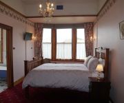
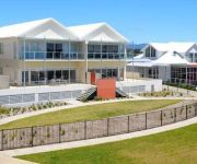
Comfort Inn The Pier
Low Head Pilot Station
Jensens Bed and Breakfast
PEPPERS YORK COVE TAMAR VALLEY
Videos from this area
These are videos related to the place based on their proximity to this place.
George Town, Tasmania Real Estate - Ray White Launceston
With views from the deck on the second level, this home is an entertainers delight. On the private rear yard lies a huge garage with loads of storage space and fruit trees throughout the yard....
Flying circuits in the Jabiru
Practicing circuits in the Jabiru 120 at George Town Tasmania. Perfect conditions with 10kts of headwind.
Targa Tas 2011, hot laps and Prologue in a taxi
The XE Falcon is back to competing. The day before Prologue we took event guests for some easy laps around Symmons Plains, a good chance to further settle the car in and hopefully any problems...
Nikon D5000. Worth Buying?
Our weekend trip to Low Head, Tasmania and going crazy as usual! Please visit us at http://www.narrazeevisuals.com.
Targa Tasmania 2011 - TS00 Prologue in #517 1973 Mustang
This is the prologue stage of Targa Tasmania 2011 in our restored 1973 Mach 1 Mustang. We did the stage in 3min 49sec which is (I am told) a decent time for us. We have some problems in the...
Targa Tas 2011 prologue, Evans/Feaver Evo X
Targa Tasmania 2011 Prologue, in the Hankook TMR Evo X RS of Dean Evans and Toni Feaver. Time of 3m:20.8, being 12th fastest. Car runs a five-speed manual, E85 fuel and weighs approx 1470kg.
Fishing Trip Beauty Point Jan 21 - 2010
Andre with John, fishing on the Tamar River near Bell Bay - Beauty Point area northern Tasmania.
Beauty Point Tourist Park presented by Peter Bellingham Photography
Beauty Point Tourist Park located only one hour's drive from Launceston Airport or the Spirit of Tasmania ferry terminal at Devonport. Beauty Point Tourist park is situated on 7 picturesque...
Beauty Point Tourist Park - Kookaburra Cottage presented by Peter Bellingham Photography
Beauty Point Tourist Park - Kookaburra Cottage.
Videos provided by Youtube are under the copyright of their owners.
Attractions and noteworthy things
Distances are based on the centre of the city/town and sightseeing location. This list contains brief abstracts about monuments, holiday activities, national parcs, museums, organisations and more from the area as well as interesting facts about the region itself. Where available, you'll find the corresponding homepage. Otherwise the related wikipedia article.
Narawntapu National Park
Narawntapu (formerly known as "Asbestos Range") is a national park in Tasmania, Australia. It lies on Tasmania's north coast, adjoining Bass Strait, between Port Sorell in the west and the mouth of the Tamar River in the east. It lies about 20 km east of Devonport, 60 km north-west of Launceston and 250 km north of Hobart. Narawntapu encompasses islands in the Port Sorell estuary and the Carbuncle, as well as land extending to low water mark, including intertidal mudflats.
Tamar River
The Tamar River is a 70 kilometre estuarine in northern Tasmania formed by the merging of the North Esk River and South Esk Rivers at Launceston (the largest settlement) to its mouth at Low Head, north of the second largest settlement George Town and into the Bass Strait. Low Head Lighthouse is located at the tip of a peninsula, on the east side of the mouth of the Tamar River.
Batman Bridge
The Batman Bridge is a modern bridge spanning the Tamar River in northern Tasmania. The bridge is on the Batman Highway connecting the West Tamar Highway (state route A7) to the East Tamar Highway (state route A8). The eastern end of the bridge is located at Whirlpool Reach, George Town Council and the western end is located about halfway between Kayena and Deviot, West Tamar Council.
George Town, Tasmania
George Town is one of the larger towns in north-east Tasmania, on the eastern bank of the mouth of the Tamar River. At the 2006 census, George Town had a population of 4,266. It is the regional centre of the George Town Council local government area. George Town is one of the oldest European settlements in Australia. It was first settled in 1804, two years before the now much more important city of Launceston. George Town Post Office opened on 11 December 1822.
West Tamar Council
The West Tamar Council is a local government area of Tasmania, Australia. It covers almost all of the western shore of the Tamar River, from Bass Strait in the north, down to Launceston in the south. The municipal area starts with the Launceston suburb of Riverside in the south; the satellite suburb of Legana; the towns of Exeter, Beaconsfield and Beauty Point, all the way up to the beach resort town of Greens Beach at the mouth of the Tamar River.
Beaconsfield, Tasmania
Beaconsfield is a town near the Tamar River, in the north-east of Tasmania, Australia. It lies 40 kilometres north of Launceston on the West Tamar Highway. It is part of the Municipality of West Tamar. At the 2006 census, Beaconsfield had a population of 1,056.
Beauty Point, Tasmania
Beauty Point is a town by the Tamar River, in the north-east of Tasmania, Australia. It lies 45 km north of Launceston, on the West Tamar Highway and at the 2006 census, had a population of 1,116. It is part of the Municipality of West Tamar Council. Beauty Point is a tiny township originally established as the first deep water port on the Tamar River. The town was first established as a port to service the nearby gold mine town of Beaconsfield.
Low Head, Tasmania
Low Head is a small hamlet on a peninsula by the same name 5 km north-west of George Town, Tasmania, Australia. On the mouth of the Tamar River. It is known for its diving off the Low Head Pilots Station. The town has a lighthouse, a beach and a penguin colony. At the 2006 census, Low Head had a population of 474. The area which is a suburb of George Town is popular during the summer time.
Beaconsfield Mine collapse
The Beaconsfield Mine collapse occurred on 25 April 2006 in Beaconsfield, Tasmania, Australia. Of the seventeen people who were in the mine at the time, fourteen escaped immediately following the collapse, one was killed and the remaining two were found alive using a remote-controlled device. These two miners were rescued on 9 May 2006, two weeks after being trapped nearly a kilometre below the surface.
Bell Bay aluminium smelter
The Bell Bay aluminium smelter is located on the Tamar River at Bell Bay, Tasmania, Australia. The smelter has a production capacity of 178,000 tonnes of aluminium per year. It is owned and operated by Rio Tinto Alcan.
Bell Bay Pulp Mill
The Bell Bay Pulp Mill, also known as the Tamar Valley Pulp Mill or Gunns Pulp Mill, is a proposed $2.3 billion pulp mill which Gunns Limited is planning to build in the Tamar Valley, near Launceston, Tasmania.
Exeter, Tasmania
Exeter is a small town approximately 24 kilometres north of the city of Launceston, Tasmania, Australia. At the 2006 census, Exeter had a population of 339. It is an important town agriculturally due to its positioning in the centre of a large rural area known for its orchards, dairy and beef cattle, fruit produce and sheep herds.
Hebe (ship)
The Hebe was a ship that struck a reef between Low Head and Western Head on the entrance to Port Dalrymple, Tasmania, Australia on 15 June 1808. The ship was carrying a cargo of Indian goods from Madras to Sydney Australia when it was totally wrecked. All the crew except for one lascar escaped drowning and returned with the ship's master, Joseph Leigh, to Sydney aboard the Estramina on 11 October 1808.
Bell Bay, Tasmania
Bell Bay is an industrial centre and port located on the eastern shore of the Tamar River, in northern Tasmania, Australia. It lies just south of George Town.
Star of the Sea College, George Town
Star of the Sea College is an Irish Catholic kindergarten through tenth grade school located in George Town, Tasmania.
Beaconsfield Mine & Heritage Centre
The Beaconsfield Mine & Heritage Centre is located in Beaconsfield, Tasmania. It was originally called the Grubb Shaft Gold and Heritage Museum. It was formed in 1972 after discussions were held as to forming a district museum.
Beechford, Tasmania
Beechford is a small beach side town on the northern coast of Tasmania. Not far from Georgetown Tasmania just 13.6 kilometres and 48.0 kilometres north of Launceston, is the tiny seaside town of Beechford. The place where the Curries River joins up with the Tasman Sea in Bass Strait. The turnoff to this place is found on the Georgetown to Bridport Road through Lefroy and it is a place that is yet to be “discovered” by tourism.
Kelso, Tasmania
Kelso is a populated place in northern Tasmania located west of George Town. It was settled in the early 19th century and is located on Kelso Bay, a small bay on the Tamar River. Kelso is known as a fishing resort for flathead, whiting and mullet. Kelso is also located near the Narawntapu National Park. At the 2006 census, Kelso had a population of 170.
Low Head Lighthouse
Low Head Lighthouse is in Low Head, Tasmania, about 7 kilometres north of George Town on the east side of the mouth of the Tamar River. It was the third lighthouse to be constructed in Australia, and it is also Australia's oldest continuously used pilot station. This light is now unmanned and automated.
York Town, Tasmania
York Town is a locality in northern Tasmania. It was the first attempt to establish a British presence in northern Tasmania, in 1804. It was a "bustling village" until 1808.


