Discover Linda
Linda in West Coast (Tasmania) is a place in Australia about 506 mi (or 814 km) south of Canberra, the country's capital city.
Current time in Linda is now 06:09 AM (Tuesday). The local timezone is named Australia / Hobart with an UTC offset of 11 hours. We know of 8 airports near Linda. The closest airport in Australia is Queenstown Airport in a distance of 4 mi (or 6 km), West. Besides the airports, there are other travel options available (check left side).
There is one Unesco world heritage site nearby. It's Tasmanian Wilderness in a distance of 114 mi (or 184 km), North. If you need a hotel, we compiled a list of available hotels close to the map centre further down the page.
While being here, you might want to pay a visit to some of the following locations: Hobart, Currie, Melbourne, and . To further explore this place, just scroll down and browse the available info.
Local weather forecast
Todays Local Weather Conditions & Forecast: 19°C / 66 °F
| Morning Temperature | 14°C / 58 °F |
| Evening Temperature | 17°C / 62 °F |
| Night Temperature | 16°C / 61 °F |
| Chance of rainfall | 0% |
| Air Humidity | 79% |
| Air Pressure | 1014 hPa |
| Wind Speed | Gentle Breeze with 7 km/h (4 mph) from North-West |
| Cloud Conditions | Overcast clouds, covering 100% of sky |
| General Conditions | Overcast clouds |
Tuesday, 26th of November 2024
20°C (67 °F)
15°C (59 °F)
Few clouds, gentle breeze.
Wednesday, 27th of November 2024
16°C (61 °F)
16°C (61 °F)
Moderate rain, gentle breeze, overcast clouds.
Thursday, 28th of November 2024
17°C (63 °F)
15°C (60 °F)
Moderate rain, moderate breeze, overcast clouds.
Hotels and Places to Stay
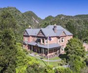
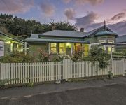
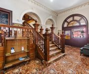
Penghana Bed & Breakfast
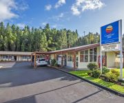
Comfort Inn Gold Rush
WEST COASTER MOTEL
Queenstown Motor Lodge
Mt Lyell Anchorage
The Empire Hotel
Videos from this area
These are videos related to the place based on their proximity to this place.
Lyell Highway out of Queenstown [Go Pro]
a drive up the Lyell Highway out of Queenstown in Tasmania - this is a truly spectacular road and forms part of one of the Targa Tasmania stages.
Queenstown Views, Tasmania, October 2009
Views of Queenstown, West Coast of Tasmania. October, 2009.
WILD WEST QUEENSTOWN!!
Making our way back from the remote West Coast of Tasmania, we pulled in to the last outpost on the moon; the copper mining town of Queenstown. Copyright CoffeeKvetch 2012, All Rights Reserved.
Jaguar TWR XJS -Queenstown Hill - In car on 2008 Targa Tasmania
Our 1985 Jaguar TWR JaguarSport XJS climbs the 99 bends of the Queenstown hill in the 2008 Targa Tasmania. This year it was dry at least. www.bluemountainsgetaways.com.
Targa Tasmania 2010 TS35 Queenstown Car 736
Gavin James & Tim Kulhanek place the fastest time for the entire field over the 99 bends out of Queenstown.
Tours-TV.com: Queenstown, Tasmania
Australia : Tasmania. See on map http://tours-tv.com/en/Queenstown-Tasmania .
Tasmanian Wilderness Railway Steam Train..warming up.
Queenstown, Tasmania, Australia. The Mt Lyell No 1 Engine preparing for its day of hauling, slowly bubbling and wheezing into life. The West Coast Wilderness Railway, Tasmania is a reconstruction...
Dangerous mountain pass in Tasmania
This video was taken while driving out of Queenstown on the Lyell Highway in Tasmania. At the end of the video you can see an amazing waterfall which is well over 100 metres tall.
Targa Tasmania 2014
The Queenstown stage was rather wet, here you can see both Marc and I having a laugh as the car is sliding around going up the mountain... The Lotus Exige V6 performed like a champ, just wish...
Tasmanian Wilderness Railway Steam Train
Queenstown, Tasmania, Australia. The Mt Lyell No 1 Engine preparing for its day of hauling, slowly bubbling and wheezing into life.
Videos provided by Youtube are under the copyright of their owners.
Attractions and noteworthy things
Distances are based on the centre of the city/town and sightseeing location. This list contains brief abstracts about monuments, holiday activities, national parcs, museums, organisations and more from the area as well as interesting facts about the region itself. Where available, you'll find the corresponding homepage. Otherwise the related wikipedia article.
West Coast Range
The West Coast Range of Tasmania is a group of mountains in the West Coast area of Tasmania in Australia that lies to the west of the Franklin-Gordon Wild Rivers National Park The range has had a significant number of mines utilising the geologically rich zone of Mount Read Volcanics.
Mount Lyell (Tasmania)
Mount Lyell is a mountain in the West Coast Range, Tasmania, named by Charles Gould in 1863 after another geologist Charles Lyell. It was named during the nineteenth century controversy about the theory of evolution put forward by Charles Darwin, Lyell was a supporter of Darwin's. It was also the common short name of the Mount Lyell Mining and Railway Company.
Gormanston, Tasmania
Gormanston is a town in Tasmania on the slopes of Mount Owen, above the town of Queenstown in Tasmania's West Coast. At the 2006 census, Gormanston had a population of 167. It lies at the shoulder between Mount Lyell and Mount Owen and is south or 'up the hill' from an equally abandoned community, the remains of the townsite of Linda which is at the northern side of the Linda Valley.
Linda, Tasmania
Linda is an old ghost town in the Linda Valley in the West Coast Range of Tasmania, Australia. It was the town supporting the North Mount Lyell mine. When North Mount Lyell was taken over by Mount Lyell Mining and Railway Company in 1903, Linda was quickly reduced in significance and eventually most residents moved to Gormanston, the nearby Mount Lyell town. Linda Post Office opened on 18 December 1899 and closed in 1966.
Iron Blow
Iron Blow was the site of the earliest major mining venture at Mount Lyell on the west coast of Tasmania in 1883. It was above the location where Steve Karlson, Michael McDonough, and William McDonough were camped in the area on a ridge between mountains of the West Coast Range.



!['Lyell Highway out of Queenstown [Go Pro]' preview picture of video 'Lyell Highway out of Queenstown [Go Pro]'](https://img.youtube.com/vi/oqk6y6zwO0Y/mqdefault.jpg)


