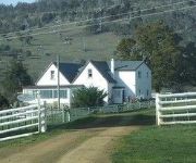
Delve into Moogara
Moogara in Derwent Valley (Tasmania) is a town located in Australia about 532 mi (or 855 km) south of Canberra, the country's capital town.
Time in Moogara is now 02:53 PM (Saturday). The local timezone is named Australia / Hobart with an UTC offset of 11 hours. We know of 8 airports closer to Moogara. The closest airport in Australia is Hobart International Airport in a distance of 30 mi (or 49 km), East. Besides the airports, there are other travel options available (check left side).
In need of a room? We compiled a list of available hotels close to the map centre further down the page.
Since you are here already, you might want to pay a visit to some of the following locations: Hobart, Currie, , and . To further explore this place, just scroll down and browse the available info.
Local weather forecast
Todays Local Weather Conditions & Forecast: 29°C / 84 °F
| Morning Temperature | 13°C / 56 °F |
| Evening Temperature | 19°C / 65 °F |
| Night Temperature | 17°C / 62 °F |
| Chance of rainfall | 0% |
| Air Humidity | 22% |
| Air Pressure | 1012 hPa |
| Wind Speed | Gentle Breeze with 6 km/h (4 mph) from East |
| Cloud Conditions | Overcast clouds, covering 100% of sky |
| General Conditions | Light rain |
Sunday, 24th of November 2024
15°C (60 °F)
12°C (54 °F)
Overcast clouds, gentle breeze.
Monday, 25th of November 2024
23°C (73 °F)
14°C (57 °F)
Few clouds, gentle breeze.
Tuesday, 26th of November 2024
24°C (75 °F)
8°C (47 °F)
Sky is clear, gentle breeze, clear sky.
Hotels and Places to Stay
Roslyn House B&B
Videos from this area
These are videos related to the place based on their proximity to this place.
battle of the derwent 2010 pro am tasmania
battle of the derwent march 2010 tasmania boxing pro am filmed in newnorfolk tasmania.
Royal Derwent Mental Asylum- Ward 2, Ward 4, Ward 5, Admin Tunnel
Walkthrough of an abandoned (haunted) mental asylum- Royal Derwent Hospital located in Tasmania Australia. * PLEASE SUBSCRIBE!!
Salmon Ponds Heritage Hatchery & Gardens
Celebrating 150 years of the first hatching of trout in Tasmania.
Slow run in the Tassie bush.MOV
On a 2 day riding trip in Tassie, I was riding like the old man I am, lol! We had a couple of state enduro racers on our crew and they were unbelievably fast! You get an idea how much faster...
Targa Wrest Point, an edited account of day one stages and out of car footage
I have put together a run of the event to the end of day one not including Longley stage (seeing as it is already posted). It shows the cars and people running in the event and a bit of an...
Ride on a TT-R 125 Small wheel
This is my mates TTR 125 sorry the cameras wobbling i was holding it and couldnt use the clutch.
wild tassie wedge tailed eagle close up
on a hunting trip early one morning and spotted this wedge tailed eagle looking at me from a tree so i got some close up footage of him.
Warcraft 3 - Custom made RPG - YETI
Warcraft 3 - Custom made RPG This is my first big custom made RPG. It has taken me about 5 months so far. It is a Yeti based RPG so you will be playing as one of four classes but you will...
Videos provided by Youtube are under the copyright of their owners.
Attractions and noteworthy things
Distances are based on the centre of the city/town and sightseeing location. This list contains brief abstracts about monuments, holiday activities, national parcs, museums, organisations and more from the area as well as interesting facts about the region itself. Where available, you'll find the corresponding homepage. Otherwise the related wikipedia article.
Plenty, Tasmania
Plenty is a small locality and the name of a tributary river on the south side of the ]]River Derwent in the Derwent Valley in Tasmania. It is on the main road between New Norfolk and Bushy Park. At the 2006 census, Plenty had a population of 164. Formerly the location of hop growing, and fishing of the local migrating salmon, it is now notable for the salmon ponds and the Museum of Trout Fishing.
Uxbridge, Tasmania
Uxbridge, Tasmania is a Postal Code within Tasmania, Australia. 38px This Tasmania geography article is a stub. You can help Wikipedia by expanding it. vte More details are available on geocode maps.


