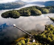
Discover Derwent Bridge
Derwent Bridge in Central Highlands (Tasmania) is a town in Australia about 499 mi (or 803 km) south of Canberra, the country's capital city.
Current time in Derwent Bridge is now 05:37 AM (Saturday). The local timezone is named Australia / Hobart with an UTC offset of 11 hours. We know of 8 airports near Derwent Bridge. The closest airport in Australia is Queenstown Airport in a distance of 36 mi (or 58 km), West. Besides the airports, there are other travel options available (check left side).
There is one Unesco world heritage site nearby. It's Tasmanian Wilderness in a distance of 126 mi (or 203 km), North. Looking for a place to stay? we compiled a list of available hotels close to the map centre further down the page.
When in this area, you might want to pay a visit to some of the following locations: Hobart, Currie, , and . To further explore this place, just scroll down and browse the available info.
Local weather forecast
Todays Local Weather Conditions & Forecast: 23°C / 73 °F
| Morning Temperature | 11°C / 52 °F |
| Evening Temperature | 25°C / 77 °F |
| Night Temperature | 15°C / 59 °F |
| Chance of rainfall | 0% |
| Air Humidity | 40% |
| Air Pressure | 1020 hPa |
| Wind Speed | Light breeze with 5 km/h (3 mph) from South-East |
| Cloud Conditions | Overcast clouds, covering 100% of sky |
| General Conditions | Overcast clouds |
Saturday, 23rd of November 2024
22°C (72 °F)
17°C (62 °F)
Overcast clouds, light breeze.
Sunday, 24th of November 2024
25°C (78 °F)
15°C (58 °F)
Light rain, gentle breeze, overcast clouds.
Monday, 25th of November 2024
24°C (76 °F)
11°C (52 °F)
Sky is clear, gentle breeze, clear sky.
Hotels and Places to Stay
Lake St Clair Lodge
Pumphouse Point
Videos from this area
These are videos related to the place based on their proximity to this place.
Lake St Clair, Tasmania
travel #LakeStClair #Tasmania Visiting Australia's deepest Lake located in North West of Tasmania.
Videos provided by Youtube are under the copyright of their owners.
Attractions and noteworthy things
Distances are based on the centre of the city/town and sightseeing location. This list contains brief abstracts about monuments, holiday activities, national parcs, museums, organisations and more from the area as well as interesting facts about the region itself. Where available, you'll find the corresponding homepage. Otherwise the related wikipedia article.
Derwent Bridge, Tasmania
Derwent Bridge is a locality on the Lyell Highway at the southern edge of the Cradle Mountain-Lake St Clair National Park. It is just south of Lake St Clair and the Lake St Clair visitor centre; and it is north of Lake King William and the Butlers Gorge Power Station. It is also the last inhabited location before Linda Valley in the West Coast Range - this section of the highway passes through the Wild Rivers National Park.


