Explore Salisbury South
The district Salisbury South of in Salisbury (South Australia) is located in Australia about 594 mi west of Canberra, the country's capital.
If you need a place to sleep, we compiled a list of available hotels close to the map centre further down the page.
Depending on your travel schedule, you might want to pay a visit to some of the following locations: Adelaide, Mitcham, Honiton, Koomooloo and Loxton. To further explore this place, just scroll down and browse the available info.
Local weather forecast
Todays Local Weather Conditions & Forecast: 30°C / 85 °F
| Morning Temperature | 19°C / 66 °F |
| Evening Temperature | 21°C / 69 °F |
| Night Temperature | 19°C / 66 °F |
| Chance of rainfall | 0% |
| Air Humidity | 37% |
| Air Pressure | 1004 hPa |
| Wind Speed | Moderate breeze with 11 km/h (7 mph) from East |
| Cloud Conditions | Broken clouds, covering 71% of sky |
| General Conditions | Light rain |
Wednesday, 27th of November 2024
20°C (69 °F)
17°C (62 °F)
Light rain, fresh breeze, overcast clouds.
Thursday, 28th of November 2024
19°C (66 °F)
17°C (62 °F)
Light rain, moderate breeze, overcast clouds.
Friday, 29th of November 2024
21°C (70 °F)
16°C (61 °F)
Sky is clear, moderate breeze, clear sky.
Hotels and Places to Stay
MAWSON LAKES HOTEL AND FUNCTION CENTRE
Sfera's Park Suites & Convention Centre
Rose & Crown Hotel
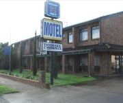
Pooraka Motor Inn
ibis Styles Adelaide Manor
Comfort Inn Manhattan
Enfield Hotel
QUEST MAWSON LAKES
Videos from this area
These are videos related to the place based on their proximity to this place.
Brushwood Fencing Panels by 'Ausbrush'
Fencing panels by 'Ausbrush' ph 0418-841-889 www.ausbrush.com - Shipping DIY Australia-wide including Perth, Brisbane, Gold Coast, Adelaide, Melbourne, Geelong, Canberrra ACT, Sydney, ...
Citizenship Ceremony 2007 and Part Deep Sea Cruising
We had our citizenship ceremony held at Salisbury City Council in Adelaide.
'Ausbrush' Brushwood Fencing Installation - Inline Method
From Australia www.ausbrush.com Shows installation of 'Ausbrush' brushwood privacy fencing with brush roll finishes Ph 0418-841-889. Panels made from the Australian native Melaleuca uncinata...
North Somerset/Wiltshire Quads on Salisbury Plain
Should of got a jetski :) cant wait to get back on it.
Three Car Train at Salisbury Station
A three car diesel train arriving on platform 2 at Salisbury Station heading towards Gawler Central.
Why am i riding a motorcycle? | Motovlog #1 yzf-r15 v2
My first motovlog. Why am i riding a motorcycle? Camera: Gopro hero 3 black Microphone: Zalman Microphone ZM-MIC 1 Bike: 2014 Yamaha yzf-r15 http://www.facebook.com/dodgeskitz87 Are you...
The Ghan passing Chidda Railway station
I was lucky to get this as I did not realise that it took less than ten minutes for the Ghan to get here from Adelaide Railway Station.
Goods Train Leaving Adelaide
While waiting to catch a train into the city I saw this goods train going past, which was fortuitous because I find it hard predicting when goods trains go past.
5MP1 Parafield Gardens
QR National freight, 5MP1 with 6003 & LDP003 upfront, hauling LZ3103 Dead attached. Passing through Parafield Gardens on Friday 14th September 2012. The thumping noise at 24seconds, ...
Videos provided by Youtube are under the copyright of their owners.
Attractions and noteworthy things
Distances are based on the centre of the city/town and sightseeing location. This list contains brief abstracts about monuments, holiday activities, national parcs, museums, organisations and more from the area as well as interesting facts about the region itself. Where available, you'll find the corresponding homepage. Otherwise the related wikipedia article.
Gulfview Heights, South Australia
Gulfview Heights is a small suburb of Adelaide, South Australia and is within the City of Salisbury and City of Tea Tree Gully local government area. It is adjacent to Wynn Vale, Salisbury East and Para Hills.
Greenfields railway station
Greenfields railway station is a railway station on the Gawler railway line which is located adjacent to Parafield Airport, in the northern Adelaide suburbs of Parafield and Parafield Gardens. It is located 15.5 km by railway from the Adelaide Railway Station. The station was opened in 1969 and was originally referred to as 'Green Fields' in passenger timetables. Greenfields is one of only two stations on the Gawler line to have a pedestrian underpass (the other is Parafield Gardens).
Parafield Gardens railway station
Parafield Gardens railway station is a railway station on the Gawler railway line which is located adjacent to Parafield Airport, in the northern Adelaide suburbs of Parafield and Parafield Gardens. It is located 16.6 km by railway from the Adelaide Railway Station. Parafield Gardens is one of only two stations on the Gawler line to have a pedestrian underpass remaining (the other is Greenfields), as other stations have had theirs closed due to concerns with safety and vandalism.
Parafield railway station
Parafield railway station is a railway station on the Gawler railway line which is located in the northern Adelaide suburbs of Parafield and Parafield Gardens. The station was originally opened in 1928 to serve the then under construction airport adjacent to the line. In 1982 the station was rebuilt at the same time as standardisation of the mainline from Adelaide to Port Pirie. Commencing in April 2008, the station was rebuilt again.
Chidda railway station
Chidda railway station is a railway station on the Gawler railway line which is located in the northern Adelaide suburbs of Salisbury, Salisbury South and Salisbury Downs. It is located 18.6 km by railway from the Adelaide Railway Station. Initially, step down platforms with a length of 121.9 metres were provided. In the second half of 1974 they were replaced by the current island platform which also has a length of 121.9 metres.
Nurlutta railway station
Nurlutta railway station is a railway station on the Gawler Central railway line which is located in the northern Adelaide suburbs of Salisbury and Salisbury North. It is located 21.5 km by railway from the Adelaide Railway Station. The station opened in 1950 and facilities consist of two 91.4 metre long platforms with small shelters. Until 1976 Nurlutta was unique on the Adelaide Suburban system in that it was the only station to have platforms either side of a level crossing.
Salisbury East, South Australia
Salisbury East is a suburb of Adelaide, South Australia, located 20 kilometres north of the Adelaide CBD. It is split between the local government areas (LGAs) of the City of Salisbury and the City of Tea Tree Gully.
Salisbury railway station, Adelaide
Salisbury Interchange is a railway station and bus interchange in the northern suburbs of Adelaide, South Australia. Salisbury Interchange is on the Gawler Central railway line, 18.6 km (11½ miles) from Adelaide station There are a large bus interchange and a park-and-ride facility alongside the station . Salisbury is an important regional centre for shopping, recreation and government services.
Parafield, South Australia
Parafield is a non-residential suburb of Adelaide approximately 18 km north of the CBD. It is completely occupied by Parafield Airport. It is bordered by Main North Road to the east, Kings Road to the north and the Gawler railway line to the west, where it is served by Parafield station. To the south it abuts the Mawson Lakes campus of the University of South Australia. Parafield Post Office opened on 1 July 1946, was renamed Parafield Airport in 1965 and closed in 1986.
Hilra railway station
Hilra railway station is a former railway station on the defunct Penfield railway line which is located in the northern Adelaide suburb of Salisbury North. It is located 21.7km by railway from the Adelaide Railway Station. The station was located parallel to Langford Terrace, adjacent to the freight train line, and inline roughly to Compton Street. The station was opened in 1941 along with the Penfield line.
G.M.H. railway station
G.M.H. railway station Is a former railway station which spurred off the Gawler Central railway line. The station was located in Adelaide's Holden car manufacturing factory in the northern suburb of Elizabeth South. The start of the spur was approximately halfway between the Elizabeth South and Nurlutta railway stations. It was closed in 1992, and the station platforms were demolished, but some of the track that leads to the station is still intact.
Lyell McEwin Hospital
The Lyell McEwin Hospital (LMH) is a 257-bed acute care teaching hospital located in Adelaide, South Australia that provides a full range of medical, surgical, diagnostic, emergency and support services to a population of more than 300,000 people living primarily in Adelaide’s northern suburbs. It is affiliated with the University of Adelaide and the University of South Australia.
Parafield Gardens, South Australia
Parafield Gardens is a suburb of Adelaide, South Australia. The suburb is largely residential, with a pocket of industrial land in the southwest corner. There are two small shopping centres in the area, one on Salisbury Highway which has a Foodland (South Australia), and another on Sheperdson Road which has an Independent Grocers of Australia.
Parabanks Shopping Centre
Parabanks Shopping Centre is a shopping centre located in the major shopping area of Salisbury, a suburb in the northern part of Metropolitan Adelaide, South Australia.
Elizabeth Vale, South Australia
Elizabeth Vale is a suburb in the northern extent of Adelaide, South Australia. It was established in 1955. Its main roads are Main North Road to the east and John Rice Avenue which bisects the suburb. The southern boundary is the northern bank of the Little Para River. Elizabeth Vale has two hospitals, the Lyell McEwin Hospital, a public teaching hospital, and the private Central Districts Hospital.
Para Hills West, South Australia
Para Hills West is a suburb of Adelaide, South Australia and is within the City of Salisbury. It has two schools, Para Hills West Primary School and Para Hills High School.
Adelaide Hills bushfires (1939)
The Adelaide Hills bushfires of 1939 were a series of bushfires in the Adelaide Hills, South Australia, which burned from 10-14 January. There had been ample rain during the winter of 1938 resulting in heavy understorey, but drought set in toward the end of the year. A heatwave in early January 1939 ensured the fuel load was very dry and particularly susceptible to fire. The fires were finally extinguished when thunderstorms arrived during the evening of the 14th.
Salisbury, South Australia
Salisbury is a northern suburb in Adelaide, South Australia. It is the seat of the City of Salisbury, and in the South Australian Legislative Assembly electoral district of Ramsay and the Australian House of Representatives divisions of Wakefield and Port Adelaide. The suburb is a service area for the City of Salisbury district, with an abundance of parklands, shops, cafes and restaurants.
Brahma Lodge, South Australia
Brahma Lodge is a northern suburb of Adelaide, South Australia. It is located in the City of Salisbury.
Elizabeth South, South Australia
Elizabeth South is a northern suburb of Adelaide, South Australia in the City of Playford.
Salisbury South, South Australia
Salisbury South is a suburb located in the City of Salisbury, Adelaide, South Australia.
Salisbury Park, South Australia
Salisbury Park is a suburb located in the City of Salisbury, Adelaide, South Australia.
Salisbury North, South Australia
Salisbury North is a suburb located in the City of Salisbury, Adelaide, South Australia. Salisbury Adams Road Post Office opened on 22 November 1965 and was renamed Salisbury North Whites Road in 1968.
Salisbury Plain, South Australia
Salisbury Plain is a suburb located in the City of Salisbury, Adelaide, South Australia. Near the much larger suburbs of Salisbury, Salisbury East and Salisbury Downs
Salisbury Downs, South Australia
Salisbury Downs is a suburb located in the City of Salisbury, Adelaide, South Australia. Salisbury Downs Post Office opened on 8 July 1991.


