Delve into Green Fields
The district Green Fields of in Salisbury (South Australia) is a district located in Australia about 596 mi west of Canberra, the country's capital town.
In need of a room? We compiled a list of available hotels close to the map centre further down the page.
Since you are here already, you might want to pay a visit to some of the following locations: Adelaide, Mitcham, Honiton, Koomooloo and Loxton. To further explore this place, just scroll down and browse the available info.
Local weather forecast
Todays Local Weather Conditions & Forecast: 22°C / 71 °F
| Morning Temperature | 19°C / 67 °F |
| Evening Temperature | 22°C / 72 °F |
| Night Temperature | 18°C / 64 °F |
| Chance of rainfall | 5% |
| Air Humidity | 81% |
| Air Pressure | 1017 hPa |
| Wind Speed | Gentle Breeze with 6 km/h (4 mph) from North-East |
| Cloud Conditions | Overcast clouds, covering 100% of sky |
| General Conditions | Moderate rain |
Monday, 25th of November 2024
24°C (74 °F)
20°C (69 °F)
Broken clouds, gentle breeze.
Tuesday, 26th of November 2024
29°C (85 °F)
21°C (70 °F)
Light rain, gentle breeze, overcast clouds.
Wednesday, 27th of November 2024
27°C (80 °F)
22°C (71 °F)
Moderate rain, gentle breeze, broken clouds.
Hotels and Places to Stay
Sfera's Park Suites & Convention Centre
MAWSON LAKES HOTEL AND FUNCTION CENTRE
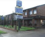
Pooraka Motor Inn
ibis Styles Adelaide Manor
Comfort Inn Manhattan
Enfield Hotel
Rose & Crown Hotel
Lindy Lodge Motel
QUEST MAWSON LAKES
CHIFLEY ON SOUTH TERRACE
Videos from this area
These are videos related to the place based on their proximity to this place.
Ignorance of Adelaide Drivers
Left hand turn from Maxwell Rd on to Main North Road. This road is a 60km road, to which I was doing, as the speed alert sounds at 60kph. I put on right hand indicator to turn right about 200m...
11 Rowland Road, Pooraka South Australia By George Psarros
Property Video shoot of 11 Rowland Road, Pooraka South Australia by PlatinumHD http://www.platinumhd.tv for Ray White North East.
Citizenship Ceremony 2007 and Part Deep Sea Cruising
We had our citizenship ceremony held at Salisbury City Council in Adelaide.
Three Car Train at Salisbury Station
A three car diesel train arriving on platform 2 at Salisbury Station heading towards Gawler Central.
The Ghan passing Chidda Railway station
I was lucky to get this as I did not realise that it took less than ten minutes for the Ghan to get here from Adelaide Railway Station.
Goods Train Leaving Adelaide
While waiting to catch a train into the city I saw this goods train going past, which was fortuitous because I find it hard predicting when goods trains go past.
5MP1 Parafield Gardens
QR National freight, 5MP1 with 6003 & LDP003 upfront, hauling LZ3103 Dead attached. Passing through Parafield Gardens on Friday 14th September 2012. The thumping noise at 24seconds, ...
Cessna Citation VH-HVM landing 21R Parafield (YPPF).
Amazing view from the cockpit as a Cessna Citation II Bravo VH-HVM lands on runway 21R at Parafield (YPPF), South Australia (Includes Adelaide approach and Parafield Tower air traffic control)....
Videos provided by Youtube are under the copyright of their owners.
Attractions and noteworthy things
Distances are based on the centre of the city/town and sightseeing location. This list contains brief abstracts about monuments, holiday activities, national parcs, museums, organisations and more from the area as well as interesting facts about the region itself. Where available, you'll find the corresponding homepage. Otherwise the related wikipedia article.
City of Salisbury
The City of Salisbury is a local government area (LGA) located on the northern fringes of Adelaide, South Australia. It has an estimated population of 130,022 people and encompasses an area of 158 km². The council's main offices are situated in the Salisbury central business district. Geographically, the region is located on the outskirts of Adelaide. In recent years the council has become a leader in water management and the use of recycled water.
Mawson Lakes, South Australia
Mawson Lakes is a suburb and new residential development in the City of Salisbury, Adelaide, with the first land being released in 1998. Named in honor of Sir Douglas Mawson, it has a census area population of 10,872 people. The suburb is located in the northern suburbs of Adelaide around 12 km north of the Central business district.
Cavan, South Australia
Cavan is a suburb north of Adelaide, within the City of Salisbury local government area. The suburb was either named by Daniel Brady or B. Gillick, both probably Irish immigrants, after Cavan in County Cavan, Republic of Ireland. Brady purchased land and established the 1849 Cross Keys Hotel and Gillick the 1855 Cavan Arms Hotel. Cavan Post Office opened on 2 March 1959 and closed in 1974.
Endeavour College
Endeavour College is a Lutheran high school in Mawson Lakes, a northern suburb of Adelaide, South Australia.
Greenfields railway station
Greenfields railway station is a railway station on the Gawler railway line which is located adjacent to Parafield Airport, in the northern Adelaide suburbs of Parafield and Parafield Gardens. It is located 15.5 km by railway from the Adelaide Railway Station. The station was opened in 1969 and was originally referred to as 'Green Fields' in passenger timetables. Greenfields is one of only two stations on the Gawler line to have a pedestrian underpass (the other is Parafield Gardens).
Parafield Gardens railway station
Parafield Gardens railway station is a railway station on the Gawler railway line which is located adjacent to Parafield Airport, in the northern Adelaide suburbs of Parafield and Parafield Gardens. It is located 16.6 km by railway from the Adelaide Railway Station. Parafield Gardens is one of only two stations on the Gawler line to have a pedestrian underpass remaining (the other is Greenfields), as other stations have had theirs closed due to concerns with safety and vandalism.
Parafield railway station
Parafield railway station is a railway station on the Gawler railway line which is located in the northern Adelaide suburbs of Parafield and Parafield Gardens. The station was originally opened in 1928 to serve the then under construction airport adjacent to the line. In 1982 the station was rebuilt at the same time as standardisation of the mainline from Adelaide to Port Pirie. Commencing in April 2008, the station was rebuilt again.
Chidda railway station
Chidda railway station is a railway station on the Gawler railway line which is located in the northern Adelaide suburbs of Salisbury, Salisbury South and Salisbury Downs. It is located 18.6 km by railway from the Adelaide Railway Station. Initially, step down platforms with a length of 121.9 metres were provided. In the second half of 1974 they were replaced by the current island platform which also has a length of 121.9 metres.
Dry Creek, South Australia
Dry Creek is a mostly industrial suburb north of Adelaide, containing significant wetlands and a substantial area devoted to salt crystallization pans, managed by Cheetham Salt Limited. It is named for Dry Creek, a stream and drain which flows out to Gulf St Vincent through the Barker Inlet on the north-east border of the suburb. It was the site of the soapworks of W. H.
Mawson Interchange
Mawson Interchange is a railway station and bus interchange in the new, developing suburb of Mawson Lakes, north of Adelaide, South Australia. The Interchange serves nearby residential and commercial developments and also the Mawson Lakes campus of the University of South Australia and Technology Park. Mawson Interchange is on the Gawler railway line. 14.3 km from Adelaide Railway Station.
Parafield, South Australia
Parafield is a non-residential suburb of Adelaide approximately 18 km north of the CBD. It is completely occupied by Parafield Airport. It is bordered by Main North Road to the east, Kings Road to the north and the Gawler railway line to the west, where it is served by Parafield station. To the south it abuts the Mawson Lakes campus of the University of South Australia. Parafield Post Office opened on 1 July 1946, was renamed Parafield Airport in 1965 and closed in 1986.
Little Para River
The Little Para River is a seasonal creek running across the Adelaide plains of South Australia, whose catchment fills reservoirs that supply some of the water needs of Adelaide’s northern suburbs. It runs from its source near Lower Hermitage in the Mount Lofty Ranges, flows north westerly to the Little Para Reservoir and then westerly to the Barker Inlet of the Gulf St Vincent at Globe Derby Park.
Pooraka railway station
Pooraka railway station was located approximately 12.9 km by rail from Adelaide on the now closed Northfield branch line. The station opened in 1913, at the same time the Gepps Cross Abattoirs opened adjacent to the station. Pooraka station was located to the west of Main North Road. The station was closed to passengers in 1987 but some cattle trains still used the nearby stock ramp sidings until the early 1990s.
Parafield Gardens, South Australia
Parafield Gardens is a suburb of Adelaide, South Australia. The suburb is largely residential, with a pocket of industrial land in the southwest corner. There are two small shopping centres in the area, one on Salisbury Highway which has a Foodland (South Australia), and another on Sheperdson Road which has an Independent Grocers of Australia.
CSSIP
Cooperative Research Centre for Sensor Signal and Information Processing (CSSIP) was an organisation established under the Cooperative Research Centres Program of the Australian Government.
Para Hills West, South Australia
Para Hills West is a suburb of Adelaide, South Australia and is within the City of Salisbury. It has two schools, Para Hills West Primary School and Para Hills High School.
Pooraka, South Australia
Pooraka is a suburb in Adelaide, South Australia. It is around 12 km north of the central business district. Pooraka East Post Office opened on 1 December 1965 and closed in 1986.
Green Fields, South Australia
Green Fields is a suburb of Adelaide, the capital of South Australia. It is around 13 km north of the city centre, and mostly consists of industrial warehouses and light industry.
Bolivar, South Australia
Bolivar is an outer northern suburb of Adelaide, South Australia. It is located in the City of Salisbury.
Globe Derby Park
Globe Derby Park is a suburb of Adelaide, South Australia. It is located in the City of Salisbury.
Globe Derby Park (harness racing)
Globe Derby Park is considered the premier Standardbred harness racing venue in South Australia. It is located 15 kilometres north of the Adelaide CBD. The first public meeting was held on the afternoon of 24 June 1969. Globe Derby Park was named after the stallion Globe Derby, who was considered the most influential Standardbred sire in Australian and New Zealand. The track has a crushed granite surface and is 845.50 metres long with races running anti-clockwise.
Salisbury Downs, South Australia
Salisbury Downs is a suburb located in the City of Salisbury, Adelaide, South Australia. Salisbury Downs Post Office opened on 8 July 1991.
District Council of Yatala
The District Council of Yatala is a historic local government area of South Australia established in 1853.
Dry Creek (South Australia)
Dry Creek or Dry Creek Drain is a seasonal stream in South Australia. In season it flows from its source near Yatala Vale in the Mount Lofty Ranges to the Barker Inlet of the Gulf St Vincent via a manufactured drain near Globe Derby Park. It passes through Modbury, Walkley Heights and Pooraka. The suburb of Dry Creek and Dry Creek railway station are named after the stream.
Bolivar railway station, South Australia
Bolivar is a railway station in South Australia on the standard gauge line between Adelaide and Crystal Brook, originally with little more than a crossing loop for passing trains going in opposite directions. The original crossing loop is located about 30 km by rail from Mile End, South Australia, between Taylors Road, (now the western end of the Northern Expressway), and King Road, both in Virginia, South Australia. (The King Road gated level crossing actually crosses two tracks.


