Delve into Mount Osmond
The district Mount Osmond of in Burnside (South Australia) with it's 2,375 habitants Mount Osmond is a subburb in Australia about 592 mi west of Canberra, the country's capital town.
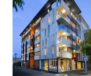
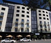
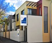
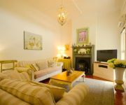
If you need a hotel, we compiled a list of available hotels close to the map centre further down the page.
While being here, you might want to pay a visit to some of the following locations: Mitcham, Adelaide, Honiton, Koomooloo and Loxton. To further explore this place, just scroll down and browse the available info.
Local weather forecast
Todays Local Weather Conditions & Forecast: 18°C / 64 °F
| Morning Temperature | 16°C / 61 °F |
| Evening Temperature | 18°C / 64 °F |
| Night Temperature | 13°C / 55 °F |
| Chance of rainfall | 0% |
| Air Humidity | 48% |
| Air Pressure | 1014 hPa |
| Wind Speed | Gentle Breeze with 9 km/h (5 mph) from North-East |
| Cloud Conditions | Few clouds, covering 23% of sky |
| General Conditions | Light rain |
Monday, 4th of November 2024
18°C (64 °F)
13°C (56 °F)
Broken clouds, gentle breeze.
Tuesday, 5th of November 2024
23°C (74 °F)
26°C (78 °F)
Overcast clouds, moderate breeze.
Wednesday, 6th of November 2024
20°C (69 °F)
15°C (59 °F)
Light rain, moderate breeze, scattered clouds.
Hotels and Places to Stay
Pullman Adelaide
Mount Lofty House - MGallery by Sofitel
Clarion Hotel Soho
Oaks Plaza Pier
MANTRA HINDMARSH SQUARE
RNR APARTMENTS ADELAIDE
MANTRA ON FROME
Quest King William South
Adina Adelaide Treasury
Westbury Cottage B & B
Videos from this area
These are videos related to the place based on their proximity to this place.
Rachel Jackson at Cleland Wildlife Park, South Australia
Rachel Jackson at Cleland Wildlife Park, South Australia.
Power by Ford: '79 XD Falcon Stage 2 Street Engine Start & Rev
High Definition Exhaust Video. Tuning is not quite perfect as yet, still a little rich, hence the smoke when I open the fuel tap. I'm still playing with camera distance to get the sound just...
Channel 9 - Today Show - Cleland Wildlife Park - 6th May, 2013
Channel 9's Today Show crossed live to Cleland Wildlife Park for weather presentations and featured some of the animals from the park.
Koalas at Cleland Wildlife Park
Koala footage shot at Cleland Wildlife Park. View more great South Australian Parks & Reserves at http://www.parks.sa.gov.au.
Rachel, Caitlin and Rachel at Cleland Wildlife Park, South Australia
I created this video with the YouTube Video Editor (http://www.youtube.com/editor)
NR119 leads a freight train through Foster's Corner, Belair
Locomotives are NR119, DL45, DL44 and BL35.
Yurrebilla Trail 2006 Segment 1
Download the full length video ~25 minutes = ~1 GB, for $4.00 at www.cyberholidays.com.au . Cyber Holidays films the Yurrebilla Trail 2006, segment 1. The following is the full text associated...
Videos provided by Youtube are under the copyright of their owners.
Attractions and noteworthy things
Distances are based on the centre of the city/town and sightseeing location. This list contains brief abstracts about monuments, holiday activities, national parcs, museums, organisations and more from the area as well as interesting facts about the region itself. Where available, you'll find the corresponding homepage. Otherwise the related wikipedia article.
Brown Hill Creek
Brown Hill Creek, in South Australia, {{#invoke:Coordinates|coord}}{{#coordinates:34|59|S|138|39|E|region:AU-SA|| | |name= }}, is one of several creeks running in a generally west-north-west direction, draining the western watershed of the Mount Lofty Ranges. The creek runs through the suburb of Brown Hill Creek with the area around the mouth of creek in the suburb of Mitcham. This area was known to the Kaurna people of the Adelaide Plains as Wirraparinga, meaning "creek and scrub place".
Waterfall Gully, South Australia
Waterfall Gully is an eastern suburb of the South Australian capital city of Adelaide. It is located in the foothills of the Mount Lofty Ranges around 5 km east-south-east of the Adelaide city centre. For the most part, the suburb encompasses one long gully with First Creek at its centre and Waterfall Gully Road running adjacent to the creek. At the southern end of the gully is First Falls, the waterfall for which the suburb was named.
Langman Reserve
Langman Reserve is a large reserve situated in the Adelaide foothills between the suburbs of Burnside and Waterfall Gully, South Australia. It was converted from a quarry in the late 1960s, and is named after a former mayor of the City of Burnside. The reserve, frequented by people of all ages, comprises a sporting oval, toilets, barbecues, tennis courts and a walk through native bushland. The carpark is located on Waterfall Gully Road.
Burnside, South Australia
Burnside is a small suburb that is part of the City of Burnside in the eastern suburbs of Adelaide. It is primarily a residential suburb, and was one of the first suburbs of Adelaide. It was named Burnside, an amalgamation of the Scottish word for creek, "Burn" and "side" because of the original property's location on the side of Second Creek. Burnside was established and named by Peter Anderson and his family who came from Scotland in 1839.
Glenunga, South Australia
Not to be confused with Glenalta, South Australia. 50x40pxThis article needs additional citations for verification. Please help improve this article by adding citations to reliable sources. Unsourced material may be challenged and removed.
Glenside, South Australia
Glenside is a suburb in the City of Burnside, Adelaide, South Australia, around 2 kilometres south-east of the Central business district, home to 2,985 people in a total land area of 1.40 km². It is ordered on the north by Greenhill Road, on the east by Portrush Road, on the south by Flemington Street and Windsor Road and the west by Fullarton Road. The suburb has a rectangular layout.
Leawood Gardens, South Australia
Leawood Gardens is a small suburb of Adelaide, South Australia in both the City of Mitcham and the City of Burnside located in the foothills of the Adelaide Hills.
Beaumont, South Australia
Beaumont is a suburb of Adelaide in the City of Burnside. Founded as a purpose-built village by Sir Samuel Davenport in 1848, it initially struggled due to high land prices in the area. However, with Adelaide's inevitable expansion residents eventually settled.
Mount Osmond, South Australia
Mount Osmond is a small suburb of 2,497 people in the South Australian capital city of Adelaide. It is part of the City of Burnside local government area and located in the foothills of the Adelaide Hills, five kilometres south east of the city centre. The suburb is high on the hill of the same name, which is the last hill on the right when approaching Adelaide down the South Eastern Freeway before the road levels out onto the Adelaide Plains.
Glen Osmond, South Australia
Glen Osmond is a small suburb of Adelaide, South Australia in the City of Burnside which is in the foothills of the Adelaide Hills.
Hazelwood Park, South Australia
Hazelwood Park is a suburb in the City of Burnside, Adelaide, South Australia with a census area population of 1,717 people. The suburb is about 5 kilometres east of the Central business district. Hazelwood Park, a suburban park inside the suburb, is the major attraction in the suburb. This includes the Burnside Swimming Centre, a popular site during Adelaide's hot weather.
Linden Park, South Australia
Linden Park is a suburb of Adelaide, South Australia in the City of Burnside.
St Georges, South Australia
St Georges is a suburb of Adelaide in the City of Burnside.
Myrtle Bank, South Australia
Myrtle Bank is a suburb of Adelaide, South Australia in the City of Unley. The suburb is named after a property near the foothills built in 1842 by William Sanders (1801-1880), who arrived in South Australia in 1838. He named the premises 'Myrtle Bank', because his friend James Gall of Trinity living in Edinburgh had a fine property of the same name. During World War I the property became a repatriation hospital.
Eagle On The Hill, South Australia
Eagle On The Hill is an unbounded locality of Adelaide in the Adelaide Foothills. It borders Mount Osmond and Waterfall Gully. The village is located on Mount Barker Road, which was formerly the only connection from Adelaide to the South Eastern Freeway. Once the Adelaide-Crafers Highway through the Heysen Tunnels was opened in 2000, Eagle on the Hill went into a precipitous decline.
Burnside Village
Burnside Village is an upscale shopping centre located in Adelaide, South Australia. It is situated in the City of Burnside suburb of Glenside, in the eastern suburbs. Burnside Village is home to over 100 premium lifestyle and fashion stores. The centre features a diverse mix of retail and is home to a 100-year-old River Red Gum Tree in the aptly named Tree Mall. Burnside Village is home to South Australia’s first Zara store, as well as the first for stores such as Husk, Willow and Thurley.
Urrbrae, South Australia
Urrbrae is a suburb of Adelaide, South Australia. It is located in the City of Mitcham. Located at the foot of the Adelaide Hills, it is bordered on the east by the South Eastern Freeway, and the Old Toll House, which marked the traditional entrance to the city of Adelaide in the 19th century.
Carrick Hill
Carrick Hill is a publicly accessible property at the foot of the Adelaide Hills, in the suburb of Springfield, in South Australia. It was the Adelaide home of Sir Edward "Bill" Hayward and his wife Lady Ursula (née Barr-Smith), and contains a large collection of drawings, sculptures, antiques and paintings.
Glenunga International High School
Glenunga International High School (informally known as Glenunga or GIHS) is a publicly funded school in Adelaide, South Australia. It is located approximately four km south-east of the Adelaide city centre in the suburb of Glenunga, between L'Estrange St and Conyngham St, adjoining the major thoroughfare Glen Osmond Road. In terms of academic performance, it is one of the top schools in the state, performing exceptionally in the NAPLAN, SACE, and International Baccalaureate Diploma.
Brown Hill Creek, South Australia
Brown Hill Creek is a south-eastern suburb of Adelaide in the City of Mitcham in South Australia, named after the eponymous Brown Hill Creek. In the creek valley behind Brown Hill has contained some form of park for many years; a stone plaque declaring a "pleasure resort" from the early part of the 20th century still stands at the entrance to the valley.
Beaumont House
Beaumont House, occasionally known as Claremont, is an eclectic Romanesque-Classical brick residence located at 631 Glynburn Road in Beaumont, South Australia. Beaumont House was constructed for Augustus Short, the first Anglican bishop of Adelaide and founder of St Peter's Cathedral. Beaumont House was constructed on land initially owned by Sir Samuel Davenport, a wealthy Adelaide landlord.
Heysen Tunnels
The Heysen Tunnels are twin tube road tunnels which carry the Adelaide-Crafers Highway under Eagle On The Hill in the Mount Lofty Ranges in South Australia. The tunnels were excavated using a tunnelling machine normally used in heavy-duty mining operations which tunnelled through 500 metres of rock for each tunnel at an average rate of 3 metres per day. The tunnels were completed in 1998 and officially opened in May 2000. Each tunnel carries 3 lanes of traffic.
South Australian Research and Development Institute
The South Australian Research and Development Institute (SARDI) is a state government funded institute with locations throughout South Australia. SARDI is part of Primary Industries and Resources South Australia (PIRSA)
Beautiful (2009 film)
Beautiful is a 2009 Australian independent film, written and directed by Dean O'Flaherty, which was released by Adelaide-based Kojo Pictures on 5 March 2009. The film marked the feature filmmaking debut of both O'Flaherty and Kojo Pictures. The South Australian Film Corporation provided approximately 10 per cent of the $1.5m budget, while the rest came from private investors.
Benacre, Glen Osmond
Benacre is a house in Glen Osmond,, which is listed on the Register of the National Estate. It is located at 6 Benacre Place.


